 |
|
Location & QuickFacts
| FAA Information Effective: | 2008-09-25 |
| Airport Identifier: | TN66 |
| Airport Status: | Operational |
| Longitude/Latitude: | 085-02-49.8380W/35-44-40.2460N
-85.047177/35.744513 (Estimated) |
| Elevation: | 1000 ft / 304.80 m (Estimated) |
| Land: | 5 acres |
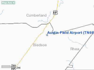
| From nearest city: | 11 nautical miles NE of Pikeville, TN |
| Location: | Bledsoe County, TN |
| Magnetic Variation: | 02W (1990) |
Owner & Manager
| Ownership: | Privately owned |
| Owner: | John L. Austin |
| Address: | 2356 Hickory Forest Dr
Memphis, TN 38119 |
| Phone number: | 901-767-3810 |
| Address: |
|
Airport Operations and Facilities
| Airport Use: | Private |
| Wind indicator: | Yes |
| Segmented Circle: | No |
| Control Tower: | No |
| Sectional chart: | Atlanta |
| Region: | ASO - Southern |
| Boundary ARTCC: | ZTL - Atlanta |
| Tie-in FSS: | BNA - Nashville |
| FSS Toll Free: | 1-800-WX-BRIEF |
Airport Communications
Runway Information
Runway 06/24
| Dimension: | 2100 x 100 ft / 640.1 x 30.5 m |
| Surface: | TURF, Good Condition |
| |
Runway 06 |
Runway 24 |
| Traffic Pattern: | Left | Left |
| Obstruction: | 100 ft hill, 3000.0 ft from runway | |
|
Radio Navigation Aids
| ID |
Type |
Name |
Ch |
Freq |
Var |
Dist |
| DTE | NDB | Mark Anton | | 394.00 | 02W | 16.8 nm |
| HEM | NDB | Huchn | | 233.00 | 02W | 30.1 nm |
| MMI | NDB | Mc Minn County | | 242.00 | 03W | 31.7 nm |
| MNV | NDB | Madisonville | | 361.00 | 04W | 34.6 nm |
| RN | NDB | Warri | | 209.00 | 02W | 35.0 nm |
| CQN | NDB | Daisy | | 341.00 | 02W | 35.2 nm |
| HDI | NDB | Hardwick | | 369.00 | 01W | 36.2 nm |
| SKN | NDB | Hurricane | | 256.00 | 02W | 39.8 nm |
| APT | NDB | Jasper | | 382.00 | 02W | 48.8 nm |
| HCH | VORTAC | Hinch Mountain | 123X | 117.60 | 02W | 4.0 nm |
| GQO | VORTAC | Choo Choo | 105X | 115.80 | 01E | 47.4 nm |
Remarks
- PRVDD ALL OPNS ARE CONDUCTED IN VFR WX CONDS AND THE LDG AREA IS LTD TO PVT USE.
Images and information placed above are from
http://www.airport-data.com/airport/TN66/
We thank them for the data!
| General Info
|
| Country |
United States
|
| State |
TENNESSEE
|
| FAA ID |
TN66
|
| Latitude |
35-44-40.246N
|
| Longitude |
085-02-49.838W
|
| Elevation |
1000 feet
|
| Near City |
PIKEVILLE
|
We don't guarantee the information is fresh and accurate. The data may
be wrong or outdated.
For more up-to-date information please refer to other sources.
|
|


