|
 |
|
||||
|
Coordinates: 35°54′12″N 089°23′50″W / 35.90333°N 89.39722°W
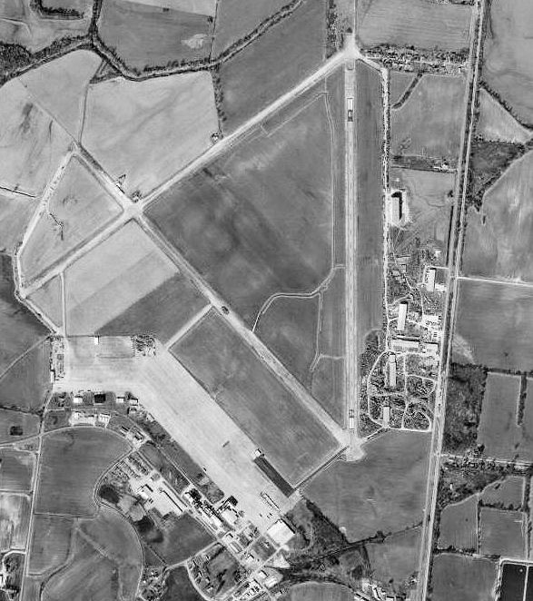
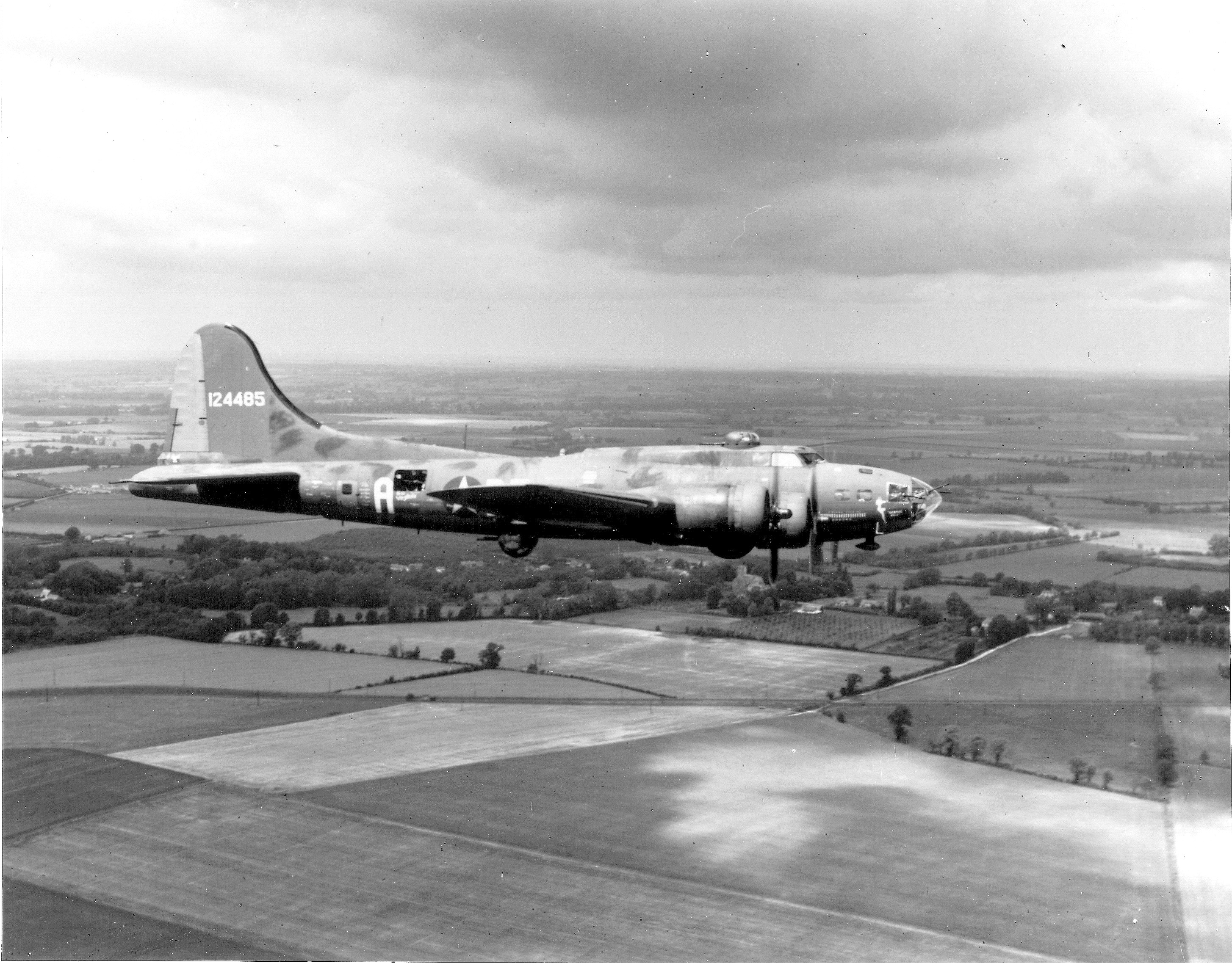
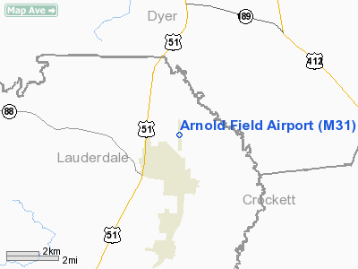
Arnold Field (FAA LID: M31) is a municipal public-use airport located two miles (3 km) northwest of the central business district of Halls, a town in Lauderdale County, Tennessee, United States. The airport is named for a former Mayor, Sammie Arnold The airport is operated on the grounds of the former Dyersburg Army Air Base. In the 1940s the Dyersburg Army Air Base was a training facility for World War II B-17 Flying Fortress bomber pilots and crews. In 2007, Arnold Field is home to 15 general purpose aircraft and the Veterans' Museum. History of the Dyersburg Army Air BaseConstruction begins 1942
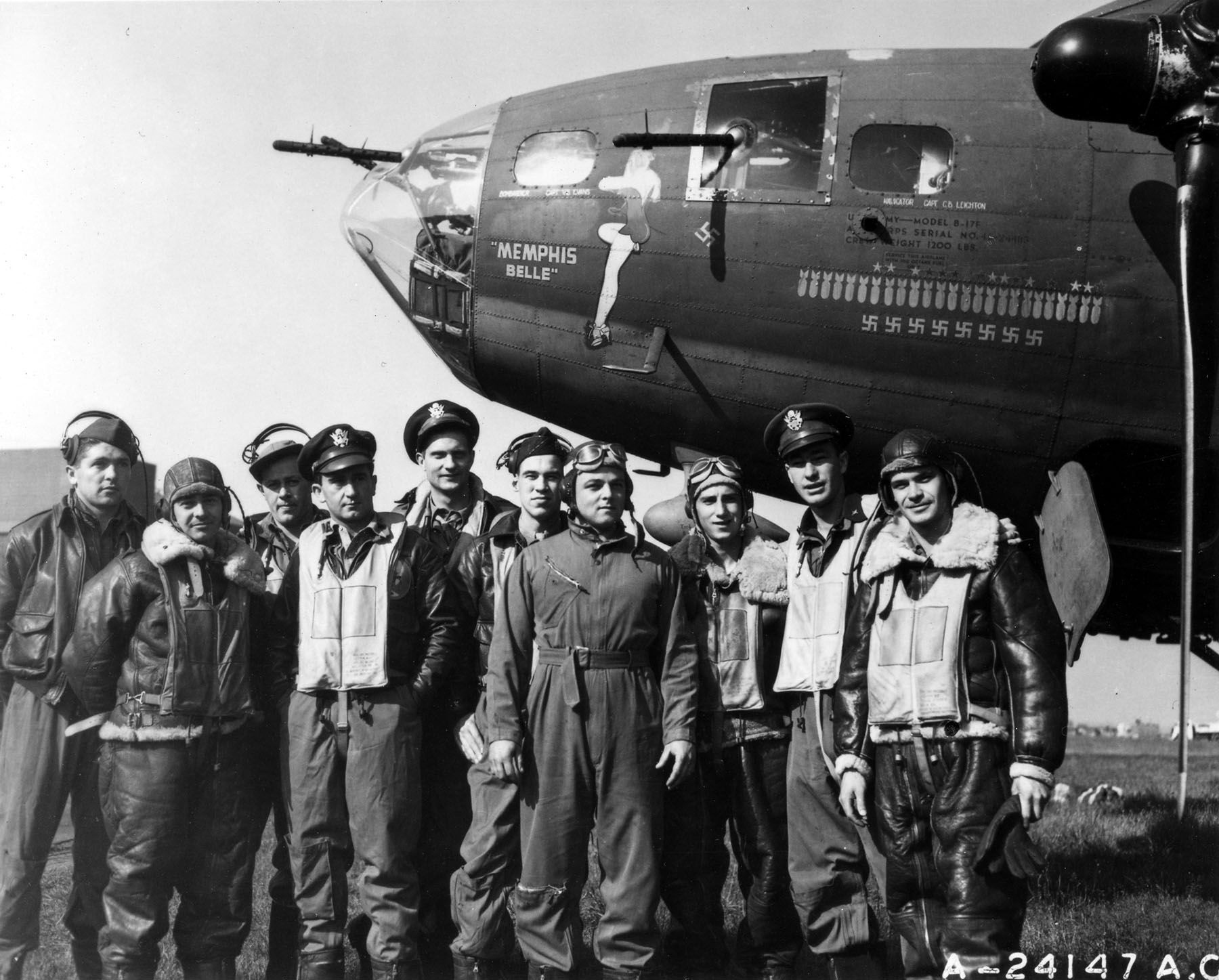
The Dyersburg Army Air Base (DAAB), promoted by Congressman Jere Cooper and solicited by local officials of Dyersburg in 1941, was actually located near the edge of Halls, Tennessee since an Army study indicated that the Lauderdale County site was better suited for the base. Construction begun in March 1942 on "what was to become one of the largest combat crew training schools built during the early war years." The Base was the largest combat crew training school built during the early war years. It was the only inland B-17 training base east of the Mississippi River. The base was located on 2,541 acres (10.28 km), not including the practice range. Approximately 7,700 crew men received their last phase training at DAAB. 114 crew men lost their lives.
Life on the baseThree concrete runways, a hospital, libraries, an Olympic-sized swimming pool, and a 600 seat movie theatre were hurriedly built on the former crop fields. Although barracks were moved from other sites and many built for the soldiers, very little housing was available for families. Citizens in Brownsville, Ripley, Halls and Dyersburg made room for the influx of wives, mothers and children who wanted to spend a short time with their soldiers before they went to combat. Attics, garages, and closets were transformed into sleeping areas. President Harry Truman visited the base during the war as did Roy Acuff and Governor Jim McCord. Deactivation of the base 1946
In 1946, with World War II over, the DAAB was deactivated, and the base was hastily dismantled, land was sold, and barracks and guard shacks were moved to private property. The former morgue was moved and became a two bedroom residence later occupied by a mayor of Halls. The Army left as quickly as it arrived. Today, the only evidence of the base's location is the configuration of crumbling runways, a Norden bombsight storage building, one hangar out of the original five, tall chimneys where the theatre and other sites were located, and a 95 acres (0.38 km) apron. To quote Lt. Colonel Robert Little (Ret.), "Our job was to give about one hundred more hours of flying — we would give them instrument flying, a lot of take offs and landings, some formations, and a little bit of navigation — to men coming from camps like Roswell, New Mexico, and a transition school for B-17s." Remaining on the site are chimneys and concrete foundations, two buildings, Norden Bombsite, Storage Vaults, one hangar and pocked runways. Veterans' Museum
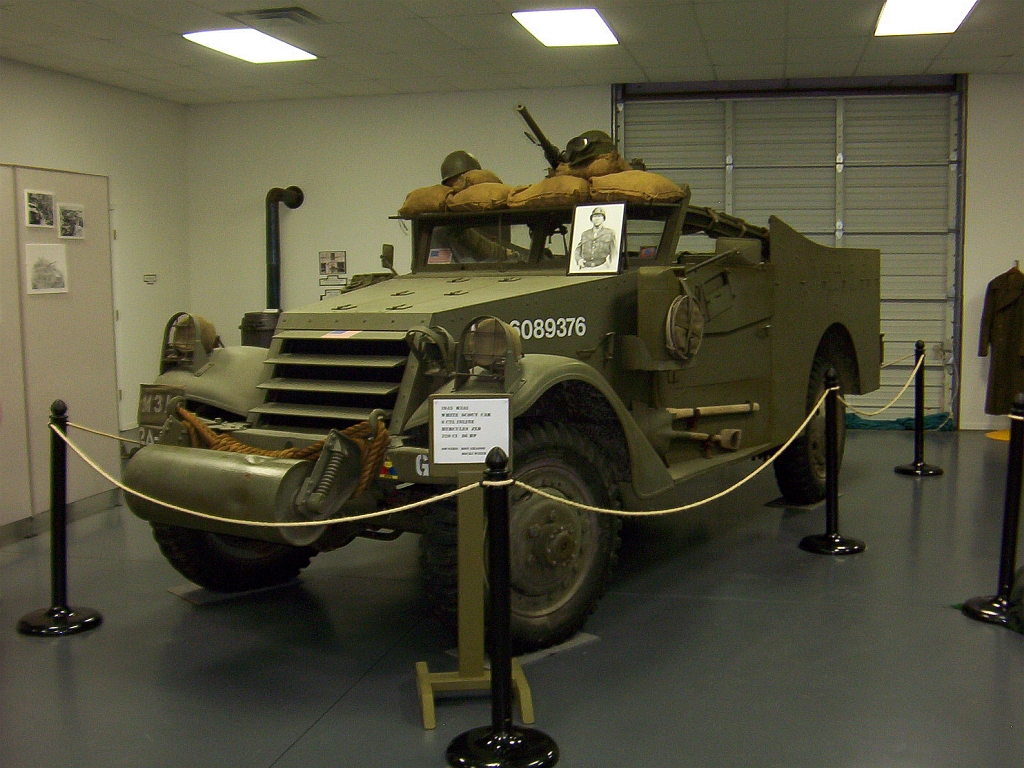
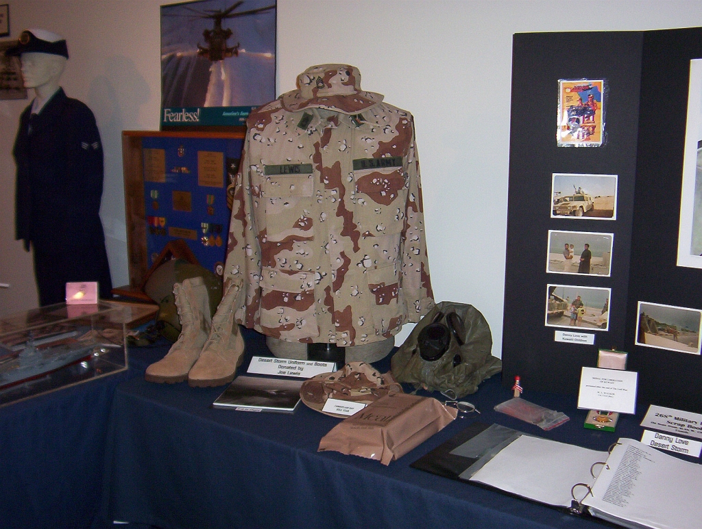
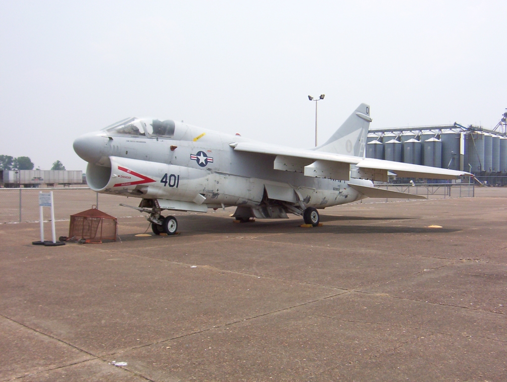
Foundation and purposeThe Veterans' Museum, located on the site of the former air base, was built in 1997. It is owned and operated by The Dyersburg Army Air Base Memorial Association, a non-profit organization. The purpose of the museum is the preservation and documentation of materials related to military activities from World War I to the Iraq war, as well as documenting the history of the air base itself. RV parking is available at no charge and admittance to the museum is free. Electrical hookup is $10 per day. ExhibitsThe exhibits of the Veterans' Museum stem from donations by organizations and individuals. Outside exhibits of the museum are a A-7 Corsair II and military vehicles. The 8,900 ft (827 m) indoor exhibition displays items ranging from military vehicle displays and uniforms to photographs, personal and official letters, diaries, technical publications, divisional histories, videos and other military memorabilia. Murals painted by Ernie Berke and photographs of 72 crews are also displayed. Special exhibits:
Air showsIn irregular intervals, the museum organizes and houses air shows on Arnold Field. Other facilitiesThe museum houses conference facilities for up to 50 people and the Sammie Arnold Lending Library, with books covering the topics documented in the museum. Facilities and aircraftArnold Field covers an area of 29 acres (12 ha) which contains one concrete paved runway (18/36) measuring 4,700 x 75 ft (1,433 x 23 m). For the 12-month period ending December 3, 1996, the airport had 7,290 aircraft operations, an average of 19 per day: 99% general aviation and 1% military. The above content comes from Wikipedia and is published under free licenses – click here to read more.
Location & QuickFacts
Owner & Manager
Airport Operations and Facilities
Airport Communications
Airport Services
Runway InformationRunway 18/36
Radio Navigation Aids
Remarks
Images and information placed above are from We thank them for the data!
We don't guarantee the information is fresh and accurate. The data may
be wrong or outdated.
|
|||||||||||||||||||||||||||||||||||||||||||||||||||||||||||||||||||||||||||||||||||||||||||||||||||||||||||||||||||||||||||||||||||||||||||||||||||||||||||||||||||||||||||||||||||||||||||||||||||||||||||||||||||||||||||||||||||||||||||||||||||||||||||||||||||||||||||||||||||||||||||||||||||||||||||||||||||||||||||||||||||||||

 |
|
Copyright 2004-2026 © by Airports-Worldwide.com, Vyshenskoho st. 36, Lviv 79010, Ukraine Legal Disclaimer |