 |
|
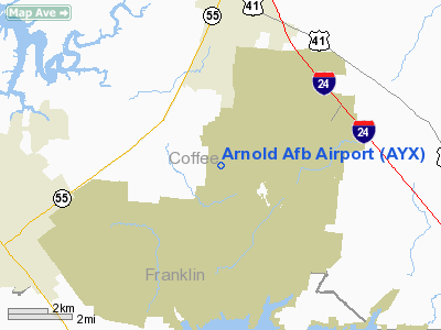
Location & QuickFacts
| FAA Information Effective: | 2008-09-25 |
| Airport Identifier: | AYX |
| Airport Status: | Operational |
| Longitude/Latitude: | 086-05-08.9520W/35-23-33.2830N
-86.085820/35.392579 (Estimated) |
| Elevation: | 1067 ft / 325.22 m (Estimated) |
| Land: | 0 acres |
| From nearest city: | 0 nautical miles of Tullahoma, TN |
| Location: | Coffee County, TN |
| Magnetic Variation: | 02W (1995) |
Owner & Manager
| Ownership: | Air Force owned |
| Owner: | Usaf |
| Address: | Arnold Afb
Tullahoma, TN 37389 |
| Manager: | Murray King
CHIEF AIRFIELD MANAGEMENT. |
| Address: | Arnold Afb
Tullahoma, TN 37389 |
| Phone number: | 931-454-6654 |
Airport Operations and Facilities
| Airport Use: | Private |
| Segmented Circle: | No |
| Control Tower: | No |
| Lighting Schedule: | 24 HRS
RY LGTS OPER ONLY AS RQRD FOR APVD FLTS. |
| Beacon Color: | Clear-Green (lighted land airport) |
| Sectional chart: | Atlanta |
| Region: | ASO - Southern |
| Boundary ARTCC: | ZME - Memphis |
| Tie-in FSS: | BNA - Nashville |
| FSS on Airport: | No |
| FSS Toll Free: | 1-800-WX-BRIEF |
| NOTAMs Facility: | BNA (NOTAM-d service avaliable) |
Airport Communications
Runway Information
Runway 03/21
| Dimension: | 6000 x 150 ft / 1828.8 x 45.7 m |
| Surface: | ASPH, |
| Pavement Class: | 35 /F/B/X/T |
| Weight Limit: | Single wheel: 162000 lbs.
Dual wheel: 216000 lbs.
Dual tandem wheel: 289000 lbs.
RY 03/21 WT BRG CPTY ST175. RY 03 FIRST 1000 FT WT BRG CPTY ST121 DDTW425. |
| Edge Lights: | High |
| |
Runway 03 |
Runway 21 |
| Longitude: | 086-05-23.8200W | 086-04-53.6900W |
| Latitude: | 35-23-05.8600N | 35-23-59.8400N |
| Elevation: | 1067.00 ft | 0.00 ft |
| Traffic Pattern: | Left | Left |
| Crossing Height: | 45.00 ft | 45.00 ft |
| VASI: | 4-box on left side | 4-box on left side |
| Visual Glide Angle: | 3.00° | 3.00° |
| Runway End Identifier: | Yes | Yes |
|
Radio Navigation Aids
| ID |
Type |
Name |
Ch |
Freq |
Var |
Dist |
| SYI | FAN MARKER | Bomar | | | 01W | 19.4 nm |
| ULH | NDB | Burwi | | 332.00 | 03W | 8.7 nm |
| BGF | NDB | Boiling Fork | | 263.00 | 02W | 12.9 nm |
| UOS | NDB | Sewanee | | 275.00 | 02E | 14.7 nm |
| RN | NDB | Warri | | 209.00 | 02W | 26.7 nm |
| TNY | NDB | Kelso | | 358.00 | 01W | 27.3 nm |
| APT | NDB | Jasper | | 382.00 | 02W | 31.7 nm |
| LUG | NDB | Verona | | 251.00 | 00W | 36.0 nm |
| FQW | NDB | Walter Hill | | 371.00 | 02W | 36.9 nm |
| SKN | NDB | Hurricane | | 256.00 | 02W | 38.0 nm |
| SWZ | NDB | Sewart | | 391.00 | 02W | 38.6 nm |
| HEM | NDB | Huchn | | 233.00 | 02W | 43.3 nm |
| CQN | NDB | Daisy | | 341.00 | 02W | 47.5 nm |
| JUE | NDB | Lebanon | | 414.00 | 02W | 49.3 nm |
| GZS | NDB | Giles/dcmsnd | | 375.00 | 00E | 49.9 nm |
| UXM | VOR | Tullahoma Regional | | 109.65 | 03W | 7.9 nm |
| SYI | VOR/DME | Shelbyville | 027X | 109.00 | 01W | 20.1 nm |
| RQZ | VORTAC | Rocket | 059X | 112.20 | 02E | 44.8 nm |
| HSV | VOT | Huntsville | | 111.00 | | 41.8 nm |
| MQY | VOT | Smyrna | | 110.20 | | 42.3 nm |
Remarks
- CAUTION: LDG AT PILOT'S DISCRETION.
- JASU: A/M32-86, A/M32-60.
- TRAN ALERT: TRAN MAINTENANCE SUPPORT EXTREMELY LIMITED.
- FUEL: J8
- OIL: JOAP 24 HR PN.
- CAUTION: DEER AND BIRD HAZ. CTC BASE OPS 10 MIN PRIOR TO LDG FOR ARR INFO AND WILDLIFE WATCH UPDATE.
- CAUTION: C-130 AIRDROP OR COPTER OPR IN VICINITY POSSIBLE.
- TFC PAT: OVERHEAD 2500'. AVOID OVERFLIGHT OF LARGE ROCKET TEST FACILITY 1 NM E.
Images and information placed above are from
http://www.airport-data.com/airport/AYX/
We thank them for the data!
| General Info
|
| Country |
United States
|
| State |
TENNESSEE
|
| FAA ID |
AYX
|
| Latitude |
35-23-33.283N
|
| Longitude |
086-05-08.952W
|
| Elevation |
1067 feet
|
| Near City |
TULLAHOMA
|
We don't guarantee the information is fresh and accurate. The data may
be wrong or outdated.
For more up-to-date information please refer to other sources.
|
|


