 |
|
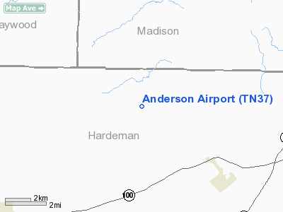
Location & QuickFacts
| FAA Information Effective: | 2008-09-25 |
| Airport Identifier: | TN37 |
| Airport Status: | Operational |
| Longitude/Latitude: | 089-01-20.2260W/35-24-15.2860N
-89.022285/35.404246 (Estimated) |
| Elevation: | 392 ft / 119.48 m (Estimated) |
| Land: | 7 acres |
| From nearest city: | 5 nautical miles NW of Toone, TN |
| Location: | Hardeman County, TN |
| Magnetic Variation: | 01E (1985) |
Owner & Manager
| Ownership: | Privately owned |
| Owner: | Thomas C Anderson Jr |
| Address: | Box 115
Toone, TN 38381 |
| Phone number: | 731-658-6124 |
| Address: |
|
Airport Operations and Facilities
| Airport Use: | Private |
| Wind indicator: | Yes |
| Segmented Circle: | No |
| Control Tower: | No |
| Landing fee charge: | No |
| Sectional chart: | Memphis |
| Region: | ASO - Southern |
| Boundary ARTCC: | ZME - Memphis |
| Tie-in FSS: | MKL - Jackson |
| FSS on Airport: | No |
| FSS Toll Free: | 1-800-WX-BRIEF |
Airport Services
| Airframe Repair: | NONE |
| Power Plant Repair: | NONE |
Runway Information
Runway 14/32
| Dimension: | 2330 x 60 ft / 710.2 x 18.3 m |
| Surface: | TURF, |
| |
Runway 14 |
Runway 32 |
| Traffic Pattern: | Left | Left |
|
Radio Navigation Aids
| ID |
Type |
Name |
Ch |
Freq |
Var |
Dist |
| BAV | NDB | Hardeman | | 404.00 | 01E | 11.5 nm |
| FYE | NDB | Somerville | | 255.00 | 00E | 21.7 nm |
| SZY | NDB | Sibley | | 386.00 | 01E | 26.8 nm |
| COO | NDB | Covington | | 326.00 | 02E | 29.8 nm |
| TGC | NDB | Gibson | | 378.00 | 01E | 32.9 nm |
| DNT | NDB | Nally Dunston | | 343.00 | 01W | 40.1 nm |
| HHY | NDB | Pinhook | | 346.00 | 01W | 41.1 nm |
| MIG | NDB | Millington | | 232.00 | 04E | 45.3 nm |
| OLV | NDB | Olive Branch | | 275.00 | 01E | 45.5 nm |
| HZD | NDB | Huntingdon | | 217.00 | 00E | 49.3 nm |
| MKL | VOR/DME | Mc Kellar | 057X | 112.00 | 02E | 13.2 nm |
| JKS | VOR/DME | Jacks Creek | 031X | 109.40 | 02E | 34.5 nm |
| DYR | VORTAC | Dyersburg | 115X | 116.80 | 03E | 39.6 nm |
| HLI | VORTAC | Holly Springs | 071X | 112.40 | 03E | 44.7 nm |
Remarks
- 160' TOWER 300' EAST OF RWY
- EXISTED PRIOR TO 1959.
Images and information placed above are from
http://www.airport-data.com/airport/TN37/
We thank them for the data!
| General Info
|
| Country |
United States
|
| State |
TENNESSEE
|
| FAA ID |
TN37
|
| Latitude |
35-24-15.286N
|
| Longitude |
089-01-20.226W
|
| Elevation |
392 feet
|
| Near City |
TOONE
|
We don't guarantee the information is fresh and accurate. The data may
be wrong or outdated.
For more up-to-date information please refer to other sources.
|
|


