 |
|
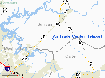
Air Trade Center Heliport |
Location & QuickFacts
| FAA Information Effective: | 2008-09-25 |
| Airport Identifier: | TN57 |
| Airport Status: | Operational |
| Longitude/Latitude: | 082-18-04.0000W/36-25-08.0000N
-82.301111/36.418889 (Estimated) |
| Elevation: | 1620 ft / 493.78 m (Surveyed) |
| Land: | 36 acres |
| From nearest city: | 6 nautical miles NE of Johnson City, TN |
| Location: | Washington County, TN |
| Magnetic Variation: | 04W (1985) |
Owner & Manager
| Ownership: | Privately owned |
| Owner: | Edwards & Associates Inc |
| Address: | Po Box 3689
Bristol, TN 37625 |
| Phone number: | 423-538-5111 |
| Manager: | Bill Finney |
| Address: | Po Box 3689
Bristol, TN 37625 |
| Phone number: | 423-538-5111
EXT 3801. |
Airport Operations and Facilities
| Airport Use: | Private |
| Wind indicator: | Yes |
| Segmented Circle: | No |
| Control Tower: | No |
| Lighting Schedule: | RDO-CTL
ACTVT PERIMETER LIGHTS H1, H2, H3, H4, H5, H6 - 123.075. |
| Landing fee charge: | No |
| Sectional chart: | Cincinnati |
| Region: | ASO - Southern |
| Boundary ARTCC: | ZTL - Atlanta |
| Tie-in FSS: | BNA - Nashville |
| FSS on Airport: | No |
| FSS Toll Free: | 1-800-WX-BRIEF |
Airport Communications
Airport Services
Runway Information
Helipad H1
| Dimension: | 55 x 28 ft / 16.8 x 8.5 m |
| Surface: | CONC, |
| |
Runway H1 |
Runway |
| Traffic Pattern: | Left | Left |
|
Helipad H2
| Dimension: | 55 x 28 ft / 16.8 x 8.5 m |
| Surface: | CONC, |
| |
Runway H2 |
Runway |
| Traffic Pattern: | Left | Left |
|
Helipad H3
| Dimension: | 55 x 28 ft / 16.8 x 8.5 m |
| Surface: | CONC, |
| |
Runway H3 |
Runway |
| Traffic Pattern: | Left | Left |
|
Helipad H4
| Dimension: | 55 x 28 ft / 16.8 x 8.5 m |
| Surface: | CONC, |
| |
Runway H4 |
Runway |
| Traffic Pattern: | Left | Left |
|
Helipad H5
| Dimension: | 55 x 28 ft / 16.8 x 8.5 m |
| Surface: | CONC, |
| |
Runway H5 |
Runway |
| Traffic Pattern: | Left | Left |
|
Helipad H6
| Dimension: | 55 x 28 ft / 16.8 x 8.5 m |
| Surface: | CONC, |
| |
Runway H6 |
Runway |
| Traffic Pattern: | Left | Left |
|
Radio Navigation Aids
| ID |
Type |
Name |
Ch |
Freq |
Var |
Dist |
| MRN | FAN MARKER | Lenoir | | | 03W | 49.8 nm |
| EZT | NDB | Elizabethton | | 275.00 | 02W | 6.4 nm |
| BO | NDB | Booie | | 221.00 | 04W | 9.5 nm |
| JJO | NDB | Mountain City | | 396.00 | 04W | 23.1 nm |
| VJ | NDB | Whine | | 236.00 | 05W | 25.4 nm |
| BAR | NDB | Hemlock | | 320.00 | 02W | 25.9 nm |
| RVN | NDB | Rogersville | | 329.00 | 04W | 28.3 nm |
| DYQ | NDB | Dulaney | | 263.00 | 04W | 33.2 nm |
| LQV | NDB | Long Hollow | | 252.00 | 03W | 41.1 nm |
| JU | NDB | Ashee | | 410.00 | 07W | 47.4 nm |
| GZG | VOR/DME | Glade Spring | 039X | 110.20 | 02W | 26.7 nm |
| HMV | VORTAC | Holston Mountain | 093X | 114.60 | 04W | 8.4 nm |
Remarks
- VFR PVT USE COORD THE USE OF THE HELI WITH NASHVILLE FSDO.
Images and information placed above are from
http://www.airport-data.com/airport/TN57/
We thank them for the data!
| General Info
|
| Country |
United States
|
| State |
TENNESSEE
|
| FAA ID |
TN57
|
| Latitude |
36-25-51.375N
|
| Longitude |
082-18-28.495W
|
| Elevation |
1620 feet
|
| Near City |
JOHNSON CITY
|
We don't guarantee the information is fresh and accurate. The data may
be wrong or outdated.
For more up-to-date information please refer to other sources.
|
|


