 |
|
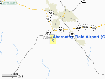
Location & QuickFacts
| FAA Information Effective: | 2008-09-25 |
| Airport Identifier: | GZS |
| Airport Status: | Operational |
| Longitude/Latitude: | 087-03-24.5700W/35-09-13.3500N
-87.056825/35.153708 (Estimated) |
| Elevation: | 685 ft / 208.79 m (Surveyed) |
| Land: | 308 acres |
| From nearest city: | 3 nautical miles SW of Pulaski, TN |
| Location: | Giles County, TN |
| Magnetic Variation: | 02W (2000) |
Owner & Manager
| Ownership: | Publicly owned |
| Owner: | City Of Pulaski
AND GILES COUNTY |
| Address: | South First St Po Box 633
Pulaski, TN 38478 |
| Phone number: | 931-363-2516 |
| Manager: | Randy Jones |
| Address: | 626 Bethel Rd
Pulaski, TN 38478 |
| Phone number: | 931-363-6827 |
Airport Operations and Facilities
| Airport Use: | Open to public |
| Wind indicator: | Yes |
| Segmented Circle: | Yes |
| Control Tower: | No |
| Lighting Schedule: | DUSK-DAWN |
| Beacon Color: | Clear-Green (lighted land airport) |
| Landing fee charge: | No |
| Sectional chart: | Atlanta |
| Region: | ASO - Southern |
| Boundary ARTCC: | ZME - Memphis |
| Tie-in FSS: | MKL - Jackson |
| FSS on Airport: | No |
| FSS Toll Free: | 1-800-WX-BRIEF |
| NOTAMs Facility: | MKL (NOTAM-d service avaliable) |
| Federal Agreements: | NGY |
Airport Communications
| CTAF: | 122.800 |
| Unicom: | 122.800 |
Airport Services
| Fuel available: | 100LLA |
| Bottled Oxygen: | NONE |
| Bulk Oxygen: | NONE |
Runway Information
Runway 16/34
| Dimension: | 5001 x 75 ft / 1524.3 x 22.9 m |
| Surface: | ASPH, Good Condition |
| Weight Limit: | Single wheel: 27000 lbs.
Dual wheel: 39000 lbs. |
| Edge Lights: | Medium |
| |
Runway 16 |
Runway 34 |
| Longitude: | 087-03-38.2600W | 087-03-10.8700W |
| Latitude: | 35-09-35.3700N | 35-08-51.3200N |
| Elevation: | 685.00 ft | 644.00 ft |
| Alignment: | 127 | 127 |
| Traffic Pattern: | Left | Left |
| Markings: | Non-precision instrument, Good Condition | Non-precision instrument, Good Condition |
| VASI: | 2-box on right side | 2-box on left side |
| Runway End Identifier: | Yes | Yes |
| Obstruction: | 232 ft tree, 4719.0 ft from runway, 52 ft left of centerline, 19:1 slope to clear
TREES 164' RIGHT EXTNDD CNTRLN. | 59 ft tree, 1446.0 ft from runway, 158 ft left of centerline, 21:1 slope to clear |
|
Radio Navigation Aids
| ID |
Type |
Name |
Ch |
Freq |
Var |
Dist |
| SYI | FAN MARKER | Bomar | | | 01W | 35.2 nm |
| GZS | NDB | Giles/dcmsnd | | 375.00 | 00E | 0.1 nm |
| LRT | NDB | Lawrenceburg | | 269.00 | 00E | 11.2 nm |
| LUG | NDB | Verona | | 251.00 | 00W | 24.1 nm |
| TNY | NDB | Kelso | | 358.00 | 01W | 25.3 nm |
| CWH | NDB | Capshaw | | 350.00 | 01W | 26.6 nm |
| PBC | NDB | Maury County | | 365.00 | 01W | 27.4 nm |
| HUA | NDB | Redstone | | 287.00 | 00W | 32.8 nm |
| JHG | NDB | Hohenwald | | 257.00 | 01W | 33.7 nm |
| ULH | NDB | Burwi | | 332.00 | 03W | 44.1 nm |
| BGF | NDB | Boiling Fork | | 263.00 | 02W | 48.6 nm |
| CPP | NDB | Cole Spring | | 230.00 | 01W | 48.6 nm |
| UXM | VOR | Tullahoma Regional | | 109.65 | 03W | 42.1 nm |
| DCU | VOR/DME | Decatur | 075X | 112.80 | 01W | 30.9 nm |
| SYI | VOR/DME | Shelbyville | 027X | 109.00 | 01W | 39.0 nm |
| RQZ | VORTAC | Rocket | 059X | 112.20 | 02E | 29.9 nm |
| MSL | VORTAC | Muscle Shoals | 112X | 116.50 | 01E | 34.4 nm |
| GHM | VORTAC | Graham | 053X | 111.60 | 03E | 45.2 nm |
| HSV | VOT | Huntsville | | 111.00 | | 17.4 nm |
Remarks
- ROCK QUARRY APROX 1000' FM RWY 34, ADV NTC GIVEN TO ARPT WHEN EXPLOSIVES ARE SCHED.
- ARPT UNATNDD THANKSGIVING; CHRISTMAS & NEW YEAR'S DAY.
- INTMT RADIO CONTROLLED ACFT OPERATIONS AFTERNOONS & WEEKENDS.
Images and information placed above are from
http://www.airport-data.com/airport/GZS/
We thank them for the data!
| General Info
|
| Country |
United States
|
| State |
TENNESSEE
|
| FAA ID |
GZS
|
| Latitude |
35-09-13.340N
|
| Longitude |
087-03-24.570W
|
| Elevation |
689 feet
|
| Near City |
PULASKI
|
We don't guarantee the information is fresh and accurate. The data may
be wrong or outdated.
For more up-to-date information please refer to other sources.
|
|


