 |
|
Location & QuickFacts
| FAA Information Effective: | 2008-09-25 |
| Airport Identifier: | TN41 |
| Airport Status: | Operational |
| Longitude/Latitude: | 084-45-55.0000W/35-46-22.0000N
-84.765278/35.772778 (Estimated) |
| Elevation: | 809 ft / 246.58 m (Estimated) |
| Land: | 0 acres |
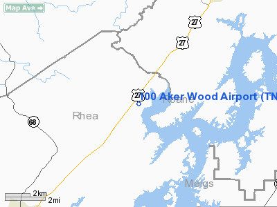
| From nearest city: | 7 nautical miles NE of Spring City, TN |
| Location: | Rhea County, TN |
| Magnetic Variation: | 03W (1995) |
Owner & Manager
| Ownership: | Privately owned |
| Owner: | Philip & Marjorie Hodge |
| Address: | 500 Pegasus Dr.
Spring City, TN 37381 |
| Phone number: | 423-365-4684 |
| Manager: | Philip & Marjorie Hodge |
| Address: | 500 Pegasus Dr.
Spring City, TN 37381 |
| Phone number: | 423-365-4684 |
Airport Operations and Facilities
| Airport Use: | Private |
| Wind indicator: | Yes |
| Segmented Circle: | No |
| Control Tower: | No |
| Sectional chart: | Atlanta |
| Region: | ASO - Southern |
| Boundary ARTCC: | ZTL - Atlanta |
| Tie-in FSS: | BNA - Nashville |
| FSS Toll Free: | 1-800-WX-BRIEF |
Runway Information
Runway 14/32
| Dimension: | 1914 x 75 ft / 583.4 x 22.9 m |
| Surface: | TURF, |
| |
Runway 14 |
Runway 32 |
| Traffic Pattern: | Left | Left |
|
Radio Navigation Aids
| ID |
Type |
Name |
Ch |
Freq |
Var |
Dist |
| DTE | NDB | Mark Anton | | 394.00 | 02W | 19.3 nm |
| MNV | NDB | Madisonville | | 361.00 | 04W | 23.2 nm |
| MMI | NDB | Mc Minn County | | 242.00 | 03W | 24.8 nm |
| HDI | NDB | Hardwick | | 369.00 | 01W | 37.8 nm |
| CQN | NDB | Daisy | | 341.00 | 02W | 41.2 nm |
| HEM | NDB | Huchn | | 233.00 | 02W | 42.0 nm |
| JAU | NDB | Jacksboro | | 204.00 | 03W | 44.9 nm |
| BPO | NDB | Piney Grove | | 403.00 | 05W | 48.2 nm |
| RN | NDB | Warri | | 209.00 | 02W | 48.7 nm |
| HCH | VORTAC | Hinch Mountain | 123X | 117.60 | 02W | 10.4 nm |
| VXV | VORTAC | Volunteer | 111X | 116.40 | 03W | 43.2 nm |
| TYS | VOT | Knoxville | | 112.00 | | 37.7 nm |
Remarks
Images and information placed above are from
http://www.airport-data.com/airport/TN41/
We thank them for the data!
| General Info
|
| Country |
United States
|
| State |
TENNESSEE
|
| FAA ID |
TN41
|
| Latitude |
35-46-22.000N
|
| Longitude |
084-45-55.000W
|
| Elevation |
809 feet
|
| Near City |
SPRING CITY
|
We don't guarantee the information is fresh and accurate. The data may
be wrong or outdated.
For more up-to-date information please refer to other sources.
|
|


