 |
|
Location & QuickFacts
| FAA Information Effective: | 2008-09-25 |
| Airport Identifier: | SD55 |
| Airport Status: | Operational |
| Longitude/Latitude: | 098-16-24.0000W/44-18-57.0000N
-98.273333/44.315833 (Estimated) |
| Elevation: | 1323 ft / 403.25 m (Estimated) |
| Land: | 160 acres |
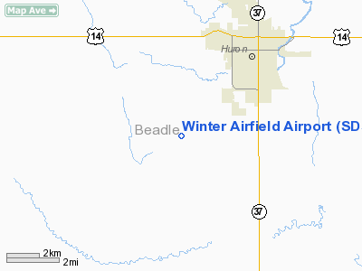
| From nearest city: | 4 nautical miles SW of Huron, SD |
| Location: | Beadle County, SD |
| Magnetic Variation: | 07E (1990) |
Owner & Manager
| Ownership: | Privately owned |
| Owner: | Jack W. Winter |
| Address: | 39704 -- 212th St
Huron, SD 57350-6520 |
| Phone number: | 605-352-1798 |
| Manager: | Jack W. Winter |
| Address: | 39704 -- 212th St
Huron, SD 57350-6520 |
| Phone number: | 605-352-1798 |
Airport Operations and Facilities
| Airport Use: | Private |
| Wind indicator: | Yes |
| Segmented Circle: | No |
| Control Tower: | No |
| Sectional chart: | Omaha |
| Region: | AGL - Great Lakes |
| Boundary ARTCC: | ZMP - Minneapolis |
| Tie-in FSS: | HON - Huron |
| FSS on Airport: | No |
| FSS Toll Free: | 1-800-WX-BRIEF |
Runway Information
Runway 12/30
| Dimension: | 2700 x 30 ft / 823.0 x 9.1 m |
| Surface: | TURF, |
| |
Runway 12 |
Runway 30 |
| Traffic Pattern: | Left | Left |
|
Radio Navigation Aids
| ID |
Type |
Name |
Ch |
Freq |
Var |
Dist |
| MHE | VOR/DME | Mitchell | 029X | 109.20 | 07E | 34.0 nm |
| HON | VORTAC | Huron | 123X | 117.60 | 10E | 7.6 nm |
Remarks
- AREA 125 FT EITHER SIDE & 200 FT EACH END BE CLEAR OF OBSTRUCTIONS; OBSTRUCTIONS IN APCHS BE REMOVED OR LOWERED OR THRS DSPLCD TO PROVIDE 20:1 APCH SLOPE.
Images and information placed above are from
http://www.airport-data.com/airport/SD55/
We thank them for the data!
| General Info
|
| Country |
United States
|
| State |
SOUTH DAKOTA
|
| FAA ID |
SD55
|
| Latitude |
44-18-57.000N
|
| Longitude |
098-16-24.000W
|
| Elevation |
1323 feet
|
| Near City |
HURON
|
We don't guarantee the information is fresh and accurate. The data may
be wrong or outdated.
For more up-to-date information please refer to other sources.
|
|


