 |
|
Coordinates: 43°23′25″N 099°50′32″W / 43.39028°N 99.84222°W / 43.39028; -99.84222
Winner Regional Airport
Bob Wiley Field |
| IATA: none – ICAO: KICR – FAA LID: ICR |
| Summary |
| Airport type |
Public |
| Owner |
City of Winner |
| Serves |
Winner, South Dakota |
| Elevation AMSL |
2,032 ft / 619 m |
| Runways |
| Direction |
Length |
Surface |
| ft |
m |
| 13/31 |
4,500 |
1,372 |
Concrete |
| 3/21 |
2,900 |
884 |
Turf |
| Statistics (2007) |
| Aircraft operations |
19,800 |
| Source: Federal Aviation Administration |
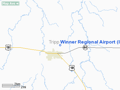
Winner Regional Airport (ICAO: KICR, FAA LID: ICR), also known as Bob Wiley Field, is a public airport located one mile (2 km) northeast of the central business district of Winner, a city in Tripp County, South Dakota, United States. The airport is owned by the City of Winner. The airport's FAA location identifier, formerly SFD, was changed on July 5, 2007.
Facilities and aircraft
Winner Regional Airport covers an area of 226 acres (91 ha) which contains two runways: 13/31 which has a concrete pavement measuring 4,500 x 75 ft (1,372 x 23 m) and 3/21 with a turf surface measuring 2,900 x 150 ft (884 x 46 m). For the 12-month period ending June 13, 2007, the airport had 19,800 aircraft operations, an average of 54 per day: 98% general aviation and 2% air taxi.
The above content comes from Wikipedia and is published under free licenses – click here to read more.
Location & QuickFacts
| FAA Information Effective: | 2008-09-25 |
| Airport Identifier: | ICR |
| Airport Status: | Operational |
| Longitude/Latitude: | 099-50-31.5160W/43-23-24.7800N
-99.842088/43.390217 (Estimated) |
| Elevation: | 2032 ft / 619.35 m (Surveyed) |
| Land: | 226 acres |
| From nearest city: | 1 nautical miles NE of Winner, SD |
| Location: | Tripp County, SD |
| Magnetic Variation: | 10E (1980) |
Owner & Manager
| Ownership: | Publicly owned |
| Owner: | City Of Winner |
| Address: | Po Box 691
Winner, SD 57580 |
| Phone number: | 605-842-2606 |
| Manager: | Don Bice |
| Address: | Rr 2 Box 100
Winner, SD 57580 |
| Phone number: | 605-842-0740 |
Airport Operations and Facilities
| Airport Use: | Open to public |
| Wind indicator: | Yes |
| Segmented Circle: | Yes |
| Control Tower: | No |
| Lighting Schedule: | DUSK-DAWN
MIRL RY 13/31 OPER DUSK-0000; FOR MIRL RY 13/31 AFTER 0000 KEY CTAF 5 TIMES. |
| Beacon Color: | Clear-Green (lighted land airport) |
| Landing fee charge: | No |
| Sectional chart: | Omaha |
| Region: | AGL - Great Lakes |
| Boundary ARTCC: | ZMP - Minneapolis |
| Tie-in FSS: | HON - Huron |
| FSS on Airport: | No |
| FSS Toll Free: | 1-800-WX-BRIEF |
| NOTAMs Facility: | ICR (NOTAM-d service avaliable) |
| Federal Agreements: | NGY |
Airport Communications
| CTAF: | 122.800 |
| Unicom: | 122.800 |
Airport Services
| Fuel available: | 100LLA |
| Airframe Repair: | MAJOR |
| Power Plant Repair: | MAJOR |
| Bottled Oxygen: | NONE |
| Bulk Oxygen: | NONE |
Runway Information
Runway 03/21
| Dimension: | 2900 x 150 ft / 883.9 x 45.7 m
400 FT BY 200 FT SAFETY AREA ON SE END. |
| Surface: | TURF, Good Condition |
| |
Runway 03 |
Runway 21 |
| Longitude: | 099-50-48.1200W | 099-50-23.7200W |
| Latitude: | 43-23-16.2800N | 43-23-38.7200N |
| Alignment: | 38 | 127 |
| Traffic Pattern: | Left | Left |
| Runway End Identifier: | No | No |
| Centerline Lights: | No | No |
| Touchdown Lights: | No | No |
| Obstruction: | , 50:1 slope to clear | 5 ft fence, 100.0 ft from runway, 20:1 slope to clear |
|
Runway 13/31
| Dimension: | 4500 x 75 ft / 1371.6 x 22.9 m
400 FT BY 200 FT SAFETY AREA ON SE END. |
| Surface: | CONC, |
| Weight Limit: | Single wheel: 12500 lbs. |
| Edge Lights: | Medium |
| |
Runway 13 |
Runway 31 |
| Longitude: | 099-50-50.2100W | 099-50-07.1450W |
| Latitude: | 43-23-38.7500N | 43-23-07.3030N |
| Elevation: | 2008.00 ft | 0.00 ft |
| Alignment: | 127 | 127 |
| Traffic Pattern: | Left | Left |
| Markings: | Non-precision instrument, Good Condition | Non-precision instrument, Good Condition |
| Crossing Height: | 38.00 ft | 35.00 ft |
| VASI: | 2-light PAPI on left side | 2-light PAPI on left side |
| Visual Glide Angle: | 3.00° | 3.00° |
| Runway End Identifier: | No | No |
| Centerline Lights: | No | No |
| Touchdown Lights: | No | No |
|
Radio Navigation Aids
| ID |
Type |
Name |
Ch |
Freq |
Var |
Dist |
| VTN | NDB | Valentine | | 314.00 | 08E | 44.4 nm |
| ISD | VOR | Winner | | 112.80 | 08E | 6.8 nm |
| ANW | VOR/DME | Ainsworth | 074X | 112.70 | 09E | 49.8 nm |
Remarks
- DEER ON & INVOF ARPT.
- HIGH AIR TFC OCT-NOV.
Images and information placed above are from
http://www.airport-data.com/airport/ICR/
We thank them for the data!
|
|


