 |
|
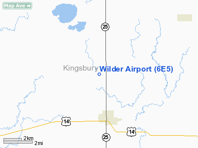
Location & QuickFacts
| FAA Information Effective: | 2008-09-25 |
| Airport Identifier: | 6E5 |
| Airport Status: | Operational |
| Longitude/Latitude: | 097-33-40.2790W/44-25-50.8900N
-97.561189/44.430803 (Estimated) |
| Elevation: | 1729 ft / 527.00 m (Surveyed) |
| Land: | 236 acres |
| From nearest city: | 2 nautical miles N of Desmet, SD |
| Location: | Kingsbury County, SD |
| Magnetic Variation: | 07E (1985) |
Owner & Manager
| Ownership: | Publicly owned |
| Owner: | City Of Desmet |
| Address: | Po Drawer 70
Desmet, SD 57231 |
| Phone number: | 605-854-3731 |
| Manager: | Ryan Petersen |
| Address: | Po Drawer 70
Desmet, SD 57231 |
| Phone number: | 605-860-1547 |
Airport Operations and Facilities
| Airport Use: | Open to public |
| Wind indicator: | Yes |
| Segmented Circle: | Yes |
| Control Tower: | No |
| Lighting Schedule: | DUSK-DAWN
ACTVT MIRL RY 15/33 - CTAF |
| Beacon Color: | Clear-Green (lighted land airport) |
| Landing fee charge: | No |
| Sectional chart: | Omaha |
| Region: | AGL - Great Lakes |
| Boundary ARTCC: | ZMP - Minneapolis |
| Tie-in FSS: | HON - Huron |
| FSS on Airport: | No |
| FSS Toll Free: | 1-800-WX-BRIEF |
| NOTAMs Facility: | HON (NOTAM-d service avaliable) |
| Federal Agreements: | NGY |
Airport Communications
Airport Services
| Airframe Repair: | NONE |
| Power Plant Repair: | NONE |
| Bottled Oxygen: | NONE |
| Bulk Oxygen: | NONE |
Runway Information
Runway 15/33
| Dimension: | 3700 x 60 ft / 1127.8 x 18.3 m |
| Surface: | ASPH, Fair Condition |
| Weight Limit: | Single wheel: 12500 lbs. |
| Edge Lights: | Medium |
| |
Runway 15 |
Runway 33 |
| Traffic Pattern: | Left | Left |
| Markings: | Basic, Good Condition | Basic, Good Condition |
| Crossing Height: | 31.00 ft | 34.00 ft |
| VASI: | 2-light PAPI on left side | 2-light PAPI on left side |
| Visual Glide Angle: | 3.00° | 3.00° |
| Obstruction: | 55 ft trees, 1730.0 ft from runway, 200 ft left of centerline, 28:1 slope to clear | 9 ft road, 620.0 ft from runway, 46:1 slope to clear |
|
Radio Navigation Aids
| ID |
Type |
Name |
Ch |
Freq |
Var |
Dist |
| MDS | NDB | Wentworth | | 400.00 | 05E | 32.3 nm |
| BKX | VOR/DME | Brookings | 025X | 108.80 | 06E | 33.0 nm |
| MHE | VOR/DME | Mitchell | 029X | 109.20 | 07E | 44.4 nm |
| HON | VORTAC | Huron | 123X | 117.60 | 10E | 32.2 nm |
| ATY | VORTAC | Watertown | 113X | 116.60 | 09E | 37.5 nm |
Images and information placed above are from
http://www.airport-data.com/airport/6E5/
We thank them for the data!
| General Info
|
| Country |
United States
|
| State |
SOUTH DAKOTA
|
| FAA ID |
6E5
|
| Latitude |
44-25-50.890N
|
| Longitude |
097-33-40.279W
|
| Elevation |
1729 feet
|
| Near City |
DESMET
|
We don't guarantee the information is fresh and accurate. The data may
be wrong or outdated.
For more up-to-date information please refer to other sources.
|
|


