|
|
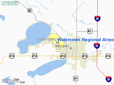
| Watertown Regional Airport |
 |
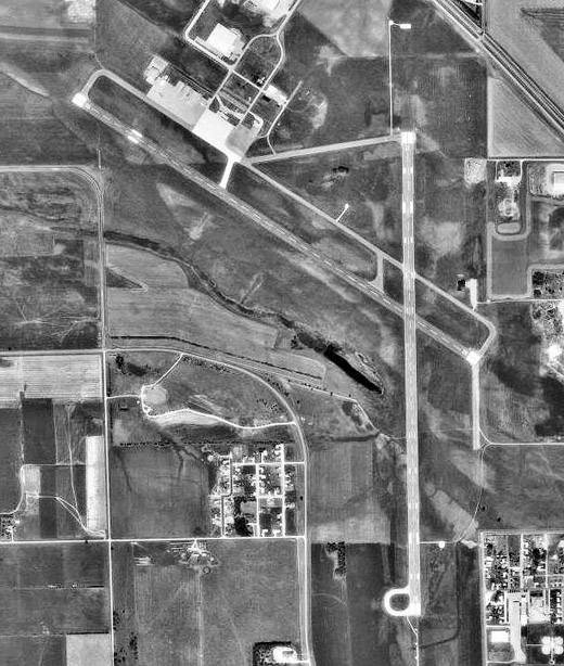 |
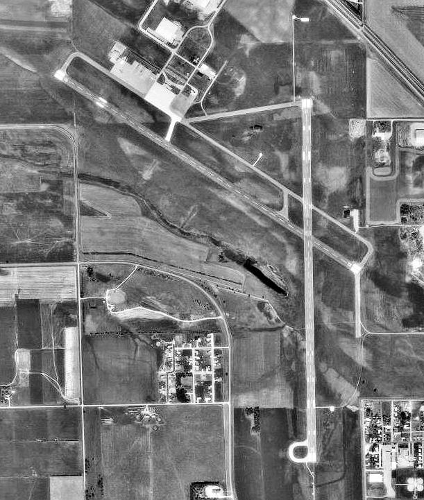
| 1991 USGS Photo |
| IATA: ATY – ICAO: KATY – FAA LID: ATY |
| Summary |
| Operator |
City of Watertown |
| Location |
Watertown, South Dakota |
| Elevation AMSL |
1,748 ft / 532.8 m |
| Coordinates |
44°54′50″N 97°09′17″W / 44.91389°N 97.15472°W / 44.91389; -97.15472 |
| Runways |
| Direction |
Length |
Surface |
| ft |
m |
| 12/30 |
6,900 |
2,103 |
Asphalt |
| 17/35 |
6,895 |
2,102 |
Asphalt |
Watertown Regional Airport (IATA: ATY, ICAO: KATY, FAA LID: ATY) is a public airport located two miles (3 km) northwest of the central business district (CBD) of Watertown, a city in Codington County, South Dakota, USA. The airport covers 919 acres (372 ha) and has two runways. It is mostly used for general aviation, but is also served by one commercial airline. Service is subsidized by the Essential Air Service program. Airlines and destinations
| Airlines |
Destinations |
| Delta Connection operated by Mesaba Airlines |
Pierre, Minneapolis/St. Paul |
History
During World War II the airfield was used by the United States Army Air Force. Used as a Second Air Force cold weather bomber training base as an auxiliary to Sioux Falls Army Air Field, and by Air Proving Ground Command.
The above content comes from Wikipedia and is published under free licenses – click here to read more.
Location & QuickFacts
| FAA Information Effective: | 2008-09-25 |
| Airport Identifier: | ATY |
| Airport Status: | Operational |
| Longitude/Latitude: | 097-09-17.0000W/44-54-50.3000N
-97.154722/44.913972 (Estimated) |
| Elevation: | 1749 ft / 533.10 m (Surveyed) |
| Land: | 919 acres |
| From nearest city: | 2 nautical miles NW of Watertown, SD |
| Location: | Codington County, SD |
| Magnetic Variation: | 06E (1985) |
Owner & Manager
| Ownership: | Publicly owned |
| Owner: | City Of Watertown |
| Address: | P.o. Box 910
Watertown, SD 57201 |
| Phone number: | 605-882-6209 |
| Manager: | Erick Dahl |
| Address: | 2416 Boeing Avenue
Watertown, SD 57201 |
| Phone number: | 605-882-6209
CELL 605-868-9179. |
Airport Operations and Facilities
| Airport Use: | Open to public |
| Wind indicator: | Yes |
| Segmented Circle: | Yes |
| Control Tower: | No |
| Lighting Schedule: | DUSK-DAWN
ACTVT HIRL RY 17/35; MIRL RY 12/30; REIL RYS 12 & 30; PAPI RYS 12; 30; 17 & 35 & MALSR RY 35 - CTAF. |
| Beacon Color: | Clear-Green (lighted land airport) |
| Landing fee charge: | No |
| Sectional chart: | Twin Cities |
| Region: | AGL - Great Lakes |
| Boundary ARTCC: | ZMP - Minneapolis |
| Tie-in FSS: | HON - Huron |
| FSS on Airport: | No |
| FSS Toll Free: | 1-800-WX-BRIEF |
| NOTAMs Facility: | ATY (NOTAM-d service avaliable) |
| Certification type/date: | I A S 05/1973
PPR 48 HRS UNSKED ACR OPNS WITH MORE THAN 30 PSGR SEATS CALL AMGR 605 882-6209/886-4733. |
| Federal Agreements: | NGPY |
Airport Communications
| CTAF: | 123.050 |
| Unicom: | 123.050 |
Airport Services
| Fuel available: | 100LLA |
| Airframe Repair: | MAJOR |
| Power Plant Repair: | MAJOR |
Runway Information
Runway 12/30
| Dimension: | 6899 x 100 ft / 2102.8 x 30.5 m |
| Surface: | ASPH, Good Condition |
| Surface Treatment: | Porous Friction Course |
| Weight Limit: | Single wheel: 85000 lbs.
Dual wheel: 108000 lbs.
Dual tandem wheel: 175000 lbs. |
| Edge Lights: | Medium |
| |
Runway 12 |
Runway 30 |
| Longitude: | 097-10-09.4958W | 097-08-50.5261W |
| Latitude: | 44-55-19.9347N | 44-54-41.3182N |
| Elevation: | 1748.00 ft | 1732.00 ft |
| Alignment: | 125 | 127 |
| Traffic Pattern: | Left | Left |
| Markings: | Non-precision instrument, Good Condition | Non-precision instrument, Good Condition |
| Crossing Height: | 48.00 ft | 34.00 ft |
| Displaced threshold: | 0.00 ft | 300.00 ft |
| VASI: | 4-light PAPI on left side | 4-light PAPI on left side |
| Visual Glide Angle: | 3.00° | 3.00° |
| Runway End Identifier: | Yes | Yes |
| Obstruction: | 71 ft tree, 2149.0 ft from runway, 5 ft left of centerline, 27:1 slope to clear | 51 ft tree, 2013.0 ft from runway, 329 ft left of centerline, 35:1 slope to clear |
| Decleard distances: | Take off run available 6900.00 ft
Take off distance available 6900.00 ft
Actual stop distance available 6900.00 ft
| Take off run available 6900.00 ft
Actual stop distance available 6900.00 ft
Landing distance available 6600.00 ft
|
|
Runway 17/35
| Dimension: | 6894 x 100 ft / 2101.3 x 30.5 m |
| Surface: | ASPH, Good Condition |
| Surface Treatment: | Porous Friction Course |
| Weight Limit: | Single wheel: 85000 lbs.
Dual wheel: 108000 lbs.
Dual tandem wheel: 175000 lbs. |
| Edge Lights: | High |
| |
Runway 17 |
Runway 35 |
| Longitude: | 097-09-03.8090W | 097-09-04.2172W |
| Latitude: | 44-55-14.0162N | 44-54-05.9478N |
| Elevation: | 1740.00 ft | 1743.00 ft |
| Alignment: | 127 | 0 |
| ILS Type: | | ILS/DME
|
| Traffic Pattern: | Left | Left |
| Markings: | Precision instrument, Good Condition | Precision instrument, Good Condition |
| Crossing Height: | 35.00 ft | 54.00 ft |
| VASI: | 4-light PAPI on left side | 4-light PAPI on left side |
| Visual Glide Angle: | 3.00° | 3.00° |
| Approach lights: | | MALSR |
| Runway End Identifier: | Yes | |
| Obstruction: | , 50:1 slope to clear | 83 ft bldg, 3775.0 ft from runway, 412 ft left of centerline, 43:1 slope to clear |
|
Radio Navigation Aids
| ID |
Type |
Name |
Ch |
Freq |
Var |
Dist |
| VVV | NDB | Ortonville | | 332.00 | 05E | 38.9 nm |
| DXX | NDB | Dawson/madison | | 341.00 | 06E | 41.7 nm |
| BKX | VOR/DME | Brookings | 025X | 108.80 | 06E | 39.5 nm |
| ATY | VORTAC | Watertown | 113X | 116.60 | 09E | 4.0 nm |
Remarks
- GULLS & GEESE ON & INVOF ARPT APR-NOV.
- DEER & OTHER WILDLIFE OCNLY ON ARPT
- GLIDER OPNS MAY THRU SEP.
- ANNUALLY APRIL- SEPT HAY CUTTING OPNS IN PROGRESS; FARMING EQUIP MAY BE IN APCHS.
- ACR OPNS INVOLVING ACFT WITH MORE THAN 9 PSGRS ARE NOT AUZD IN EXCESS OF 15 MINS BEFORE OR AFTER SKED ARR/DEP TIMES WITHOUT PRIOR COORDINATION WITH AMGR AND CFMN THAT ARFF IS AVBL PRIOR TO LANDING OR TAKEOFF.
Images and information placed above are from
http://www.airport-data.com/airport/ATY/
We thank them for the data!
| General Info
|
| Country |
United States
|
| State |
SOUTH DAKOTA
|
| FAA ID |
ATY
|
| Latitude |
44-54-50.330N
|
| Longitude |
097-09-16.990W
|
| Elevation |
1748 feet
|
| Near City |
WATERTOWN
|
We don't guarantee the information is fresh and accurate. The data may
be wrong or outdated.
For more up-to-date information please refer to other sources.
|
|