 |
|
Location & QuickFacts
| FAA Information Effective: | 2008-09-25 |
| Airport Identifier: | AGZ |
| Airport Status: | Operational |
| Longitude/Latitude: | 098-17-46.2830W/43-03-47.9770N
-98.296190/43.063327 (Estimated) |
| Elevation: | 1475 ft / 449.58 m (Surveyed) |
| Land: | 167 acres |
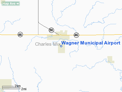
| From nearest city: | 1 nautical miles S of Wagner, SD |
| Location: | Charles Mix County, SD |
| Magnetic Variation: | 07E (1985) |
Owner & Manager
| Ownership: | Publicly owned |
| Owner: | City Of Wagner |
| Address: | P O Box 40
Wagner, SD 57380 |
| Phone number: | 605-384-3741 |
| Manager: | John Otte |
| Address: | Box 576
Wagner, SD 57380 |
| Phone number: | 605-384-5858 |
Airport Operations and Facilities
| Airport Use: | Open to public |
| Wind indicator: | Yes |
| Segmented Circle: | Yes |
| Control Tower: | No |
| Lighting Schedule: | DUSK-DAWN
MIRL RY 08/26 OPERATE DUSK-0000. AFT 0000 ACTVT - CTAF. |
| Beacon Color: | Clear-Green (lighted land airport) |
| Landing fee charge: | No |
| Sectional chart: | Omaha |
| Region: | AGL - Great Lakes |
| Boundary ARTCC: | ZMP - Minneapolis |
| Tie-in FSS: | HON - Huron |
| FSS on Airport: | No |
| FSS Toll Free: | 1-800-WX-BRIEF |
| NOTAMs Facility: | HON (NOTAM-d service avaliable) |
| Federal Agreements: | NGY |
Airport Communications
| CTAF: | 122.800 |
| Unicom: | 122.800 |
Airport Services
| Fuel available: | 100LL |
| Airframe Repair: | MAJOR |
| Power Plant Repair: | MAJOR |
| Bottled Oxygen: | NONE |
| Bulk Oxygen: | NONE |
Runway Information
Runway 08/26
| Dimension: | 3500 x 60 ft / 1066.8 x 18.3 m |
| Surface: | ASPH, Fair Condition |
| Weight Limit: | Single wheel: 12500 lbs. |
| Edge Lights: | Medium |
| |
Runway 08 |
Runway 26 |
| Traffic Pattern: | Left | Left |
| Markings: | Basic, Fair Condition | Basic, Fair Condition |
| Runway End Identifier: | No | No |
| Centerline Lights: | No | No |
| Touchdown Lights: | No | No |
| Obstruction: | 28 ft pline, 1205.0 ft from runway, 90 ft left of centerline, 35:1 slope to clear | 15 ft road, 620.0 ft from runway, 28:1 slope to clear |
|
Runway 14/32
| Dimension: | 2228 x 150 ft / 679.1 x 45.7 m |
| Surface: | TURF, Good Condition |
| |
Runway 14 |
Runway 32 |
| Traffic Pattern: | Left | Left |
| Runway End Identifier: | No | No |
| Centerline Lights: | No | No |
| Touchdown Lights: | No | No |
| Obstruction: | 19 ft road, 470.0 ft from runway, 24:1 slope to clear | 141 ft pline, 3392.0 ft from runway, 24:1 slope to clear |
|
Radio Navigation Aids
| ID |
Type |
Name |
Ch |
Freq |
Var |
Dist |
| AGZ | NDB | Wagner | | 392.00 | 08E | 0.2 nm |
| YKN | VOR/DME | Yankton | 051X | 111.40 | 07E | 41.0 nm |
| MHE | VOR/DME | Mitchell | 029X | 109.20 | 07E | 44.4 nm |
| ONL | VORTAC | O'neill | 086X | 113.90 | 10E | 39.6 nm |
Remarks
- SPRAY ACFT OPERATING INVOF ARPT APR-NOV.
- RYS 14/32 CLSD 1 NOV-15 APR.
- WILDLIFE ON AND INVOF ARPT.
- PRVDD AN UNOBSTRUCTED 20:1 APCH SLOPE AT EACH END OF RWY IS MAINTAINED.
Images and information placed above are from
http://www.airport-data.com/airport/AGZ/
We thank them for the data!
| General Info
|
| Country |
United States
|
| State |
SOUTH DAKOTA
|
| FAA ID |
AGZ
|
| Latitude |
43-03-47.977N
|
| Longitude |
098-17-46.283W
|
| Elevation |
1475 feet
|
| Near City |
WAGNER
|
We don't guarantee the information is fresh and accurate. The data may
be wrong or outdated.
For more up-to-date information please refer to other sources.
|
|


