 |
|
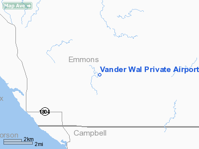
Vander Wal Private Airport |
Location & QuickFacts
| FAA Information Effective: | 2008-09-25 |
| Airport Identifier: | SD74 |
| Airport Status: | Operational |
| Longitude/Latitude: | 100-22-34.4470W/45-59-43.9790N
-100.376235/45.995550 (Estimated) |
| Elevation: | 1955 ft / 595.88 m (Estimated) |
| Land: | 0 acres |
| From nearest city: | 8 nautical miles NW of Pollock, SD |
| Location: | Edmunds County, SD |
| Magnetic Variation: | 10E (1985) |
Owner & Manager
| Ownership: | Privately owned |
| Owner: | Willis Vander Wal |
| Address: | Rr 1 Box 64
Pollock, SD 57648 |
| Manager: | Carter Vander Wal |
| Address: | Rr 1 Box 64
Pollock, SD 57648 |
| Phone number: | 701-336-7223 |
Airport Operations and Facilities
| Airport Use: | Private |
| Wind indicator: | Yes |
| Segmented Circle: | No |
| Control Tower: | No |
| Sectional chart: | Twin Cities |
| Region: | AGL - Great Lakes |
| Boundary ARTCC: | ZMP - Minneapolis |
| Tie-in FSS: | HON - Huron |
| FSS on Airport: | No |
| FSS Toll Free: | 1-800-WX-BRIEF |
Airport Services
Runway Information
Runway 15/33
| Dimension: | 2600 x 50 ft / 792.5 x 15.2 m |
| Surface: | TURF, Poor Condition |
| |
Runway 15 |
Runway 33 |
| Traffic Pattern: | Left | Left |
|
Radio Navigation Aids
| ID |
Type |
Name |
Ch |
Freq |
Var |
Dist |
| RVB | NDB | Riverbend | | 407.00 | 09E | 26.8 nm |
| BI | NDB | Jadan | | 230.00 | 11E | 43.7 nm |
| BIS | VOR/DME | Bismarck | 112X | 116.50 | 12E | 47.6 nm |
Remarks
- FILED FOR RECORD PURPOSES ONLY.
Images and information placed above are from
http://www.airport-data.com/airport/SD74/
We thank them for the data!
| General Info
|
| Country |
United States
|
| State |
SOUTH DAKOTA
|
| FAA ID |
SD74
|
| Latitude |
45-59-43.979N
|
| Longitude |
100-22-34.447W
|
| Elevation |
1955 feet
|
| Near City |
POLLOCK
|
We don't guarantee the information is fresh and accurate. The data may
be wrong or outdated.
For more up-to-date information please refer to other sources.
|
|


