 |
|
Location & QuickFacts
| FAA Information Effective: | 2008-09-25 |
| Airport Identifier: | D58 |
| Airport Status: | Operational |
| Longitude/Latitude: | 101-04-59.5250W/45-24-53.9550N
-101.083201/45.414987 (Estimated) |
| Elevation: | 2193 ft / 668.43 m (Surveyed) |
| Land: | 74 acres |
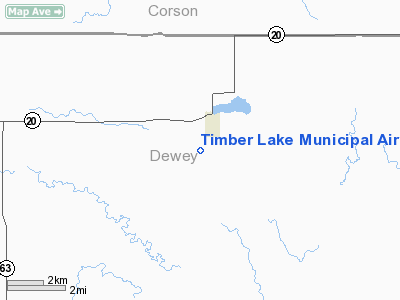
| From nearest city: | 1 nautical miles SW of Timber Lake, SD |
| Location: | Dewey County, SD |
| Magnetic Variation: | 10E (1985) |
Owner & Manager
| Ownership: | Publicly owned |
| Owner: | City Of Timber Lake |
| Address: | P O Box 431
Timber Lake, SD 57656 |
| Phone number: | 605-865-3790 |
| Manager: | Jake Kraft |
| Address: | Po Box 71
Timber Lake, SD 57656 |
| Phone number: | 605-865-3500 |
Airport Operations and Facilities
| Airport Use: | Open to public |
| Wind indicator: | Yes |
| Segmented Circle: | No |
| Control Tower: | No |
| Lighting Schedule: | DUSK-DAWN
ACTVT LIRL RY 12/30 - 122.8. |
| Beacon Color: | Clear-Green (lighted land airport) |
| Landing fee charge: | No |
| Sectional chart: | Billings |
| Region: | AGL - Great Lakes |
| Boundary ARTCC: | ZMP - Minneapolis |
| Tie-in FSS: | HON - Huron |
| FSS on Airport: | No |
| FSS Toll Free: | 1-800-WX-BRIEF |
| NOTAMs Facility: | HON (NOTAM-d service avaliable) |
| Federal Agreements: | 1 |
Airport Communications
Airport Services
| Airframe Repair: | MAJOR |
| Power Plant Repair: | MAJOR |
| Bottled Oxygen: | NONE |
| Bulk Oxygen: | NONE |
Runway Information
Runway 12/30
| Dimension: | 3300 x 150 ft / 1005.8 x 45.7 m |
| Surface: | TURF, Fair Condition |
| Edge Lights: | Low
LIGHTING SYSTEM IN POOR CONDITION. CHECK FOR NOTAMS |
| |
Runway 12 |
Runway 30 |
| Longitude: | 101-05-26.4600W | 101-04-52.5200W |
| Latitude: | 45-25-05.0900N | 45-24-42.9500N |
| Elevation: | 2176.00 ft | 2181.00 ft |
| Traffic Pattern: | Left | Left |
| Obstruction: | , 50:1 slope to clear | 17 ft road, 370.0 ft from runway, 160 ft right of centerline, 21:1 slope to clear |
|
Runway 17/35
| Dimension: | 2400 x 120 ft / 731.5 x 36.6 m |
| Surface: | TURF, Fair Condition |
| |
Runway 17 |
Runway 35 |
| Longitude: | 101-04-54.9700W | 101-04-54.9700W |
| Latitude: | 45-25-04.8800N | 45-24-41.1900N |
| Elevation: | 2193.00 ft | 2180.00 ft |
| Traffic Pattern: | Left | Left |
| Runway End Identifier: | No | No |
| Touchdown Lights: | No | No |
| Obstruction: | 4 ft fence, 120.0 ft from runway, 30:1 slope to clear | 7 ft fence, 145.0 ft from runway, 20:1 slope to clear |
|
Radio Navigation Aids
| ID |
Type |
Name |
Ch |
Freq |
Var |
Dist |
| RVB | NDB | Riverbend | | 407.00 | 09E | 29.5 nm |
| DPR | VORTAC | Dupree | 115X | 116.80 | 10E | 33.5 nm |
Remarks
- RY 12 FENCE 180 FT FROM THR; TOP OF FENCE BLO ELEV OF RY.
- FOR FIELD CONDITIONS CALL AMGR 605-865-3500.
- LIRL RY 12/30 OTS INDEFLY.
Images and information placed above are from
http://www.airport-data.com/airport/D58/
We thank them for the data!
| General Info
|
| Country |
United States
|
| State |
SOUTH DAKOTA
|
| FAA ID |
D58
|
| Latitude |
45-24-53.955N
|
| Longitude |
101-04-59.525W
|
| Elevation |
2193 feet
|
| Near City |
TIMBER LAKE
|
We don't guarantee the information is fresh and accurate. The data may
be wrong or outdated.
For more up-to-date information please refer to other sources.
|
|


