 |
|
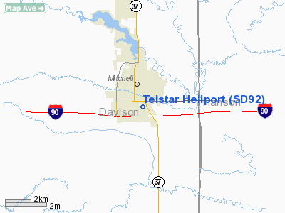
Location & QuickFacts
| FAA Information Effective: | 2008-09-25 |
| Airport Identifier: | SD92 |
| Airport Status: | Operational |
| Longitude/Latitude: | 098-01-17.2750W/43-41-53.9410N
-98.021465/43.698317 (Estimated) |
| Elevation: | 1310 ft / 399.29 m (Estimated) |
| Land: | 0 acres |
| From nearest city: | 1 nautical miles S of Mitchell, SD |
| Location: | Davison County, SD |
| Magnetic Variation: | 07E (1985) |
Owner & Manager
| Ownership: | Privately owned |
| Owner: | Jerry Regynski |
| Address: | 1300-1400 S. Kimball St.
Mitchell, SD 57301 |
| Phone number: | 605-996-6550 |
| Manager: | Jerry Regynski |
| Address: | 1300-1400 S. Kimball St.
Mitchell, SD 57301 |
| Phone number: | 605-996-6550 |
Airport Operations and Facilities
| Airport Use: | Private |
| Wind indicator: | Yes |
| Segmented Circle: | Yes |
| Control Tower: | No |
| Landing fee charge: | No |
| Sectional chart: | Omaha |
| Region: | AGL - Great Lakes |
| Boundary ARTCC: | ZMP - Minneapolis |
| Tie-in FSS: | HON - Huron |
| FSS on Airport: | No |
| FSS Toll Free: | 1-800-WX-BRIEF |
Runway Information
Helipad H1
| Dimension: | 34 x 30 ft / 10.4 x 9.1 m |
| Surface: | CONC, |
| |
Runway H1 |
Runway |
| Traffic Pattern: | Left | Left |
|
Radio Navigation Aids
| ID |
Type |
Name |
Ch |
Freq |
Var |
Dist |
| AGZ | NDB | Wagner | | 392.00 | 08E | 40.0 nm |
| MDS | NDB | Wentworth | | 400.00 | 05E | 44.7 nm |
| MHE | VOR/DME | Mitchell | 029X | 109.20 | 07E | 4.8 nm |
| HON | VORTAC | Huron | 123X | 117.60 | 10E | 46.3 nm |
Images and information placed above are from
http://www.airport-data.com/airport/SD92/
We thank them for the data!
| General Info
|
| Country |
United States
|
| State |
SOUTH DAKOTA
|
| FAA ID |
SD92
|
| Latitude |
43-41-53.941N
|
| Longitude |
098-01-17.275W
|
| Elevation |
1310 feet
|
| Near City |
MITCHELL
|
We don't guarantee the information is fresh and accurate. The data may
be wrong or outdated.
For more up-to-date information please refer to other sources.
|
|


