 |
|
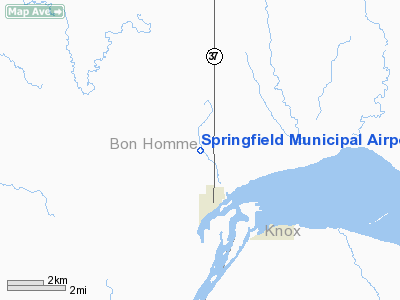
Location & QuickFacts
| FAA Information Effective: | 2008-09-25 |
| Airport Identifier: | Y03 |
| Airport Status: | Operational |
| Longitude/Latitude: | 097-54-04.2470W/42-52-47.9940N
-97.901180/42.879998 (Estimated) |
| Elevation: | 1324 ft / 403.56 m (Estimated) |
| Land: | 136 acres |
| From nearest city: | 1 nautical miles N of Springfield, SD |
| Location: | Bon Homme County, SD |
| Magnetic Variation: | 07E (1985) |
Owner & Manager
| Ownership: | Publicly owned |
| Owner: | City Of Springfield |
| Address: | Po Box 355
Springfield, SD 57062 |
| Phone number: | 605-369-2309 |
| Manager: | Melvin Ludens |
| Address: | Box 446
Springfield, SD 57062 |
| Phone number: | 605-369-2478 |
Airport Operations and Facilities
| Airport Use: | Open to public |
| Wind indicator: | Yes |
| Segmented Circle: | Yes |
| Control Tower: | No |
| Lighting Schedule: | DUSK-DAWN
ACTVT MIRL RY 15/33 AND PAPI RY 15/33 - CTAF. |
| Beacon Color: | Clear-Green (lighted land airport) |
| Landing fee charge: | No |
| Sectional chart: | Omaha |
| Region: | AGL - Great Lakes |
| Boundary ARTCC: | ZMP - Minneapolis |
| Tie-in FSS: | HON - Huron |
| FSS on Airport: | No |
| FSS Toll Free: | 1-800-WX-BRIEF |
| NOTAMs Facility: | HON (NOTAM-d service avaliable) |
| Federal Agreements: | NGY |
Airport Communications
Airport Services
| Fuel available: | 100LLA
FOR FUEL CALL 605-369-2426. |
| Bottled Oxygen: | NONE |
| Bulk Oxygen: | NONE |
Runway Information
Runway 01/19
| Dimension: | 1900 x 100 ft / 579.1 x 30.5 m |
| Surface: | TURF, Good Condition |
| |
Runway 01 |
Runway 19 |
| Longitude: | 097-54-12.9300W | 097-54-02.6600W |
| Latitude: | 42-52-38.1400N | 42-52-55.3100N |
| Elevation: | 1309.00 ft | 1315.00 ft |
| Traffic Pattern: | Left | Left |
| Obstruction: | , 50:1 slope to clear | 13 ft fence, 490.0 ft from runway, 37:1 slope to clear |
|
Runway 15/33
| Dimension: | 3500 x 60 ft / 1066.8 x 18.3 m |
| Surface: | ASPH, |
| Weight Limit: | Single wheel: 12500 lbs. |
| Edge Lights: | Medium |
| |
Runway 15 |
Runway 33 |
| Longitude: | 097-54-14.2900W | 097-53-55.5500W |
| Latitude: | 42-53-10.9900N | 42-52-39.2800N |
| Elevation: | 1323.00 ft | 1308.00 ft |
| Traffic Pattern: | Left | Left |
| Markings: | Non-precision instrument, Good Condition | Non-precision instrument, Good Condition |
| Crossing Height: | 25.00 ft | 25.00 ft |
| VASI: | 2-light PAPI on left side | 2-light PAPI on left side |
| Visual Glide Angle: | 3.00° | 3.00° |
| Obstruction: | , 50:1 slope to clear | 12 ft road, 590.0 ft from runway, 32:1 slope to clear |
|
Radio Navigation Aids
| ID |
Type |
Name |
Ch |
Freq |
Var |
Dist |
| AGZ | NDB | Wagner | | 392.00 | 08E | 20.4 nm |
| VMR | NDB | Vermillion | | 375.00 | 06E | 43.2 nm |
| YKN | VOR/DME | Yankton | 051X | 111.40 | 07E | 22.8 nm |
| ONL | VORTAC | O'neill | 086X | 113.90 | 10E | 42.6 nm |
Remarks
- RY 01 HAS A FENCE 75 FT FM THLD; TOP OF FENCE IS 3 FT BLO RY END.
- WILDLIFE ON AND INVOF ARPT.
Images and information placed above are from
http://www.airport-data.com/airport/Y03/
We thank them for the data!
| General Info
|
| Country |
United States
|
| State |
SOUTH DAKOTA
|
| FAA ID |
Y03
|
| Latitude |
42-52-47.994N
|
| Longitude |
097-54-04.247W
|
| Elevation |
1324 feet
|
| Near City |
SPRINGFIELD
|
We don't guarantee the information is fresh and accurate. The data may
be wrong or outdated.
For more up-to-date information please refer to other sources.
|
|


