 |
|
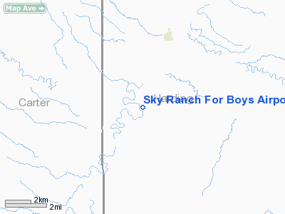
Sky Ranch For Boys Airport |
Location & QuickFacts
| FAA Information Effective: | 2008-09-25 |
| Airport Identifier: | SD33 |
| Airport Status: | Operational |
| Longitude/Latitude: | 104-00-01.7640W/45-29-59.9790N
-104.000490/45.499994 (Estimated) |
| Elevation: | 3200 ft / 975.36 m (Estimated) |
| Land: | 0 acres |
| From nearest city: | 3 nautical miles S of Camp Crook, SD |
| Location: | Harding County, SD |
| Magnetic Variation: | 12E (1985) |
Owner & Manager
| Ownership: | Privately owned |
| Owner: | Sky Ranch For Boys |
| Address: | Sky Ranch Lane
Sky Ranch, SD 57724 |
| Phone number: | 605-797-4422 |
| Manager: | Scott Louks |
| Address: | Sky Ranch For Boys
Sky Ranch, SD 57724 |
| Phone number: | 406-972-4570 |
Airport Operations and Facilities
| Airport Use: | Private |
| Wind indicator: | Yes |
| Segmented Circle: | No |
| Control Tower: | No |
| Lighting Schedule: | RDO REQ
ACTVT LIRL RY 11/29 - 123.5. |
| Landing fee charge: | No |
| Sectional chart: | Billings |
| Region: | AGL - Great Lakes |
| Boundary ARTCC: | ZLC - Salt Lake City |
| Tie-in FSS: | HON - Huron |
| FSS on Airport: | No |
| FSS Toll Free: | 1-800-WX-BRIEF |
Airport Services
| Fuel available: | 100 80
FUEL AVBL EMERGENCY USE ONLY. |
| Airframe Repair: | NONE |
| Power Plant Repair: | NONE |
Runway Information
Runway 04/22
| Dimension: | 2000 x 50 ft / 609.6 x 15.2 m |
| Surface: | GRVL-DIRT, |
| |
Runway 04 |
Runway 22 |
| Traffic Pattern: | Left | Left |
|
Runway 11/29
| Dimension: | 4800 x 30 ft / 1463.0 x 9.1 m |
| Surface: | ASPH, |
| Edge Lights: | Low
ONLY 4000 FT WEST LGTD. |
| |
Runway 11 |
Runway 29 |
| Traffic Pattern: | Left | Left |
|
Radio Navigation Aids
| ID |
Type |
Name |
Ch |
Freq |
Var |
Dist |
| EFC | NDB | Belle Fourche | | 269.00 | 11E | 46.3 nm |
| BOD | NDB | Bowman | | 374.00 | 10E | 47.6 nm |
| BUA | VOR/DME | Buffalo | 031X | 109.40 | 13E | 23.1 nm |
Remarks
- RYS & HGR LCTD IN PASTURE. CAUTION: WILDLIFE ON ARPT.
Images and information placed above are from
http://www.airport-data.com/airport/SD33/
We thank them for the data!
| General Info
|
| Country |
United States
|
| State |
SOUTH DAKOTA
|
| FAA ID |
SD33
|
| Latitude |
45-29-59.979N
|
| Longitude |
104-00-01.764W
|
| Elevation |
3200 feet
|
| Near City |
CAMP CROOK
|
We don't guarantee the information is fresh and accurate. The data may
be wrong or outdated.
For more up-to-date information please refer to other sources.
|
|


