 |
|
Location & QuickFacts
| FAA Information Effective: | 2008-09-25 |
| Airport Identifier: | 8D3 |
| Airport Status: | Operational |
| Longitude/Latitude: | 096-59-46.2900W/45-40-14.8540N
-96.996192/45.670793 (Estimated) |
| Elevation: | 1161 ft / 353.87 m (Estimated) |
| Land: | 183 acres |
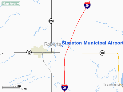
| From nearest city: | 3 nautical miles E of Sisseton, SD |
| Location: | Roberts County, SD |
| Magnetic Variation: | 06E (1985) |
Owner & Manager
| Ownership: | Publicly owned |
| Owner: | City Of Sisseton |
| Address: | 513 Veteran Ave East
Sisseton, SD 57262 |
| Phone number: | 605-698-3391 |
| Manager: | Terry Jaspers |
| Address: | 513 Veteran Ave East
Sisseton, SD 57262 |
| Phone number: | 605-698-3391 |
Airport Operations and Facilities
| Airport Use: | Open to public |
| Wind indicator: | Yes |
| Segmented Circle: | No |
| Control Tower: | No |
| Lighting Schedule: | DUSK-DAWN |
| Beacon Color: | Clear-Green (lighted land airport) |
| Landing fee charge: | No |
| Sectional chart: | Twin Cities |
| Region: | AGL - Great Lakes |
| Boundary ARTCC: | ZMP - Minneapolis |
| Tie-in FSS: | HON - Huron |
| FSS on Airport: | No |
| FSS Toll Free: | 1-800-WX-BRIEF |
| NOTAMs Facility: | HON (NOTAM-d service avaliable) |
| Federal Agreements: | NGY |
Airport Communications
Airport Services
| Fuel available: | 100LL
FUEL AVBL 24 HRS WITH CREDIT CARD. |
| Bottled Oxygen: | NONE |
| Bulk Oxygen: | NONE |
Runway Information
Runway 04/22
| Dimension: | 1932 x 150 ft / 588.9 x 45.7 m |
| Surface: | TURF, Good Condition |
| |
Runway 04 |
Runway 22 |
| Longitude: | 096-59-44.9300W | 096-59-25.8300W |
| Latitude: | 45-40-07.6300N | 45-40-21.2400N |
| Elevation: | 1158.00 ft | 1146.00 ft |
| Alignment: | 45 | 127 |
| Traffic Pattern: | Left | Left |
| Runway End Identifier: | No | No |
| Centerline Lights: | No | No |
| Touchdown Lights: | No | No |
| Obstruction: | 42 ft poles, 1080.0 ft from runway, 75 ft left of centerline, 25:1 slope to clear | 45 ft tree, 1277.0 ft from runway, 175 ft left of centerline, 28:1 slope to clear |
|
Runway 16/34
| Dimension: | 3400 x 60 ft / 1036.3 x 18.3 m |
| Surface: | ASPH, Good Condition |
| Weight Limit: | Single wheel: 12000 lbs. |
| Edge Lights: | Medium |
| |
Runway 16 |
Runway 34 |
| Longitude: | 096-59-43.2900W | 096-59-32.5200W |
| Latitude: | 45-40-23.8500N | 45-39-51.1400N |
| Elevation: | 1158.00 ft | 1159.00 ft |
| Alignment: | 127 | 127 |
| Traffic Pattern: | Left | Left |
| Markings: | Non-precision instrument, Fair Condition | Non-precision instrument, Fair Condition |
| VASI: | 2-light PAPI on left side | 2-light PAPI on left side |
| Runway End Identifier: | | No |
| Centerline Lights: | | No |
| Touchdown Lights: | | No |
| Obstruction: | 12 ft road, 500.0 ft from runway, 25:1 slope to clear | 4 ft fence, 285.0 ft from runway, 21:1 slope to clear |
|
Radio Navigation Aids
| ID |
Type |
Name |
Ch |
Freq |
Var |
Dist |
| ETH | NDB | Wheaton | | 326.00 | 05E | 20.0 nm |
| BTN | NDB | Britton | | 386.00 | 06E | 32.7 nm |
| VVV | NDB | Ortonville | | 332.00 | 05E | 32.8 nm |
| BWP | NDB | Breckenridge-wahpeton | | 233.00 | 05E | 38.2 nm |
| GWR | NDB | Gwinner | | 278.00 | 07E | 42.8 nm |
| AQP | NDB | Appleton | | 356.00 | 05E | 49.4 nm |
| MOX | VOR/DME | Morris | 033X | 109.60 | 05E | 43.6 nm |
| ATY | VORTAC | Watertown | 113X | 116.60 | 09E | 42.0 nm |
Remarks
- RY 04 +4' FENCE 300' FM THR & 175' FM THR & 125' FM CNTRLN.
- RY 16 +4' FENCE 460' FM THR.
- RY 22 +4' FENCE 300' FM THR & 85' L FM CNTRLN & 240' FM THR 125' L FM CNTRLN.
- RY 34 +4' FENCE 285' FM THR.
- WATERFOWL AND GULLS AROUND AND INVOF ARPT.
Images and information placed above are from
http://www.airport-data.com/airport/8D3/
We thank them for the data!
| General Info
|
| Country |
United States
|
| State |
SOUTH DAKOTA
|
| FAA ID |
8D3
|
| Latitude |
45-40-14.854N
|
| Longitude |
096-59-46.290W
|
| Elevation |
1161 feet
|
| Near City |
SISSETON
|
We don't guarantee the information is fresh and accurate. The data may
be wrong or outdated.
For more up-to-date information please refer to other sources.
|
|


