 |
|
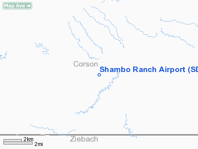
Location & QuickFacts
| FAA Information Effective: | 2008-09-25 |
| Airport Identifier: | SD41 |
| Airport Status: | Operational |
| Longitude/Latitude: | 101-50-01.4920W/45-31-59.9400N
-101.833748/45.533317 (Estimated) |
| Elevation: | 2500 ft / 762.00 m (Estimated) |
| Land: | 0 acres |
| From nearest city: | 26 nautical miles NW of Lemmon, SD |
| Location: | Corson County, SD |
| Magnetic Variation: | 10E (1985) |
Owner & Manager
| Ownership: | Privately owned |
| Owner: | Shambo Ranch |
| Address: | Box 529
Woodward, OK 73801 |
| Manager: | Mel Whitlow |
| Address: | Shambo Ranch
Meadow, SD 57694 |
Airport Operations and Facilities
| Airport Use: | Private |
| Wind indicator: | Yes |
| Segmented Circle: | No |
| Control Tower: | No |
| Landing fee charge: | No |
| Sectional chart: | Billings |
| Region: | AGL - Great Lakes |
| Boundary ARTCC: | ZMP - Minneapolis |
| Tie-in FSS: | HON - Huron |
| FSS on Airport: | No |
| FSS Toll Free: | 1-800-WX-BRIEF |
Runway Information
Runway 11/29
| Dimension: | 4750 x 75 ft / 1447.8 x 22.9 m |
| Surface: | TURF, |
| |
Runway 11 |
Runway 29 |
| Traffic Pattern: | Left | Left |
|
Radio Navigation Aids
| ID |
Type |
Name |
Ch |
Freq |
Var |
Dist |
| HEI | NDB | Hettinger | | 392.00 | 12E | 44.9 nm |
| LEM | VOR | Lemmon | | 111.40 | 13E | 25.8 nm |
| DPR | VORTAC | Dupree | 115X | 116.80 | 10E | 27.8 nm |
Remarks
- ARPT FALLS WI SCOPE OF FAR PART 157.5(A) NOT RQRG AN AIRSPACE REVIEW.
Images and information placed above are from
http://www.airport-data.com/airport/SD41/
We thank them for the data!
| General Info
|
| Country |
United States
|
| State |
SOUTH DAKOTA
|
| FAA ID |
SD41
|
| Latitude |
45-31-59.940N
|
| Longitude |
101-50-01.492W
|
| Elevation |
2500 feet
|
| Near City |
LEMMON
|
We don't guarantee the information is fresh and accurate. The data may
be wrong or outdated.
For more up-to-date information please refer to other sources.
|
|


