 |
|
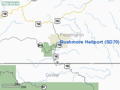
Location & QuickFacts
| FAA Information Effective: | 2008-09-25 |
| Airport Identifier: | SD70 |
| Airport Status: | Operational |
| Longitude/Latitude: | 103-25-33.0400W/43-53-14.0200N
-103.425844/43.887228 (Estimated) |
| Elevation: | 4400 ft / 1341.12 m (Estimated) |
| Land: | 0 acres |
| From nearest city: | 17 nautical miles NE of Keystone, SD |
| Location: | Pennington County, SD |
| Magnetic Variation: | 11E (1985) |
Owner & Manager
| Ownership: | Privately owned |
| Owner: | Rushmore Helicopters Inc |
| Address: |
Keystone, SD 57751 |
| Manager: | Bruce Shiltz |
| Address: | Po Box 133
Keystone, SD 57751 |
| Phone number: | 605-666-4461 |
Airport Operations and Facilities
| Airport Use: | Private |
| Wind indicator: | Yes |
| Segmented Circle: | No |
| Control Tower: | No |
| Landing fee charge: | No |
| Sectional chart: | Cheyenne |
| Region: | AGL - Great Lakes |
| Boundary ARTCC: | ZDV - Denver |
| Tie-in FSS: | HON - Huron |
| FSS on Airport: | No |
| FSS Toll Free: | 1-800-WX-BRIEF |
Runway Information
Helipad H1
| Dimension: | 700 x 100 ft / 213.4 x 30.5 m |
| Surface: | TURF, |
| |
Runway H1 |
Runway |
| Traffic Pattern: | Left | Left |
|
Radio Navigation Aids
| ID |
Type |
Name |
Ch |
Freq |
Var |
Dist |
| RA | NDB | Ranch | | 254.00 | 11E | 19.1 nm |
| SPF | NDB | Black Hills | | 300.00 | 11E | 39.1 nm |
| RCA | TACAN | Ellsworth | 025X | | 11E | 20.6 nm |
| ECS | VOR | Newcastle | | 108.20 | 11E | 38.2 nm |
| RAP | VORTAC | Rapid City | 070X | 112.30 | 13E | 18.7 nm |
Remarks
Images and information placed above are from
http://www.airport-data.com/airport/SD70/
We thank them for the data!
| General Info
|
| Country |
United States
|
| State |
SOUTH DAKOTA
|
| FAA ID |
SD70
|
| Latitude |
43-53-14.020N
|
| Longitude |
103-25-33.040W
|
| Elevation |
4400 feet
|
| Near City |
KEYSTONE
|
We don't guarantee the information is fresh and accurate. The data may
be wrong or outdated.
For more up-to-date information please refer to other sources.
|
|


