 |
|
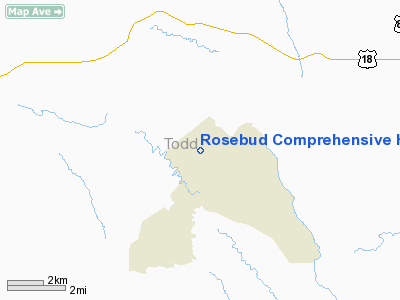
Rosebud Comprehensive Health Care Facility Heliport |
Location & QuickFacts
| FAA Information Effective: | 2008-09-25 |
| Airport Identifier: | 1SD7 |
| Airport Status: | Operational |
| Longitude/Latitude: | 100-50-59.5200W/43-15-27.0200N
-100.849867/43.257506 (Estimated) |
| Elevation: | 2715 ft / 827.53 m (Estimated) |
| Land: | 0 acres |
| From nearest city: | 1 nautical miles N of Rosebud, SD |
| Location: | Todd County, SD |
| Magnetic Variation: | 09E (1995) |
Owner & Manager
| Ownership: | Publicly owned |
| Owner: | Rosebud Phs, Ihs Hospital |
| Address: | P.o. Box 400
Rosebud, SD 57570 |
| Phone number: | 605-747-2231 |
| Manager: | Rosebud Phs, Ihs Hospital |
| Address: | P.o. Box 400
Rosebud, SD 57570 |
| Phone number: | 605-747-2231 |
Airport Operations and Facilities
| Airport Use: | Private
MEDICAL USE. |
| Wind indicator: | Yes |
| Segmented Circle: | No |
| Control Tower: | No |
| Lighting Schedule: | PHONE REQ
FOR PERIMETER LGTS CALL AMGR 605-747-2231. |
| Sectional chart: | Omaha |
| Region: | AGL - Great Lakes |
| Boundary ARTCC: | ZDV - Denver |
| Tie-in FSS: | HON - Huron |
| FSS on Airport: | No |
| FSS Toll Free: | 1-800-WX-BRIEF |
Runway Information
Helipad H1
| Dimension: | 50 x 50 ft / 15.2 x 15.2 m |
| Surface: | CONC, |
| |
Runway H1 |
Runway |
| Traffic Pattern: | Left | Left |
|
Radio Navigation Aids
| ID |
Type |
Name |
Ch |
Freq |
Var |
Dist |
| VTN | NDB | Valentine | | 314.00 | 08E | 27.2 nm |
| ISD | VOR | Winner | | 112.80 | 08E | 49.5 nm |
Remarks
- PRVDD APCH/DEP HELICOPTER OPNS CONDUCTED 240 CLKWS 200 USING PAD AS CENTER; TKOF/LNDG AREA MKD; WIND INDICATOR MAINTAINED AT TKOF/LNDG AREA.
Images and information placed above are from
http://www.airport-data.com/airport/1SD7/
We thank them for the data!
| General Info
|
| Country |
United States
|
| State |
SOUTH DAKOTA
|
| FAA ID |
1SD7
|
| Latitude |
43-15-27.020N
|
| Longitude |
100-50-59.520W
|
| Elevation |
2715 feet
|
| Near City |
ROSEBUD
|
We don't guarantee the information is fresh and accurate. The data may
be wrong or outdated.
For more up-to-date information please refer to other sources.
|
|


