 |
|
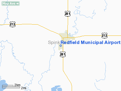
Location & QuickFacts
| FAA Information Effective: | 2008-09-25 |
| Airport Identifier: | 1D8 |
| Airport Status: | Operational |
| Longitude/Latitude: | 098-31-46.3430W/44-51-44.9140N
-98.529540/44.862476 (Estimated) |
| Elevation: | 1307 ft / 398.37 m (Surveyed) |
| Land: | 180 acres |
| From nearest city: | 1 nautical miles SW of Redfield, SD |
| Location: | Spink County, SD |
| Magnetic Variation: | 07E (1985) |
Owner & Manager
| Ownership: | Publicly owned |
| Owner: | City Of Redfield |
| Address: | 626 N. Main Street
Redfield, SD 57469 |
| Phone number: | 605-472-4550 |
| Manager: | Adam Hansen |
| Address: | 626 N. Main Street, 626 N. Main St
Redfield, SD 57469 |
| Phone number: | 605-472-0810 |
Airport Operations and Facilities
| Airport Use: | Open to public |
| Wind indicator: | Yes |
| Segmented Circle: | Yes |
| Control Tower: | No |
| Lighting Schedule: | DUSK-DAWN |
| Beacon Color: | Clear-Green (lighted land airport) |
| Landing fee charge: | No |
| Sectional chart: | Twin Cities |
| Region: | AGL - Great Lakes |
| Boundary ARTCC: | ZMP - Minneapolis |
| Tie-in FSS: | HON - Huron |
| FSS on Airport: | No |
| FSS Toll Free: | 1-800-WX-BRIEF |
| NOTAMs Facility: | HON (NOTAM-d service avaliable) |
| Federal Agreements: | NGY |
Airport Communications
| CTAF: | 122.800 |
| Unicom: | 122.800
UNICOM UNMONITORED. |
Airport Services
| Fuel available: | 100LL
FUEL AVBL 24 HRS WITH CREDIT CARD. |
| Airframe Repair: | MINOR |
| Power Plant Repair: | MINOR |
| Bottled Oxygen: | NONE |
| Bulk Oxygen: | NONE |
Runway Information
Runway 01/19
| Dimension: | 2600 x 250 ft / 792.5 x 76.2 m |
| Surface: | TURF, Good Condition |
| |
Runway 01 |
Runway 19 |
| Longitude: | 098-31-58.1800W | 098-31-45.1800W |
| Latitude: | 44-51-24.4900N | 44-51-48.0100N |
| Elevation: | 1305.00 ft | 1302.00 ft |
| Traffic Pattern: | Left | Left |
| Runway End Identifier: | No | No |
| Centerline Lights: | No | No |
| Touchdown Lights: | No | No |
| Obstruction: | , 50:1 slope to clear | 36 ft tree, 631.0 ft from runway, 35 ft right of centerline, 17:1 slope to clear |
|
Runway 13/31
| Dimension: | 3300 x 60 ft / 1005.8 x 18.3 m |
| Surface: | ASPH, Good Condition |
| Weight Limit: | Single wheel: 13000 lbs. |
| Edge Lights: | Low |
| |
Runway 13 |
Runway 31 |
| Longitude: | 098-31-59.5100W | 098-31-30.9200W |
| Latitude: | 44-51-47.8900N | 44-51-22.4300N |
| Elevation: | 1303.00 ft | 1303.00 ft |
| Traffic Pattern: | Left | Left |
| Markings: | Basic, Fair Condition | Basic, Fair Condition |
| Runway End Identifier: | No | No |
| Centerline Lights: | No | No |
| Touchdown Lights: | No | No |
| Obstruction: | 14 ft tree, 600.0 ft from runway, 28:1 slope to clear | 40 ft trees, 1860.0 ft from runway, 41:1 slope to clear |
|
Radio Navigation Aids
| ID |
Type |
Name |
Ch |
Freq |
Var |
Dist |
| ABR | VOR/DME | Aberdeen | 077X | 113.00 | 07E | 34.0 nm |
| HON | VORTAC | Huron | 123X | 117.60 | 10E | 27.1 nm |
Remarks
- ULTRALIGHT ACTIVITY ON AND INVOF ARPT.
- MIGRATORY BIRDS ON AND INVOF ARPT.
Images and information placed above are from
http://www.airport-data.com/airport/1D8/
We thank them for the data!
|
|


