 |
|
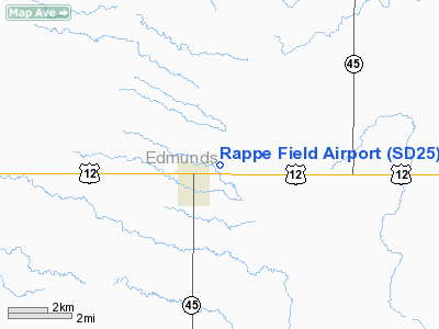
Location & QuickFacts
| FAA Information Effective: | 2008-09-25 |
| Airport Identifier: | SD25 |
| Airport Status: | Operational |
| Longitude/Latitude: | 099-00-44.4000W/45-27-07.9090N
-99.012333/45.452197 (Estimated) |
| Elevation: | 1521 ft / 463.60 m (Surveyed) |
| Land: | 12 acres |
| From nearest city: | 1 nautical miles E of Ipswich, SD |
| Location: | Edmunds County, SD |
| Magnetic Variation: | 08E (1985) |
Owner & Manager
| Ownership: | Privately owned |
| Owner: | Ipswich Flying Club Inc |
| Address: |
Ipswich, SD 57451 |
| Phone number: | 605-426-6645 |
| Manager: | William J. Rappe |
| Address: | P.o. Box 21
Ipswich, SD 57451-0021 |
| Phone number: | 605-426-6645 |
Airport Operations and Facilities
| Airport Use: | Private |
| Wind indicator: | Yes |
| Segmented Circle: | No |
| Control Tower: | No |
| Landing fee charge: | No |
| Sectional chart: | Twin Cities |
| Region: | AGL - Great Lakes |
| Boundary ARTCC: | ZMP - Minneapolis |
| Tie-in FSS: | HON - Huron |
| FSS on Airport: | No |
| FSS Toll Free: | 1-800-WX-BRIEF |
Airport Services
| Airframe Repair: | NONE |
| Power Plant Repair: | NONE |
Runway Information
Runway N/S
| Dimension: | 2525 x 75 ft / 769.6 x 22.9 m |
| Surface: | TURF, |
| |
Runway N |
Runway S |
| Traffic Pattern: | Left | Left |
|
Radio Navigation Aids
| ID |
Type |
Name |
Ch |
Freq |
Var |
Dist |
| ABR | VOR/DME | Aberdeen | 077X | 113.00 | 07E | 27.2 nm |
Remarks
- RY ROUGH; DEER ON & INVOF ARPT; NO SNOW REMOVAL WINTER MONTHS.
Images and information placed above are from
http://www.airport-data.com/airport/SD25/
We thank them for the data!
| General Info
|
| Country |
United States
|
| State |
SOUTH DAKOTA
|
| FAA ID |
SD25
|
| Latitude |
45-27-07.909N
|
| Longitude |
099-00-44.400W
|
| Elevation |
1521 feet
|
| Near City |
IPSWICH
|
We don't guarantee the information is fresh and accurate. The data may
be wrong or outdated.
For more up-to-date information please refer to other sources.
|
|


