 |
|
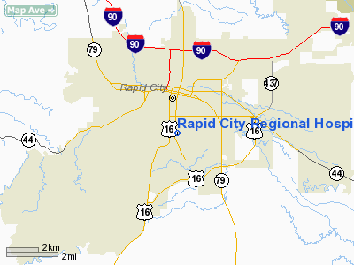
Rapid City Rgnl Hospital Heliport |
Location & QuickFacts
| FAA Information Effective: | 2008-09-25 |
| Airport Identifier: | SD40 |
| Airport Status: | Operational |
| Longitude/Latitude: | 103-13-34.6500W/44-03-27.9500N
-103.226292/44.057764 (Estimated) |
| Elevation: | 3354 ft / 1022.30 m (Estimated) |
| Land: | 0 acres |
| From nearest city: | 0 nautical miles N of Rapid City, SD |
| Location: | Pennington County, SD |
| Magnetic Variation: | 11E (1990) |
Owner & Manager
| Ownership: | Privately owned |
| Owner: | Rapid City Regional Hospital |
| Address: | 353 Fairmont Boulevard
Rapid City, SD 57701 |
| Phone number: | 605-343-5282 |
| Manager: | Rapid City Regional Hospital |
| Address: | 353 Fairmont Boulevard
Rapid City, SD 57701 |
| Phone number: | 605-343-5282 |
Airport Operations and Facilities
| Airport Use: | Private
MEDICAL USE. |
| Wind indicator: | Yes |
| Segmented Circle: | No |
| Control Tower: | No |
| Lighting Schedule: | PHONE REQ
FOR PERIMETER LGTS CALL 605-343-5282. |
| Sectional chart: | Billings |
| Region: | AGL - Great Lakes |
| Boundary ARTCC: | ZDV - Denver |
| Tie-in FSS: | HON - Huron |
| FSS Toll Free: | 1-800-WX-BRIEF |
Runway Information
Helipad H1
| Dimension: | 48 x 48 ft / 14.6 x 14.6 m |
| Surface: | CONC, |
| |
Runway H1 |
Runway |
| Traffic Pattern: | Left | Left |
|
Radio Navigation Aids
| ID |
Type |
Name |
Ch |
Freq |
Var |
Dist |
| RA | NDB | Ranch | | 254.00 | 11E | 11.3 nm |
| SPF | NDB | Black Hills | | 300.00 | 11E | 35.1 nm |
| EFC | NDB | Belle Fourche | | 269.00 | 11E | 49.0 nm |
| RCA | TACAN | Ellsworth | 025X | | 11E | 7.3 nm |
| ECS | VOR | Newcastle | | 108.20 | 11E | 48.0 nm |
| RAP | VORTAC | Rapid City | 070X | 112.30 | 13E | 10.5 nm |
Remarks
- PRVDD APCH/DEP RTE OPS FM 60 TO 330 DEGS; TKOF/LDG AREA MARKED; & WIND INDICATOR IS MAINTAINED.
Images and information placed above are from
http://www.airport-data.com/airport/SD40/
We thank them for the data!
| General Info
|
| Country |
United States
|
| State |
SOUTH DAKOTA
|
| FAA ID |
SD40
|
| Latitude |
44-03-27.950N
|
| Longitude |
103-13-34.650W
|
| Elevation |
3354 feet
|
| Near City |
RAPID CITY
|
We don't guarantee the information is fresh and accurate. The data may
be wrong or outdated.
For more up-to-date information please refer to other sources.
|
|


