 |
|
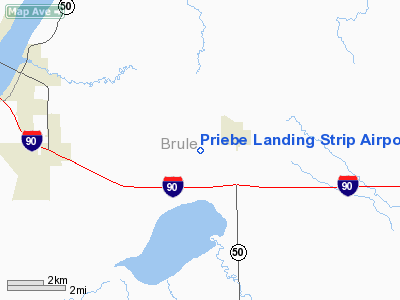
Priebe Landing Strip Airport |
Location & QuickFacts
| FAA Information Effective: | 2008-09-25 |
| Airport Identifier: | SD89 |
| Airport Status: | Operational |
| Longitude/Latitude: | 099-12-27.0000W/43-46-14.0000N
-99.207500/43.770556 (Estimated) |
| Elevation: | 1628 ft / 496.21 m (Estimated) |
| Land: | 160 acres |
| From nearest city: | 1 nautical miles SW of Pukwana, SD |
| Location: | Brule County, SD |
| Magnetic Variation: | 08E (1995) |
Owner & Manager
| Ownership: | Privately owned |
| Owner: | Carroll D Priebe |
| Address: | Rr1 Box 160
Pukwana, SD 57370 |
| Phone number: | 605-894-4255 |
| Manager: | Carroll D Priebe |
| Address: | Rr1 Box 160
Pukwana, SD 57370 |
| Phone number: | 605-894-4255 |
Airport Operations and Facilities
| Airport Use: | Private |
| Wind indicator: | Yes |
| Segmented Circle: | No |
| Control Tower: | No |
| Landing fee charge: | No |
| Sectional chart: | Omaha |
| Region: | AGL - Great Lakes |
| Boundary ARTCC: | ZMP - Minneapolis |
| Tie-in FSS: | HON - Huron |
| FSS on Airport: | No |
| FSS Toll Free: | 1-800-WX-BRIEF |
Runway Information
Runway 12/30
| Dimension: | 2690 x 105 ft / 819.9 x 32.0 m |
| Surface: | TURF, |
| |
Runway 12 |
Runway 30 |
| Traffic Pattern: | Left | Left |
| Displaced threshold: | 400.00 ft | 0.00 ft |
| Obstruction: | 25 ft pline, 1000.0 ft from runway | 23 ft bldg, 190.0 ft from runway |
|
Radio Navigation Aids
| ID |
Type |
Name |
Ch |
Freq |
Var |
Dist |
| ISD | VOR | Winner | | 112.80 | 08E | 29.5 nm |
Remarks
- PRVDD OBSTRUCTIONS CLEAR OF 125 FT EITHER SIDE OF RY CNTRLN & 200 FT FM EITHER RY END; OBSTRUCTIONS IN RY APCH SLOPE BE LOWERED OR REMOVED.
Images and information placed above are from
http://www.airport-data.com/airport/SD89/
We thank them for the data!
|
|


