 |
|
Location & QuickFacts
| FAA Information Effective: | 2008-09-25 |
| Airport Identifier: | 5P5 |
| Airport Status: | Operational |
| Longitude/Latitude: | 100-02-13.4410W/43-54-22.9620N
-100.037067/43.906378 (Estimated) |
| Elevation: | 1760 ft / 536.45 m (Surveyed) |
| Land: | 84 acres |
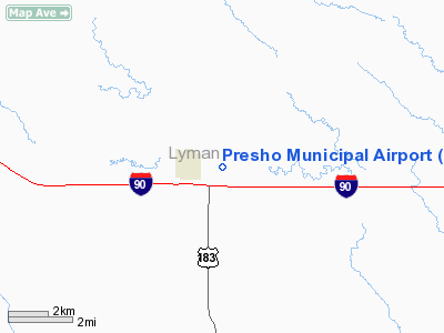
| From nearest city: | 1 nautical miles E of Presho, SD |
| Location: | Lyman County, SD |
| Magnetic Variation: | 09E (1985) |
Owner & Manager
| Ownership: | Publicly owned |
| Owner: | City Of Presho |
| Address: | Po Box 354
Presho, SD 57568 |
| Phone number: | 605-895-2337 |
| Manager: | Carl Brakke, Mayor |
| Address: | Po Box 250
Presho, SD 57568 |
| Phone number: | 605-895-2482 |
Airport Operations and Facilities
| Airport Use: | Open to public |
| Wind indicator: | Yes |
| Segmented Circle: | No |
| Control Tower: | No |
| Lighting Schedule: | DUSK-DAWN
ACTVT LIRL RY 10/28 - CTAF. |
| Beacon Color: | Clear-Green (lighted land airport) |
| Landing fee charge: | No |
| Sectional chart: | Omaha |
| Region: | AGL - Great Lakes |
| Boundary ARTCC: | ZMP - Minneapolis |
| Tie-in FSS: | HON - Huron |
| FSS on Airport: | No |
| FSS Toll Free: | 1-800-WX-BRIEF |
| NOTAMs Facility: | HON (NOTAM-d service avaliable) |
| Federal Agreements: | N |
Airport Communications
Airport Services
| Airframe Repair: | NONE |
| Power Plant Repair: | NONE |
| Bottled Oxygen: | NONE |
| Bulk Oxygen: | NONE |
Runway Information
Runway 10/28
| Dimension: | 3350 x 150 ft / 1021.1 x 45.7 m |
| Surface: | TURFRVL, Good Condition
CENTR 52' GRAVEL. |
| Edge Lights: | Low |
| |
Runway 10 |
Runway 28 |
| Longitude: | 100-02-30.8300W | 100-01-49.7900W |
| Latitude: | 43-54-25.3700N | 43-54-16.0400N |
| Elevation: | 1756.00 ft | 1742.00 ft |
| Traffic Pattern: | Left | Left |
| Runway End Identifier: | No | No |
| Touchdown Lights: | No | No |
| Obstruction: | 15 ft road, 300.0 ft from runway, 20:1 slope to clear | 4 ft fence, 110.0 ft from runway, 27:1 slope to clear |
|
Radio Navigation Aids
| ID |
Type |
Name |
Ch |
Freq |
Var |
Dist |
| ISD | VOR | Winner | | 112.80 | 08E | 27.9 nm |
| PIR | VORTAC | Pierre | 072X | 112.50 | 11E | 29.8 nm |
Remarks
- WILDLIFE & WATERFOWL ON & INVOF ARPT.
Images and information placed above are from
http://www.airport-data.com/airport/5P5/
We thank them for the data!
| General Info
|
| Country |
United States
|
| State |
SOUTH DAKOTA
|
| FAA ID |
5P5
|
| Latitude |
43-54-22.962N
|
| Longitude |
100-02-13.441W
|
| Elevation |
1760 feet
|
| Near City |
PRESHO
|
We don't guarantee the information is fresh and accurate. The data may
be wrong or outdated.
For more up-to-date information please refer to other sources.
|
|


