 |
|
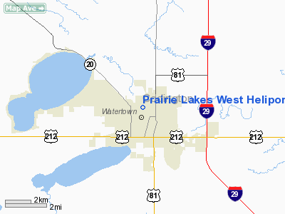
Prairie Lakes West Heliport |
Location & QuickFacts
| FAA Information Effective: | 2008-09-25 |
| Airport Identifier: | 0SD2 |
| Airport Status: | Operational |
| Longitude/Latitude: | 097-07-10.2600W/44-54-39.8700N
-97.119517/44.911075 (Estimated) |
| Elevation: | 1799 ft / 548.34 m (Estimated) |
| Land: | 0 acres |
| From nearest city: | 0 nautical miles N of Watertown, SD |
| Location: | Codington County, SD |
| Magnetic Variation: | 05E (2000) |
Owner & Manager
| Ownership: | Privately owned |
| Owner: | Prairie Lakes Healthcare System |
| Address: | 401 9th Ave Nw
Watertown, SD 57201 |
| Phone number: | 605-882-7000 |
| Manager: | Loren Robinson |
| Address: | 401 9th Ave Nw
Watertown, SD 57201 |
| Phone number: | 605-882-7866 |
Airport Operations and Facilities
| Airport Use: | Private
MEDICAL |
| Wind indicator: | Yes |
| Segmented Circle: | No |
| Control Tower: | No |
| Lighting Schedule: | PHONE REQ
FOR PERIMETER LGTS CALL (605) 882-7866. |
| Sectional chart: | Twin Cities |
| Region: | AGL - Great Lakes |
| Boundary ARTCC: | ZLC - Salt Lake City |
| Tie-in FSS: | HON - Huron |
| FSS on Airport: | No |
| FSS Toll Free: | 1-800-WX-BRIEF |
Runway Information
Helipad H1
| Dimension: | 40 x 40 ft / 12.2 x 12.2 m |
| Surface: | CONC, |
| |
Runway H1 |
Runway |
| Traffic Pattern: | Left | Left |
|
Radio Navigation Aids
| ID |
Type |
Name |
Ch |
Freq |
Var |
Dist |
| VVV | NDB | Ortonville | | 332.00 | 05E | 37.8 nm |
| DXX | NDB | Dawson/madison | | 341.00 | 06E | 40.2 nm |
| BKX | VOR/DME | Brookings | 025X | 108.80 | 06E | 38.8 nm |
| ATY | VORTAC | Watertown | 113X | 116.60 | 09E | 4.2 nm |
Remarks
- APCH/DEP 060 CLKWS TO 080; AREA MKD; WIND INDICATOR MAINTAINED; COMPLY WITH FAR PART 91.126 (6)(2); HELOS MONITOR WATERTOWN MUNI ARPT CTAF; OBSTNS IN APCH/DEP REMOVED.
Images and information placed above are from
http://www.airport-data.com/airport/0SD2/
We thank them for the data!
| General Info
|
| Country |
United States
|
| State |
SOUTH DAKOTA
|
| FAA ID |
0SD2
|
| Latitude |
44-54-39.870N
|
| Longitude |
097-07-10.260W
|
| Elevation |
1799 feet
|
| Near City |
WATERTOWN
|
We don't guarantee the information is fresh and accurate. The data may
be wrong or outdated.
For more up-to-date information please refer to other sources.
|
|


