 |
|
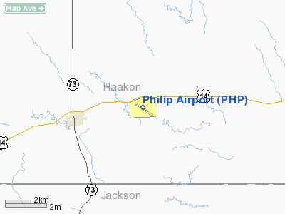
Location & QuickFacts
| FAA Information Effective: | 2008-09-25 |
| Airport Identifier: | PHP |
| Airport Status: | Operational |
| Longitude/Latitude: | 101-35-56.6170W/44-02-55.0580N
-101.599060/44.048627 (Estimated) |
| Elevation: | 2207 ft / 672.69 m (Surveyed) |
| Land: | 360 acres |
| From nearest city: | 3 nautical miles E of Philip, SD |
| Location: | Haakon County, SD |
| Magnetic Variation: | 11E (1980) |
Owner & Manager
| Ownership: | Publicly owned |
| Owner: | City Of Philip |
| Address: | P O Box 408
Philip, SD 57567 |
| Phone number: | 605-859-2175 |
| Manager: | Tom Lesselyoung |
| Address: | Po Box 408
Philip, SD 57567 |
| Phone number: | 605-859-2175 |
Airport Operations and Facilities
| Airport Use: | Open to public |
| Wind indicator: | Yes |
| Segmented Circle: | Yes |
| Control Tower: | No |
| Lighting Schedule: | DUSK-DAWN
ACTIVATE HIRL RYS 12/30; PAPI RYS 12 & 30 - CTAF. |
| Beacon Color: | Clear-Green (lighted land airport) |
| Landing fee charge: | No |
| Sectional chart: | Cheyenne |
| Region: | AGL - Great Lakes |
| Boundary ARTCC: | ZDV - Denver |
| Tie-in FSS: | HON - Huron |
| FSS on Airport: | No |
| FSS Toll Free: | 1-800-WX-BRIEF |
| NOTAMs Facility: | PHP (NOTAM-d service avaliable) |
| Federal Agreements: | NGY |
Airport Communications
| CTAF: | 122.800 |
| Unicom: | 122.800 |
Airport Services
| Fuel available: | 100LL
FUEL AVBL 24 HRS WITH CREDIT CARD. |
| Bottled Oxygen: | NONE |
| Bulk Oxygen: | NONE |
Runway Information
Runway 05/23
| Dimension: | 3600 x 150 ft / 1097.3 x 45.7 m |
| Surface: | TURF, Good Condition |
| |
Runway 05 |
Runway 23 |
| Longitude: | 101-36-15.5170W | 101-35-31.5170W |
| Latitude: | 44-02-49.9580N | 44-03-05.9580N |
| Elevation: | 2201.00 ft | 2198.00 ft |
| Alignment: | 63 | 127 |
| Traffic Pattern: | Left | Left |
| Obstruction: | , 50:1 slope to clear | 13 ft tree, 348.0 ft from runway, 100 ft right of centerline, 26:1 slope to clear |
|
Runway 12/30
| Dimension: | 4000 x 75 ft / 1219.2 x 22.9 m |
| Surface: | ASPH, Good Condition |
| Weight Limit: | Single wheel: 12500 lbs. |
| Edge Lights: | High |
| |
Runway 12 |
Runway 30 |
| Longitude: | 101-36-20.9460W | 101-35-37.9180W |
| Latitude: | 44-03-04.6260N | 44-02-40.2140N |
| Elevation: | 2207.00 ft | 2192.00 ft |
| Alignment: | 127 | 127 |
| Traffic Pattern: | Left | Left |
| Markings: | Basic, Good Condition | Basic, Good Condition |
| VASI: | 2-light PAPI on left side | 2-light PAPI on left side |
| Obstruction: | 31 ft pole, 922.0 ft from runway, 23:1 slope to clear | , 50:1 slope to clear |
|
Radio Navigation Aids
| ID |
Type |
Name |
Ch |
Freq |
Var |
Dist |
| PHP | VOR/DME | Philip | 021X | 108.40 | 12E | 2.9 nm |
Images and information placed above are from
http://www.airport-data.com/airport/PHP/
We thank them for the data!
| General Info
|
| Country |
United States
|
| State |
SOUTH DAKOTA
|
| FAA ID |
PHP
|
| Latitude |
44-02-55.058N
|
| Longitude |
101-35-56.617W
|
| Elevation |
2207 feet
|
| Near City |
PHILIP
|
We don't guarantee the information is fresh and accurate. The data may
be wrong or outdated.
For more up-to-date information please refer to other sources.
|
|


