 |
|
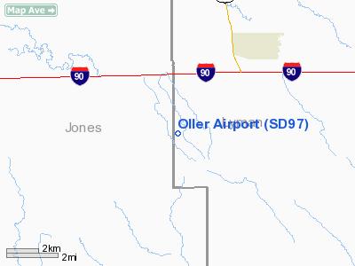
Location & QuickFacts
| FAA Information Effective: | 2008-09-25 |
| Airport Identifier: | SD97 |
| Airport Status: | Operational |
| Longitude/Latitude: | 100-21-43.4790W/43-52-39.9580N
-100.362077/43.877766 (Estimated) |
| Elevation: | 2100 ft / 640.08 m (Estimated) |
| Land: | 0 acres |
| From nearest city: | 4 nautical miles SW of Vivian, SD |
| Location: | Lyman County, SD |
| Magnetic Variation: | 09E (1985) |
Owner & Manager
| Ownership: | Privately owned |
| Owner: | Charles H. Oller |
| Address: | 28832 243rd St
Vivian, SD 57576 |
| Phone number: | 605-683-4591 |
| Manager: | Charles H. Oller |
| Address: | 28832 243rd St.
Vivian, SD 57576 |
| Phone number: | 605-683-4591 |
Airport Operations and Facilities
| Airport Use: | Private |
| Wind indicator: | Yes |
| Segmented Circle: | No |
| Control Tower: | No |
| Landing fee charge: | No |
| Sectional chart: | Omaha |
| Region: | AGL - Great Lakes |
| Boundary ARTCC: | ZMP - Minneapolis |
| Tie-in FSS: | HON - Huron |
| FSS on Airport: | No |
| FSS Toll Free: | 1-800-WX-BRIEF |
Airport Services
Runway Information
Runway 13/31
| Dimension: | 3000 x 80 ft / 914.4 x 24.4 m |
| Surface: | TURF-DIRT, |
| |
Runway 13 |
Runway 31 |
| Traffic Pattern: | Left | Left |
| Obstruction: | 25 ft plines, 50.0 ft from runway | 70 ft bldg, 200.0 ft from runway |
|
Radio Navigation Aids
| ID |
Type |
Name |
Ch |
Freq |
Var |
Dist |
| ISD | VOR | Winner | | 112.80 | 08E | 35.1 nm |
| PIR | VORTAC | Pierre | 072X | 112.50 | 11E | 32.2 nm |
Remarks
- E111 FILED FOR RECORD PURPOSES ONLY.
Images and information placed above are from
http://www.airport-data.com/airport/SD97/
We thank them for the data!
| General Info
|
| Country |
United States
|
| State |
SOUTH DAKOTA
|
| FAA ID |
SD97
|
| Latitude |
43-52-39.958N
|
| Longitude |
100-21-43.479W
|
| Elevation |
2100 feet
|
| Near City |
VIVIAN
|
We don't guarantee the information is fresh and accurate. The data may
be wrong or outdated.
For more up-to-date information please refer to other sources.
|
|


