 |
|
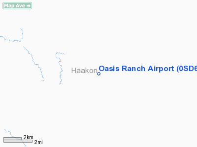
Location & QuickFacts
| FAA Information Effective: | 2008-09-25 |
| Airport Identifier: | 0SD6 |
| Airport Status: | Operational |
| Longitude/Latitude: | 101-49-33.5300W/44-17-19.9460N
-101.825981/44.288874 (Estimated) |
| Elevation: | 2580 ft / 786.38 m (Surveyed) |
| Land: | 0 acres |
| From nearest city: | 16 nautical miles NW of Philip, SD |
| Location: | Haakon County, SD |
| Magnetic Variation: | 10E (1985) |
Owner & Manager
| Ownership: | Privately owned |
| Owner: | Donald L Ferguson |
| Address: | Oasis Ranch
Philip, SD 57567 |
| Manager: | Donald L Ferguson |
| Address: | Oasis Ranch
Philip, SD 57567 |
| Phone number: | 605-859-2302 |
Airport Operations and Facilities
| Airport Use: | Private |
| Wind indicator: | Yes
GROVE OF TREES SOUTH OF RWY MAY AFFECT WIND INDICATOR. |
| Segmented Circle: | No |
| Control Tower: | No |
| Landing fee charge: | No |
| Sectional chart: | Cheyenne |
| Region: | AGL - Great Lakes |
| Boundary ARTCC: | ZDV - Denver |
| Tie-in FSS: | HON - Huron |
| FSS on Airport: | No |
| FSS Toll Free: | 1-800-WX-BRIEF |
Airport Services
Runway Information
Runway NW/SE
| Dimension: | 2500 x 25 ft / 762.0 x 7.6 m |
| Surface: | TURF, |
| |
Runway NW |
Runway SE |
| Traffic Pattern: | Left | Left |
|
Radio Navigation Aids
| ID |
Type |
Name |
Ch |
Freq |
Var |
Dist |
| PHP | VOR/DME | Philip | 021X | 108.40 | 12E | 15.5 nm |
| DPR | VORTAC | Dupree | 115X | 116.80 | 10E | 47.7 nm |
Images and information placed above are from
http://www.airport-data.com/airport/0SD6/
We thank them for the data!
| General Info
|
| Country |
United States
|
| State |
SOUTH DAKOTA
|
| FAA ID |
0SD6
|
| Latitude |
44-17-19.946N
|
| Longitude |
101-49-33.530W
|
| Elevation |
2580 feet
|
| Near City |
PHILIP
|
We don't guarantee the information is fresh and accurate. The data may
be wrong or outdated.
For more up-to-date information please refer to other sources.
|
|


