 |
|
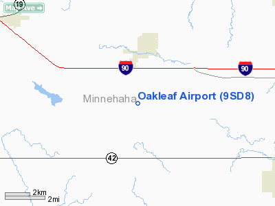
Location & QuickFacts
| FAA Information Effective: | 2008-09-25 |
| Airport Identifier: | 9SD8 |
| Airport Status: | Operational |
| Longitude/Latitude: | 096-57-01.1970W/43-34-59.9170N
-96.950333/43.583310 (Estimated) |
| Elevation: | 1625 ft / 495.30 m (Estimated) |
| Land: | 0 acres |
| From nearest city: | 2 nautical miles S of Hartford, SD |
| Location: | Minnehaha County, SD |
| Magnetic Variation: | 06E (1985) |
Owner & Manager
| Ownership: | Privately owned |
| Owner: | Don Oakleaf |
| Address: |
Hartford, SD 57033 |
| Phone number: | 605-528-3461 |
| Manager: | Don Oakleaf |
| Address: |
Hartford, SD 57033 |
| Phone number: | 605-528-3461 |
Airport Operations and Facilities
| Airport Use: | Private |
| Wind indicator: | Yes |
| Segmented Circle: | No |
| Control Tower: | No |
| Landing fee charge: | No |
| Sectional chart: | Omaha |
| Region: | AGL - Great Lakes |
| Boundary ARTCC: | ZMP - Minneapolis |
| Tie-in FSS: | HON - Huron |
| FSS on Airport: | No |
| FSS Toll Free: | 1-800-WX-BRIEF |
Runway Information
Runway 12/30
| Dimension: | 2600 x 100 ft / 792.5 x 30.5 m |
| Surface: | TURF, |
| |
Runway 12 |
Runway 30 |
| Traffic Pattern: | Left | Left |
|
Radio Navigation Aids
| ID |
Type |
Name |
Ch |
Freq |
Var |
Dist |
| FS | NDB | Rokky | | 245.00 | 06E | 7.5 nm |
| MDS | NDB | Wentworth | | 400.00 | 05E | 26.6 nm |
| SOY | NDB | Sioux Center | | 368.00 | 06E | 42.9 nm |
| VMR | NDB | Vermillion | | 375.00 | 06E | 49.3 nm |
| PQN | NDB/DME | Pipestone | 028X | 284.00 | 06E | 37.3 nm |
| BKX | VOR/DME | Brookings | 025X | 108.80 | 06E | 43.7 nm |
| YKN | VOR/DME | Yankton | 051X | 111.40 | 07E | 44.3 nm |
| MHE | VOR/DME | Mitchell | 029X | 109.20 | 07E | 48.7 nm |
| FSD | VORTAC | Sioux Falls | 097X | 115.00 | 09E | 8.4 nm |
Remarks
- PROVIDED RWY IS RELOCATED IN ORDER TO PROVIDE A 20:1 OR BETTER OBSTRUCTION FREE APCH SURFACE TO RWY 12.
Images and information placed above are from
http://www.airport-data.com/airport/9SD8/
We thank them for the data!
| General Info
|
| Country |
United States
|
| State |
SOUTH DAKOTA
|
| FAA ID |
9SD8
|
| Latitude |
43-34-59.917N
|
| Longitude |
096-57-01.197W
|
| Elevation |
1625 feet
|
| Near City |
HARTFORD
|
We don't guarantee the information is fresh and accurate. The data may
be wrong or outdated.
For more up-to-date information please refer to other sources.
|
|


