 |
|
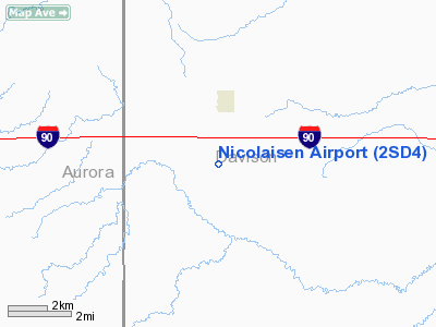
Location & QuickFacts
| FAA Information Effective: | 2008-09-25 |
| Airport Identifier: | 2SD4 |
| Airport Status: | Operational |
| Longitude/Latitude: | 098-15-55.0000W/43-41-00.0000N
-98.265278/43.683333 (Estimated) |
| Elevation: | 1440 ft / 438.91 m (Estimated) |
| Land: | 0 acres |
| From nearest city: | 2 nautical miles S of Mount Vernon, SD |
| Location: | Davison County, SD |
| Magnetic Variation: | 07E (1995) |
Owner & Manager
| Ownership: | Privately owned |
| Owner: | Richard D Nicolaisen |
| Address: | 25503 397 Th Ave
Mount Vernon, SD 57363 |
| Phone number: | 605-236-5581 |
| Manager: | Richard D Nicolaisen |
| Address: | 25503 397 Th Ave
Mount Vernon, SD 57363 |
| Phone number: | 605-236-5581 |
Airport Operations and Facilities
| Airport Use: | Private |
| Wind indicator: | Yes |
| Segmented Circle: | No |
| Control Tower: | No |
| Sectional chart: | Omaha |
| Region: | AGL - Great Lakes |
| Boundary ARTCC: | ZMP - Minneapolis |
| Tie-in FSS: | HON - Huron |
| FSS on Airport: | No |
| FSS Toll Free: | 1-800-WX-BRIEF |
Runway Information
Runway N/S
| Dimension: | 2800 x 50 ft / 853.4 x 15.2 m |
| Surface: | TURF, |
| |
Runway N |
Runway S |
| Traffic Pattern: | Left | Left |
|
Radio Navigation Aids
| ID |
Type |
Name |
Ch |
Freq |
Var |
Dist |
| AGZ | NDB | Wagner | | 392.00 | 08E | 37.3 nm |
| MHE | VOR/DME | Mitchell | 029X | 109.20 | 07E | 11.4 nm |
| HON | VORTAC | Huron | 123X | 117.60 | 10E | 45.5 nm |
Images and information placed above are from
http://www.airport-data.com/airport/2SD4/
We thank them for the data!
| General Info
|
| Country |
United States
|
| State |
SOUTH DAKOTA
|
| FAA ID |
2SD4
|
| Latitude |
43-41-00.000N
|
| Longitude |
098-15-55.000W
|
| Elevation |
1440 feet
|
| Near City |
MOUNT VERNON
|
We don't guarantee the information is fresh and accurate. The data may
be wrong or outdated.
For more up-to-date information please refer to other sources.
|
|


