 |
|
Location & QuickFacts
| FAA Information Effective: | 2008-09-25 |
| Airport Identifier: | 8F6 |
| Airport Status: | Operational |
| Longitude/Latitude: | 100-42-43.4920W/43-51-05.9630N
-100.712081/43.851656 (Estimated) |
| Elevation: | 2263 ft / 689.76 m (Estimated) |
| Land: | 83 acres |
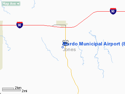
| From nearest city: | 3 nautical miles S of Murdo, SD |
| Location: | Jones County, SD |
| Magnetic Variation: | 09E (1985) |
Owner & Manager
| Ownership: | Publicly owned |
| Owner: | City Of Murdo |
| Address: | Box 432
Murdo, SD 57559 |
| Phone number: | 605-669-2272 |
| Manager: | Krysti Barnes |
| Address: | Po Box 432
Murdo, SD 57559 |
| Phone number: | 605-669-2272 |
Airport Operations and Facilities
| Airport Use: | Open to public |
| Wind indicator: | Yes |
| Segmented Circle: | Yes |
| Control Tower: | No |
| Lighting Schedule: | DUSK-DAWN
FOR MIRL RY 14/32 KEY CTAF 5 TIMES. |
| Beacon Color: | Clear-Green (lighted land airport) |
| Landing fee charge: | No |
| Sectional chart: | Omaha |
| Region: | AGL - Great Lakes |
| Boundary ARTCC: | ZMP - Minneapolis |
| Tie-in FSS: | HON - Huron |
| FSS on Airport: | No |
| FSS Toll Free: | 1-800-WX-BRIEF |
| NOTAMs Facility: | HON (NOTAM-d service avaliable) |
| Federal Agreements: | NGY |
Airport Communications
Airport Services
| Power Plant Repair: | NONE |
| Bottled Oxygen: | NONE |
| Bulk Oxygen: | NONE |
Runway Information
Runway 14/32
| Dimension: | 3400 x 60 ft / 1036.3 x 18.3 m |
| Surface: | ASPH, |
| Weight Limit: | Single wheel: 12500 lbs. |
| Edge Lights: | Medium |
| |
Runway 14 |
Runway 32 |
| Longitude: | 100-42-59.7600W | 100-42-31.4900W |
| Latitude: | 43-51-24.2600N | 43-50-50.4600N |
| Elevation: | 2269.00 ft | 2253.00 ft |
| Traffic Pattern: | Left | Left |
| Markings: | Basic, Good Condition | Basic, Good Condition |
| Runway End Identifier: | No | |
| Obstruction: | , 50:1 slope to clear | 8 ft fence, 390.0 ft from runway, 23:1 slope to clear |
|
Radio Navigation Aids
| ID |
Type |
Name |
Ch |
Freq |
Var |
Dist |
| ISD | VOR | Winner | | 112.80 | 08E | 46.8 nm |
| PHP | VOR/DME | Philip | 021X | 108.40 | 12E | 43.0 nm |
| PIR | VORTAC | Pierre | 072X | 112.50 | 11E | 40.3 nm |
Remarks
- WILDLIFE ON & INVOF ARPT.
Images and information placed above are from
http://www.airport-data.com/airport/8F6/
We thank them for the data!
| General Info
|
| Country |
United States
|
| State |
SOUTH DAKOTA
|
| FAA ID |
8F6
|
| Latitude |
43-51-05.963N
|
| Longitude |
100-42-43.492W
|
| Elevation |
2263 feet
|
| Near City |
MURDO
|
We don't guarantee the information is fresh and accurate. The data may
be wrong or outdated.
For more up-to-date information please refer to other sources.
|
|


