 |
|
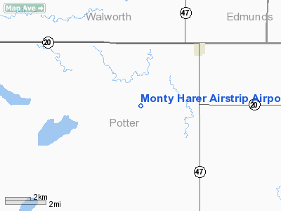
Monty Harer Airstrip Airport |
Location & QuickFacts
| FAA Information Effective: | 2008-09-25 |
| Airport Identifier: | SD79 |
| Airport Status: | Operational |
| Longitude/Latitude: | 099-50-10.4220W/45-12-04.9400N
-99.836228/45.201372 (Estimated) |
| Elevation: | 1860 ft / 566.93 m (Estimated) |
| Land: | 0 acres |
| From nearest city: | 4 nautical miles NE of Hoven, SD |
| Location: | Potter County, SD |
| Magnetic Variation: | 09E (1985) |
Owner & Manager
| Ownership: | Privately owned |
| Owner: | Darrell Harer |
| Address: | Rr 1 Box 69
Hoven, SD 57450 |
| Manager: | Monty Harer |
| Address: | Rr 1 Box 69
Hoven, SD 57450 |
| Phone number: | 605-948-2474 |
Airport Operations and Facilities
| Airport Use: | Private |
| Wind indicator: | No |
| Segmented Circle: | No |
| Control Tower: | No |
| Landing fee charge: | No |
| Sectional chart: | Twin Cities |
| Region: | AGL - Great Lakes |
| Boundary ARTCC: | ZMP - Minneapolis |
| Tie-in FSS: | HON - Huron |
| FSS on Airport: | No |
| FSS Toll Free: | 1-800-WX-BRIEF |
Runway Information
Runway N/S
| Dimension: | 2600 x 100 ft / 792.5 x 30.5 m |
| Surface: | TURF, |
| |
Runway N |
Runway S |
| Traffic Pattern: | Left | Left |
|
Radio Navigation Aids
| ID |
Type |
Name |
Ch |
Freq |
Var |
Dist |
| RVB | NDB | Riverbend | | 407.00 | 09E | 32.0 nm |
Remarks
- FOR RECORD PURPOSES ONLY.
Images and information placed above are from
http://www.airport-data.com/airport/SD79/
We thank them for the data!
| General Info
|
| Country |
United States
|
| State |
SOUTH DAKOTA
|
| FAA ID |
SD79
|
| Latitude |
45-12-04.940N
|
| Longitude |
099-50-10.422W
|
| Elevation |
1860 feet
|
| Near City |
HOVEN
|
We don't guarantee the information is fresh and accurate. The data may
be wrong or outdated.
For more up-to-date information please refer to other sources.
|
|


