 |
|
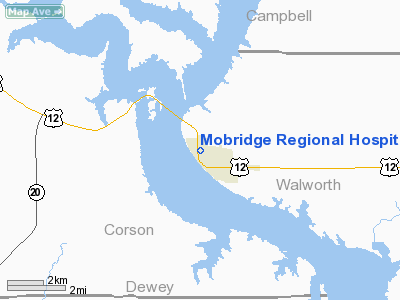
Mobridge Rgnl Hospital Heliport |
Location & QuickFacts
| FAA Information Effective: | 2008-09-25 |
| Airport Identifier: | SD80 |
| Airport Status: | Operational |
| Longitude/Latitude: | 100-26-56.4900W/45-32-44.9800N
-100.449025/45.545828 (Estimated) |
| Elevation: | 1670 ft / 509.02 m (Estimated) |
| Land: | 0 acres |
| From nearest city: | 0 nautical miles N of Mobridge, SD |
| Location: | Walworth County, SD |
| Magnetic Variation: | 09E (1995) |
Owner & Manager
| Ownership: | Privately owned |
| Owner: | Mobridge Regional Hospital |
| Address: | Po Box 580
Mobridge, SD 57601-0580 |
| Phone number: | 605-845-3692 |
| Manager: | Darlene Odde |
| Address: | Po Box 580
Mobridge, SD 57601-0580 |
| Phone number: | 605-845-3692 |
Airport Operations and Facilities
| Airport Use: | Private
MEDICAL USE. |
| Segmented Circle: | No |
| Control Tower: | No |
| Sectional chart: | Twin Cities |
| Region: | AGL - Great Lakes |
| Boundary ARTCC: | ZMP - Minneapolis |
| Tie-in FSS: | HON - Huron |
| FSS on Airport: | No |
| FSS Toll Free: | 1-800-WX-BRIEF |
Runway Information
Helipad H1
| Dimension: | 40 x 40 ft / 12.2 x 12.2 m |
| Surface: | CONC, |
| |
Runway H1 |
Runway |
| Traffic Pattern: | Left | Left |
|
Radio Navigation Aids
| ID |
Type |
Name |
Ch |
Freq |
Var |
Dist |
| RVB | NDB | Riverbend | | 407.00 | 09E | 1.7 nm |
Remarks
- PRVDD APCH/DEP 090-270, AREA IS MKD, WIND INDICATOR IS MAINTAINED & COMPLY WITH 14 CFR FAR PART 91 126(B).
Images and information placed above are from
http://www.airport-data.com/airport/SD80/
We thank them for the data!
| General Info
|
| Country |
United States
|
| State |
SOUTH DAKOTA
|
| FAA ID |
SD80
|
| Latitude |
45-32-44.980N
|
| Longitude |
100-26-56.490W
|
| Elevation |
1670 feet
|
| Near City |
MOBRIDGE
|
We don't guarantee the information is fresh and accurate. The data may
be wrong or outdated.
For more up-to-date information please refer to other sources.
|
|


