 |
|
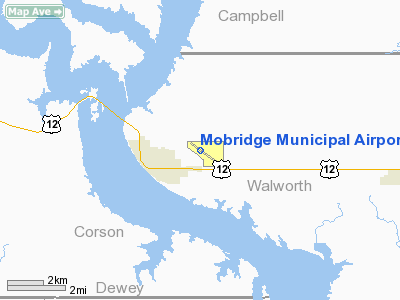
Location & QuickFacts
| FAA Information Effective: | 2008-09-25 |
| Airport Identifier: | MBG |
| Airport Status: | Operational |
| Longitude/Latitude: | 100-24-28.5090W/45-32-47.4130N
-100.407919/45.546504 (Estimated) |
| Elevation: | 1715 ft / 522.73 m (Surveyed) |
| Land: | 300 acres |
| From nearest city: | 1 nautical miles NE of Mobridge, SD |
| Location: | Walworth County, SD |
| Magnetic Variation: | 09E (1990) |
Owner & Manager
| Ownership: | Publicly owned |
| Owner: | City Of Mobridge |
| Address: | 205 E 2nd St
Mobridge, SD 57601 |
| Phone number: | 605-845-3509 |
| Manager: | Virgil Lenling |
| Address: | 102 First Avenue E
Mobridge, SD 57601 |
| Phone number: | 605-845-2977 |
Airport Operations and Facilities
| Airport Use: | Open to public |
| Wind indicator: | Yes |
| Segmented Circle: | Yes |
| Control Tower: | No |
| Lighting Schedule: | DUSK-DAWN
ACTVT MIRL RY 12/30 - CTAF. |
| Beacon Color: | Clear-Green (lighted land airport) |
| Landing fee charge: | No |
| Sectional chart: | Twin Cities |
| Region: | AGL - Great Lakes |
| Boundary ARTCC: | ZMP - Minneapolis |
| Tie-in FSS: | HON - Huron |
| FSS on Airport: | No |
| FSS Toll Free: | 1-800-WX-BRIEF |
| NOTAMs Facility: | MBG (NOTAM-d service avaliable) |
| Federal Agreements: | NGY |
Airport Communications
| CTAF: | 122.800 |
| Unicom: | 122.800 |
Airport Services
| Fuel available: | 100LLA MOGAS |
| Airframe Repair: | MAJOR |
| Power Plant Repair: | MAJOR |
| Bottled Oxygen: | NONE |
| Bulk Oxygen: | NONE |
Runway Information
Runway 12/30
| Dimension: | 4411 x 75 ft / 1344.5 x 22.9 m |
| Surface: | ASPH, Good Condition |
| Weight Limit: | Single wheel: 12500 lbs. |
| Edge Lights: | Medium |
| |
Runway 12 |
Runway 30 |
| Longitude: | 100-24-53.3630W | 100-24-03.6580W |
| Latitude: | 45-33-00.4200N | 45-32-34.4050N |
| Elevation: | 1702.00 ft | 1699.00 ft |
| Alignment: | 127 | 127 |
| Traffic Pattern: | Left | Left |
| Markings: | Non-precision instrument, Good Condition | Non-precision instrument, Good Condition |
| Crossing Height: | 31.00 ft | 31.00 ft |
| VASI: | 2-light PAPI on left side | 2-light PAPI on right side |
| Visual Glide Angle: | 3.00° | 3.00° |
| Runway End Identifier: | No | No |
| Centerline Lights: | No | No |
| Touchdown Lights: | No | No |
| Obstruction: | 40 ft gnd, 2000.0 ft from runway, 45:1 slope to clear | 60 ft pline, 2000.0 ft from runway, 30:1 slope to clear |
|
Runway 17/35
| Dimension: | 2400 x 250 ft / 731.5 x 76.2 m |
| Surface: | TURF, Good Condition |
| |
Runway 17 |
Runway 35 |
| Longitude: | 100-24-11.4820W | 100-24-11.4830W |
| Latitude: | 45-32-57.6780N | 45-32-33.9780N |
| Elevation: | 1715.00 ft | 1691.00 ft |
| Alignment: | 127 | 127 |
| Traffic Pattern: | Left | Left |
| Markings: | None, | None, |
| Runway End Identifier: | No | No |
| Centerline Lights: | No | No |
| Touchdown Lights: | No | No |
| Obstruction: | 43 ft road, 882.0 ft from runway, 20:1 slope to clear | , 50:1 slope to clear |
|
Radio Navigation Aids
| ID |
Type |
Name |
Ch |
Freq |
Var |
Dist |
| RVB | NDB | Riverbend | | 407.00 | 09E | 0.2 nm |
Images and information placed above are from
http://www.airport-data.com/airport/MBG/
We thank them for the data!
| General Info
|
| Country |
United States
|
| State |
SOUTH DAKOTA
|
| FAA ID |
MBG
|
| Latitude |
45-32-47.413N
|
| Longitude |
100-24-28.509W
|
| Elevation |
1715 feet
|
| Near City |
MOBRIDGE
|
We don't guarantee the information is fresh and accurate. The data may
be wrong or outdated.
For more up-to-date information please refer to other sources.
|
|


