 |
|
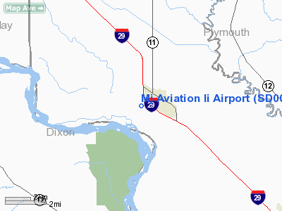
Location & QuickFacts
| FAA Information Effective: | 2008-09-25 |
| Airport Identifier: | SD00 |
| Airport Status: | Operational |
| Longitude/Latitude: | 096-41-56.1300W/42-40-43.2900N
-96.698925/42.678692 (Estimated) |
| Elevation: | 1115 ft / 339.85 m (Estimated) |
| Land: | 0 acres |
| From nearest city: | 0 nautical miles SW of Elk Point, SD |
| Location: | Union County, SD |
| Magnetic Variation: | 05E (2000) |
Owner & Manager
| Ownership: | Privately owned |
| Owner: | John O'connell |
| Address: | 24028 405 Th Ave
Letcher, SD 57359 |
| Phone number: | 605-248-2314 |
| Manager: | John O'connell |
| Address: | 24028 405 Th Ave
Letcher, SD 57359 |
| Phone number: | 605-248-2314 |
Airport Operations and Facilities
| Airport Use: | Private |
| Segmented Circle: | No |
| Control Tower: | No |
| Sectional chart: | Omaha |
| Region: | AGL - Great Lakes |
| Boundary ARTCC: | ZMP - Minneapolis |
| Tie-in FSS: | HON - Huron |
| FSS Toll Free: | 1-800-WX-BRIEF |
Runway Information
Runway 18/36
| Dimension: | 3000 x 100 ft / 914.4 x 30.5 m |
| Surface: | TURF, |
| |
Runway 18 |
Runway 36 |
| Traffic Pattern: | Left | Left |
|
Radio Navigation Aids
| ID |
Type |
Name |
Ch |
Freq |
Var |
Dist |
| VMR | NDB | Vermillion | | 375.00 | 06E | 11.6 nm |
| OI | NDB | Tommi | | 305.00 | 07E | 16.8 nm |
| GAK | NDB | Sioux Gateway | | 233.00 | 06E | 21.4 nm |
| SU | NDB | Salix | | 414.00 | 07E | 27.8 nm |
| LCG | NDB | Wayne | | 389.00 | 06E | 29.1 nm |
| ORC | NDB | Orange City | | 521.00 | 05E | 33.8 nm |
| SOY | NDB | Sioux Center | | 368.00 | 06E | 35.3 nm |
| FS | NDB | Rokky | | 245.00 | 06E | 49.3 nm |
| SHL | NDB | Sheldon | | 338.00 | 05E | 49.8 nm |
| YKN | VOR/DME | Yankton | 051X | 111.40 | 07E | 33.5 nm |
| DDL | VOR/DME | Sheldon | 023X | 108.60 | 05E | 49.8 nm |
| SUX | VORTAC | Sioux City | 112X | 116.50 | 09E | 26.1 nm |
Remarks
- AVOID INTERSTATE HWY & TOWN NE OF ARPT.
- PRVDD CLEAR 20:1 APCH, CLEAR RY SAFETY AREA AND CLEAR OBSTL FREE ZONE.
Images and information placed above are from
http://www.airport-data.com/airport/SD00/
We thank them for the data!
| General Info
|
| Country |
United States
|
| State |
SOUTH DAKOTA
|
| FAA ID |
SD00
|
| Latitude |
42-40-42.000N
|
| Longitude |
096-41-56.000W
|
| Elevation |
1120 feet
|
| Near City |
ELK POINT
|
We don't guarantee the information is fresh and accurate. The data may
be wrong or outdated.
For more up-to-date information please refer to other sources.
|
|


