 |
|
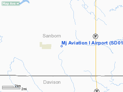
Location & QuickFacts
| FAA Information Effective: | 2008-09-25 |
| Airport Identifier: | SD01 |
| Airport Status: | Operational |
| Longitude/Latitude: | 098-06-27.5500W/43-53-59.0000N
-98.107653/43.899722 (Estimated) |
| Elevation: | 1305 ft / 397.76 m (Estimated) |
| Land: | 0 acres |
| From nearest city: | 1 nautical miles E of Letcher, SD |
| Location: | Sanborn County, SD |
| Magnetic Variation: | 06E (2000) |
Owner & Manager
| Ownership: | Privately owned |
| Owner: | John O'connell |
| Address: | 24028 405 Th Ave
Letcher, SD 57359 |
| Phone number: | 605-248-2314 |
| Manager: | John O'connell |
| Address: | 24028 405 Th Ave
Letcher, SD 57359 |
| Phone number: | 605-248-2314 |
Airport Operations and Facilities
| Airport Use: | Private |
| Segmented Circle: | No |
| Control Tower: | No |
| Sectional chart: | Omaha |
| Region: | AGL - Great Lakes |
| Boundary ARTCC: | ZMP - Minneapolis |
| Tie-in FSS: | HON - Huron |
| FSS Toll Free: | 1-800-WX-BRIEF |
Runway Information
Runway 09/27
| Dimension: | 2000 x 20 ft / 609.6 x 6.1 m |
| Surface: | ASPH, |
| |
Runway 09 |
Runway 27 |
| Traffic Pattern: | Left | Left |
|
Runway 18/36
| Dimension: | 3000 x 100 ft / 914.4 x 30.5 m |
| Surface: | TURF, |
| |
Runway 18 |
Runway 36 |
| Traffic Pattern: | Left | Left |
| Obstruction: | | 150 ft pline |
|
Radio Navigation Aids
| ID |
Type |
Name |
Ch |
Freq |
Var |
Dist |
| MDS | NDB | Wentworth | | 400.00 | 05E | 44.6 nm |
| MHE | VOR/DME | Mitchell | 029X | 109.20 | 07E | 8.0 nm |
| HON | VORTAC | Huron | 123X | 117.60 | 10E | 33.6 nm |
Remarks
- 150 FT POWERLINE 1.5 MILES S OF ARPT.
- PRVDD CLEAR 20:1 APCH SLOPE, CLEAR OBSTACLE FREE ZONE, AND CLEAR RY SAFETY AREA.
Images and information placed above are from
http://www.airport-data.com/airport/SD01/
We thank them for the data!
| General Info
|
| Country |
United States
|
| State |
SOUTH DAKOTA
|
| FAA ID |
SD01
|
| Latitude |
43-54-02.000N
|
| Longitude |
098-06-30.000W
|
| Elevation |
1300 feet
|
| Near City |
LETCHER
|
We don't guarantee the information is fresh and accurate. The data may
be wrong or outdated.
For more up-to-date information please refer to other sources.
|
|


