 |
|
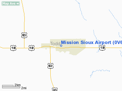
Location & QuickFacts
| FAA Information Effective: | 2008-09-25 |
| Airport Identifier: | 0V6 |
| Airport Status: | Operational |
| Longitude/Latitude: | 100-37-41.4970W/43-18-25.0120N
-100.628194/43.306948 (Estimated) |
| Elevation: | 2605 ft / 794.00 m (Estimated) |
| Land: | 240 acres |
| From nearest city: | 2 nautical miles E of Mission, SD |
| Location: | Todd County, SD |
| Magnetic Variation: | 09E (1985) |
Owner & Manager
| Ownership: | Publicly owned |
| Owner: | Rosebud Sioux Tribe |
| Address: | Box 838
Rosebud, SD 57570 |
| Phone number: | 605-747-2571 |
| Manager: | Robert Long |
| Address: | P O Box 430
Rosebud, SD 57555 |
| Phone number: | 605-856-2589 |
Airport Operations and Facilities
| Airport Use: | Open to public |
| Wind indicator: | Yes |
| Segmented Circle: | Yes |
| Control Tower: | No |
| Lighting Schedule: | DUSK-DAWN
ACTVT LIRL RY 11/29 - CTAF. |
| Beacon Color: | Clear-Green (lighted land airport) |
| Landing fee charge: | No |
| Sectional chart: | Omaha |
| Region: | AGL - Great Lakes |
| Boundary ARTCC: | ZDV - Denver |
| Tie-in FSS: | HON - Huron |
| FSS on Airport: | No |
| FSS Toll Free: | 1-800-WX-BRIEF |
| NOTAMs Facility: | HON (NOTAM-d service avaliable) |
| Federal Agreements: | NY1 |
Airport Communications
Airport Services
| Power Plant Repair: | NONE |
| Bottled Oxygen: | NONE |
| Bulk Oxygen: | NONE |
Runway Information
Runway 11/29
| Dimension: | 3200 x 60 ft / 975.4 x 18.3 m |
| Surface: | ASPH-TRTD, Fair Condition |
| Surface Treatment: | Aggregate Friction Seal Coat |
| Weight Limit: | Single wheel: 12500 lbs. |
| Edge Lights: | Low |
| |
Runway 11 |
Runway 29 |
| Longitude: | 100-38-02.6600W | 100-37-26.7300W |
| Latitude: | 43-18-34.0600N | 43-18-16.4400N |
| Elevation: | 2605.00 ft | 2560.00 ft |
| Traffic Pattern: | Left | Left |
| Markings: | Basic, Fair Condition | Basic, Fair Condition |
| Obstruction: | 6 ft fence, 400.0 ft from runway, 33:1 slope to clear | 10 ft road, 410.0 ft from runway, 21:1 slope to clear |
|
Radio Navigation Aids
| ID |
Type |
Name |
Ch |
Freq |
Var |
Dist |
| VTN | NDB | Valentine | | 314.00 | 08E | 27.0 nm |
| ISD | VOR | Winner | | 112.80 | 08E | 39.4 nm |
Remarks
- RY 29 HAS 4 FT FENCE 100-125 FT LEFT & 295-300 FT DSTC.
Images and information placed above are from
http://www.airport-data.com/airport/0V6/
We thank them for the data!
| General Info
|
| Country |
United States
|
| State |
SOUTH DAKOTA
|
| FAA ID |
0V6
|
| Latitude |
43-18-25.012N
|
| Longitude |
100-37-41.497W
|
| Elevation |
2605 feet
|
| Near City |
MISSION
|
We don't guarantee the information is fresh and accurate. The data may
be wrong or outdated.
For more up-to-date information please refer to other sources.
|
|


