 |
|
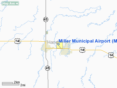
Location & QuickFacts
| FAA Information Effective: | 2008-09-25 |
| Airport Identifier: | MKA |
| Airport Status: | Operational |
| Longitude/Latitude: | 098-57-29.2120W/44-31-30.8800N
-98.958114/44.525244 (Estimated) |
| Elevation: | 1569 ft / 478.23 m (Estimated) |
| Land: | 252 acres |
| From nearest city: | 2 nautical miles E of Miller, SD |
| Location: | Hand County, SD |
| Magnetic Variation: | 07E (1995) |
Owner & Manager
| Ownership: | Publicly owned |
| Owner: | City Of Miller |
| Address: | Po Box 69
Miller, SD 57362 |
| Phone number: | 605-853-2705 |
| Manager: | James Bonebright |
| Address: | Box 69
Miller, SD 57362 |
| Phone number: | 605-853-2705 |
Airport Operations and Facilities
| Airport Use: | Open to public |
| Wind indicator: | Yes |
| Segmented Circle: | Yes |
| Control Tower: | No |
| Lighting Schedule: | RDO-CTL
ACTVT MIRL RY 15/33 & PAPI RYS 15 & 33 - 122.8. |
| Landing fee charge: | No |
| Sectional chart: | Twin Cities |
| Region: | AGL - Great Lakes |
| Boundary ARTCC: | ZMP - Minneapolis |
| Tie-in FSS: | HON - Huron |
| FSS on Airport: | No |
| FSS Toll Free: | 1-800-WX-BRIEF |
| NOTAMs Facility: | HON (NOTAM-d service avaliable) |
| Federal Agreements: | N1 |
Airport Communications
Airport Services
| Fuel available: | 100LLA
FOR FUEL CALL 605-853-2497, 871-3833. |
| Airframe Repair: | MINOR |
| Power Plant Repair: | MINOR |
| Bottled Oxygen: | NONE |
| Bulk Oxygen: | NONE |
Runway Information
Runway 15/33
| Dimension: | 3600 x 60 ft / 1097.3 x 18.3 m |
| Surface: | ASPH, Good Condition |
| Edge Lights: | Medium |
| |
Runway 15 |
Runway 33 |
| Longitude: | 098-57-38.3900W | 098-57-19.7800W |
| Latitude: | 44-31-47.3400N | 44-31-14.3800N |
| Elevation: | 1559.00 ft | 1569.00 ft |
| Alignment: | 127 | 127 |
| Traffic Pattern: | Left | Left |
| Markings: | Non-precision instrument, Fair Condition | Non-precision instrument, Fair Condition |
| Crossing Height: | 40.00 ft | 35.00 ft |
| VASI: | 2-light PAPI on left side | 2-light PAPI on left side |
| Visual Glide Angle: | 3.00° | 3.00° |
| Obstruction: | , 50:1 slope to clear | 35 ft pole, 1370.0 ft from runway, 80 ft right of centerline, 33:1 slope to clear |
|
Radio Navigation Aids
| ID |
Type |
Name |
Ch |
Freq |
Var |
Dist |
| HON | VORTAC | Huron | 123X | 117.60 | 10E | 28.2 nm |
Images and information placed above are from
http://www.airport-data.com/airport/MKA/
We thank them for the data!
| General Info
|
| Country |
United States
|
| State |
SOUTH DAKOTA
|
| FAA ID |
MKA
|
| Latitude |
44-31-30.880N
|
| Longitude |
098-57-29.212W
|
| Elevation |
1569 feet
|
| Near City |
MILLER
|
We don't guarantee the information is fresh and accurate. The data may
be wrong or outdated.
For more up-to-date information please refer to other sources.
|
|


