 |
|
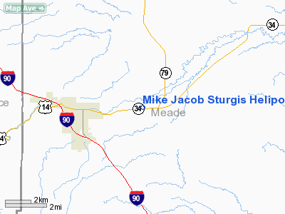
Mike Jacob Sturgis Heliport |
Location & QuickFacts
| FAA Information Effective: | 2008-09-25 |
| Airport Identifier: | SD26 |
| Airport Status: | Operational |
| Longitude/Latitude: | 103-27-00.6000W/44-25-00.4800N
-103.450167/44.416800 (Estimated) |
| Elevation: | 3280 ft / 999.74 m (Estimated) |
| Land: | 0 acres |
| From nearest city: | 3 nautical miles E of Sturgis, SD |
| Location: | Meade County, SD |
| Magnetic Variation: | () |
Owner & Manager
| Ownership: | Privately owned |
| Owner: | Black Hill Aerial Adventures Inc. |
| Address: | 620 West Blvd
Rapid City, SD 57701 |
| Phone number: | 605-343-5058 |
| Manager: | Michael Jacob |
| Address: | 620 West Blvd
Rapid City, SD 57701 |
| Phone number: | 605-343-5058 |
Airport Operations and Facilities
| Airport Use: | Private |
| Segmented Circle: | No |
| Control Tower: | No |
| Sectional chart: | Cheyenne |
| Region: | AGL - Great Lakes |
| Boundary ARTCC: | ZDV - Denver |
| Tie-in FSS: | HON - Huron |
| FSS Toll Free: | 1-800-WX-BRIEF |
Runway Information
Helipad H1
| Dimension: | 100 x 100 ft / 30.5 x 30.5 m |
| Surface: | TURF, |
| |
Runway H1 |
Runway |
| Traffic Pattern: | Left | Left |
|
Radio Navigation Aids
| ID |
Type |
Name |
Ch |
Freq |
Var |
Dist |
| SPF | NDB | Black Hills | | 300.00 | 11E | 14.9 nm |
| EFC | NDB | Belle Fourche | | 269.00 | 11E | 26.0 nm |
| RA | NDB | Ranch | | 254.00 | 11E | 33.4 nm |
| RCA | TACAN | Ellsworth | 025X | | 11E | 22.4 nm |
| ECS | VOR | Newcastle | | 108.20 | 11E | 49.0 nm |
| RAP | VORTAC | Rapid City | 070X | 112.30 | 13E | 32.5 nm |
Remarks
- PRVDD THE SPONSOR REQUEST ANOTHER REVIEW OF THE SITE DURING TOURIST SEASON; ALL APCH/DEP FROM 270 DEGS TO 360 DEGS; AREA IS MARKED; NO NIGHT OPNS; RESTRAIN UNAUTHORIZED PERSONS DURING HELO OPNS BY USING A SAFETY BARRIER, COMPLY WITH FAR PART 91.126(B)(2); AND MARK AND LIGHT ANY OBSTRUCTIONS.
Images and information placed above are from
http://www.airport-data.com/airport/SD26/
We thank them for the data!
|
|


