 |
|
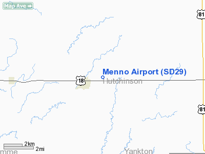
Location & QuickFacts
| FAA Information Effective: | 2008-09-25 |
| Airport Identifier: | SD29 |
| Airport Status: | Operational |
| Longitude/Latitude: | 097-33-11.2380W/43-14-39.9660N
-97.553122/43.244435 (Estimated) |
| Elevation: | 1350 ft / 411.48 m (Estimated) |
| Land: | 160 acres |
| From nearest city: | 1 nautical miles E of Menno, SD |
| Location: | Hutchinson County, SD |
| Magnetic Variation: | 07E (1985) |
Owner & Manager
| Ownership: | Privately owned |
| Owner: | M. E. Ulmer |
| Address: | Box 427
Menno, SD 57045 |
| Phone number: | 605-387-5252 |
| Address: |
|
Airport Operations and Facilities
| Airport Use: | Private |
| Wind indicator: | Yes |
| Segmented Circle: | No |
| Control Tower: | No |
| Lighting Schedule: | PHONE REQ
FOR ROTG BCN & RWY LGTS CALL 605-387-5252. |
| Beacon Color: | Clear-Green (lighted land airport) |
| Landing fee charge: | No |
| Sectional chart: | Omaha |
| Region: | AGL - Great Lakes |
| Boundary ARTCC: | ZMP - Minneapolis |
| Tie-in FSS: | HON - Huron |
| FSS on Airport: | No |
| FSS Toll Free: | 1-800-WX-BRIEF |
Airport Services
| Fuel available: | 100 MOGAS |
| Airframe Repair: | NONE |
| Power Plant Repair: | NONE |
| Bottled Oxygen: | NONE |
| Bulk Oxygen: | NONE |
Runway Information
Runway 08/26
| Dimension: | 2250 x 94 ft / 685.8 x 28.7 m |
| Surface: | TURF, Poor Condition |
| Edge Lights: | Low
NSTD LIRL. |
| |
Runway 08 |
Runway 26 |
| Traffic Pattern: | Left | Left |
| Runway End Identifier: | No | No |
| Touchdown Lights: | No | No |
| Obstruction: | , 300.0 ft from runway, 20:1 slope to clear | 45 ft trees, 250.0 ft from runway, 145 ft right of centerline, 5:1 slope to clear |
|
Radio Navigation Aids
| ID |
Type |
Name |
Ch |
Freq |
Var |
Dist |
| AGZ | NDB | Wagner | | 392.00 | 08E | 34.2 nm |
| FS | NDB | Rokky | | 245.00 | 06E | 35.0 nm |
| VMR | NDB | Vermillion | | 375.00 | 06E | 39.7 nm |
| YKN | VOR/DME | Yankton | 051X | 111.40 | 07E | 20.9 nm |
| MHE | VOR/DME | Mitchell | 029X | 109.20 | 07E | 38.4 nm |
| FSD | VORTAC | Sioux Falls | 097X | 115.00 | 09E | 41.6 nm |
Remarks
- RWY 8/26 IS NOT APVD FOR NGT OPNS BY SDDOA.
Images and information placed above are from
http://www.airport-data.com/airport/SD29/
We thank them for the data!
| General Info
|
| Country |
United States
|
| State |
SOUTH DAKOTA
|
| FAA ID |
SD29
|
| Latitude |
43-14-39.966N
|
| Longitude |
097-33-11.238W
|
| Elevation |
1350 feet
|
| Near City |
MENNO
|
We don't guarantee the information is fresh and accurate. The data may
be wrong or outdated.
For more up-to-date information please refer to other sources.
|
|


