 |
|
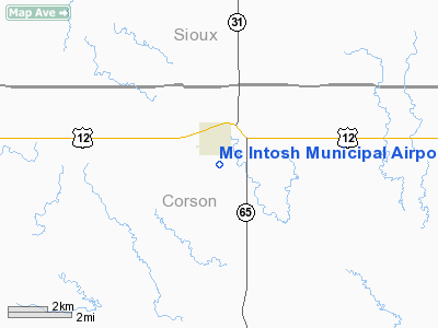
Location & QuickFacts
| FAA Information Effective: | 2008-09-25 |
| Airport Identifier: | 8D6 |
| Airport Status: | Operational |
| Longitude/Latitude: | 101-20-46.4750W/45-54-30.0020N
-101.346243/45.908334 (Estimated) |
| Elevation: | 2251 ft / 686.10 m (Surveyed) |
| Land: | 66 acres |
| From nearest city: | 1 nautical miles S of Mc Intosh, SD |
| Location: | Corson County, SD |
| Magnetic Variation: | 10E (1985) |
Owner & Manager
| Ownership: | Publicly owned |
| Owner: | City Of Mcintosh |
| Address: | Po Box 416
Mcintosh, SD 57641 |
| Phone number: | 605-273-4498 |
| Manager: | Marvin Bertsch |
| Address: | 104 Main St
Mcintosh, SD 57641 |
| Phone number: | 605-273-4478 |
Airport Operations and Facilities
| Airport Use: | Open to public |
| Wind indicator: | Yes |
| Segmented Circle: | Yes |
| Control Tower: | No |
| Lighting Schedule: | DUSK-DAWN
FOR LIRL RY 14/32 KEY 122.8 5 TIMES. |
| Beacon Color: | Clear-Green (lighted land airport) |
| Landing fee charge: | No |
| Sectional chart: | Billings |
| Region: | AGL - Great Lakes |
| Boundary ARTCC: | ZMP - Minneapolis |
| Tie-in FSS: | HON - Huron |
| FSS on Airport: | No |
| FSS Toll Free: | 1-800-WX-BRIEF |
| NOTAMs Facility: | HON (NOTAM-d service avaliable) |
| Federal Agreements: | 1 |
Airport Communications
Airport Services
| Airframe Repair: | NONE |
| Power Plant Repair: | NONE |
| Bottled Oxygen: | NONE |
| Bulk Oxygen: | NONE |
Runway Information
Runway 14/32
| Dimension: | 3700 x 150 ft / 1127.8 x 45.7 m
CENTER 50' PORTION IS TURF/AGGREGATE. |
| Surface: | TURF-GRVL, Poor Condition
TURF RUNWAY IS ROUGH DUE TO HEAVY AMOUNT OF RODENT HOLES. |
| Edge Lights: | Low |
| |
Runway 14 |
Runway 32 |
| Longitude: | 101-20-47.4800W | 101-20-21.5300W |
| Latitude: | 45-54-56.0000N | 45-54-24.2800N |
| Elevation: | 2270.00 ft | 2246.00 ft |
| Traffic Pattern: | Left | Left |
| Obstruction: | 63 ft trees, 1300.0 ft from runway, 150 ft left of centerline, 20:1 slope to clear | , 50:1 slope to clear |
|
Radio Navigation Aids
| ID |
Type |
Name |
Ch |
Freq |
Var |
Dist |
| RVB | NDB | Riverbend | | 407.00 | 09E | 44.8 nm |
| LEM | VOR | Lemmon | | 111.40 | 13E | 31.7 nm |
Remarks
- LARGE PRAIRIE DOG TOWN ADJACENT TO ARPT. COND OF STRIP MONTRD.
- ARPT CLSD WINTER MONTHS DUE TO LACK OF SNOW REMOVAL; CALL AMGR ON 605-273-4210 FOR ARPT CONDITIONS.
Images and information placed above are from
http://www.airport-data.com/airport/8D6/
We thank them for the data!
| General Info
|
| Country |
United States
|
| State |
SOUTH DAKOTA
|
| FAA ID |
8D6
|
| Latitude |
45-54-30.002N
|
| Longitude |
101-20-46.475W
|
| Elevation |
2251 feet
|
| Near City |
MC INTOSH
|
We don't guarantee the information is fresh and accurate. The data may
be wrong or outdated.
For more up-to-date information please refer to other sources.
|
|


