 |
|
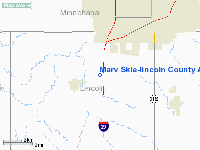
Marv Skie-lincoln County Airport |
Location & QuickFacts
| FAA Information Effective: | 2008-09-25 |
| Airport Identifier: | Y14 |
| Airport Status: | Operational |
| Longitude/Latitude: | 096-48-07.1830W/43-27-26.9170N
-96.801995/43.457477 (Estimated) |
| Elevation: | 1515 ft / 461.77 m (Estimated) |
| Land: | 134 acres |
| From nearest city: | 2 nautical miles NE of Tea, SD |
| Location: | Lincoln County, SD |
| Magnetic Variation: | 06E (1985) |
Owner & Manager
| Ownership: | Publicly owned |
| Owner: | Lincoln County |
| Address: | 100 East 5th
Canton, SD 57013 |
| Phone number: | 605-987-2581 |
| Manager: | Mark Schroeder |
| Address: | 47014 Great Planes Place
Tea, SD 57064 |
| Phone number: | 605-413-9816 |
Airport Operations and Facilities
| Airport Use: | Open to public |
| Wind indicator: | Yes |
| Segmented Circle: | No |
| Control Tower: | No |
| Lighting Schedule: | DUSK-DAWN
ACTVT MIRL RY 16/34 - CTAF. |
| Beacon Color: | Clear-Green (lighted land airport) |
| Landing fee charge: | No |
| Sectional chart: | Omaha |
| Region: | AGL - Great Lakes |
| Boundary ARTCC: | ZMP - Minneapolis |
| Tie-in FSS: | HON - Huron |
| FSS on Airport: | No |
| FSS Toll Free: | 1-800-WX-BRIEF |
| NOTAMs Facility: | HON (NOTAM-d service avaliable) |
| Federal Agreements: | NGY |
Airport Communications
| CTAF: | 122.800 |
| Unicom: | 122.800 |
Airport Services
| Fuel available: | 100LLMOGAS
FUEL AVBL 24 HRS WITH CREDIT CARD. |
| Airframe Repair: | MAJOR |
| Power Plant Repair: | MAJOR |
| Bottled Oxygen: | NONE |
| Bulk Oxygen: | NONE |
Runway Information
Runway 16/34
| Dimension: | 3650 x 60 ft / 1112.5 x 18.3 m |
| Surface: | ASPH, Fair Condition |
| Weight Limit: | Single wheel: 22000 lbs. |
| Edge Lights: | Medium |
| |
Runway 16 |
Runway 34 |
| Traffic Pattern: | Left | Left |
| Markings: | Basic, Good Condition | Basic, Good Condition |
| Crossing Height: | 22.00 ft | 29.00 ft |
| VASI: | 4-light PAPI on left side | 4-light PAPI on left side |
| Visual Glide Angle: | 3.00° | 3.00° |
| Obstruction: | 10 ft road, 470.0 ft from runway, 27:1 slope to clear | , 50:1 slope to clear |
|
Radio Navigation Aids
| ID |
Type |
Name |
Ch |
Freq |
Var |
Dist |
| FS | NDB | Rokky | | 245.00 | 06E | 2.5 nm |
| SOY | NDB | Sioux Center | | 368.00 | 06E | 33.1 nm |
| MDS | NDB | Wentworth | | 400.00 | 05E | 35.7 nm |
| VMR | NDB | Vermillion | | 375.00 | 06E | 42.1 nm |
| ORC | NDB | Orange City | | 521.00 | 05E | 42.9 nm |
| SHL | NDB | Sheldon | | 338.00 | 05E | 44.8 nm |
| ISB | NDB | Sibley | | 269.00 | 05E | 46.1 nm |
| PQN | NDB/DME | Pipestone | 028X | 284.00 | 06E | 38.6 nm |
| YKN | VOR/DME | Yankton | 051X | 111.40 | 07E | 41.3 nm |
| DDL | VOR/DME | Sheldon | 023X | 108.60 | 05E | 44.8 nm |
| FSD | VORTAC | Sioux Falls | 097X | 115.00 | 09E | 11.6 nm |
Remarks
- ULTRALIGHTS ON & INVOF ARPT.
- BE ALERT: ACFT ON APCH TO RY 03 AT JOE FOSS FIELD (FSD) DESCENDING/HOLDING AT 3300 FT OVER ROKKY LOM LCTD 2.4 MILES NNW OF THE ARPT.
- HAY CUTTING OPERATIONS MAY-SEP; FARMING EQUIPMENT MAY BE IN APCH ZONES.
Images and information placed above are from
http://www.airport-data.com/airport/Y14/
We thank them for the data!
| General Info
|
| Country |
United States
|
| State |
SOUTH DAKOTA
|
| FAA ID |
Y14
|
| Latitude |
43-27-26.917N
|
| Longitude |
096-48-07.183W
|
| Elevation |
1515 feet
|
| Near City |
TEA
|
We don't guarantee the information is fresh and accurate. The data may
be wrong or outdated.
For more up-to-date information please refer to other sources.
|
|


