 |
|
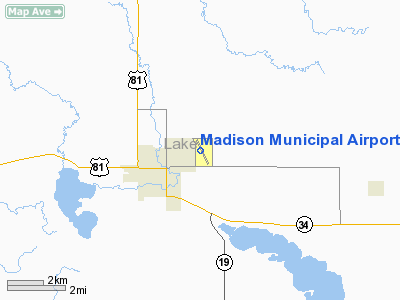
Location & QuickFacts
| FAA Information Effective: | 2008-09-25 |
| Airport Identifier: | MDS |
| Airport Status: | Operational |
| Longitude/Latitude: | 097-05-09.3600W/44-00-57.5000N
-97.085933/44.015972 (Estimated) |
| Elevation: | 1717 ft / 523.34 m (Surveyed) |
| Land: | 375 acres |
| From nearest city: | 1 nautical miles NE of Madison, SD |
| Location: | Lake County, SD |
| Magnetic Variation: | 05E (2000) |
Owner & Manager
| Ownership: | Publicly owned |
| Owner: | City Of Madison |
| Address: | Po Box 308
Madison, SD 57042 |
| Phone number: | 605-256-7500 |
| Manager: | Chris Funk |
| Address: | Po Box 231
Madison, SD 57042 |
| Phone number: | 605-256-9774 |
Airport Operations and Facilities
| Airport Use: | Open to public |
| Wind indicator: | Yes |
| Segmented Circle: | No |
| Control Tower: | No |
| Lighting Schedule: | DUSK-DAWN
ACTVT MIRL RY 15/33 & REIL RY 15 & 33 - CTAF. |
| Beacon Color: | Clear-Green (lighted land airport) |
| Landing fee charge: | No |
| Sectional chart: | Omaha |
| Region: | AGL - Great Lakes |
| Boundary ARTCC: | ZMP - Minneapolis |
| Tie-in FSS: | HON - Huron |
| FSS on Airport: | No |
| FSS Toll Free: | 1-800-WX-BRIEF |
| NOTAMs Facility: | HON (NOTAM-d service avaliable) |
| Federal Agreements: | NGY |
Airport Communications
| CTAF: | 122.800 |
| Unicom: | 122.800 |
Airport Services
| Fuel available: | 100LLA MOGAS |
| Airframe Repair: | MAJOR |
| Power Plant Repair: | MAJOR |
| Bottled Oxygen: | NONE |
| Bulk Oxygen: | NONE |
Runway Information
Runway 03/21
| Dimension: | 2600 x 200 ft / 792.5 x 61.0 m |
| Surface: | TURF, Good Condition |
| |
Runway 03 |
Runway 21 |
| Longitude: | 097-05-14.2160W | 097-04-54.2160W |
| Latitude: | 44-00-41.4030N | 44-01-02.9030N |
| Elevation: | 1709.00 ft | 1704.00 ft |
| Alignment: | 34 | 127 |
| Traffic Pattern: | Left | Left |
| Runway End Identifier: | No | No |
| Centerline Lights: | No | No |
| Touchdown Lights: | No | No |
| Obstruction: | 40 ft tree, 1400.0 ft from runway, 35:1 slope to clear | , 50:1 slope to clear |
|
Runway 15/33
| Dimension: | 5000 x 75 ft / 1524.0 x 22.9 m |
| Surface: | ASPH-CONC, |
| Weight Limit: | Single wheel: 12500 lbs. |
| Edge Lights: | Medium |
| |
Runway 15 |
Runway 33 |
| Longitude: | 097-05-27.2030W | 097-04-56.9260W |
| Latitude: | 44-01-22.5000N | 44-00-38.2190N |
| Elevation: | 1717.00 ft | 1708.00 ft |
| Alignment: | 127 | 127 |
| Traffic Pattern: | Left | Left |
| Markings: | Non-precision instrument, Good Condition | Non-precision instrument, Good Condition |
| Crossing Height: | 37.00 ft | 37.00 ft |
| VASI: | 4-light PAPI on left side | 4-light PAPI on left side |
| Visual Glide Angle: | 3.00° | 3.00° |
| Runway End Identifier: | Yes | Yes |
| Centerline Lights: | No | No |
| Touchdown Lights: | No | No |
| Obstruction: | 76 ft silo, 3600.0 ft from runway, 120 ft left of centerline, 44:1 slope to clear | 40 ft trees, 1300.0 ft from runway, 200 ft right of centerline, 32:1 slope to clear |
|
Radio Navigation Aids
| ID |
Type |
Name |
Ch |
Freq |
Var |
Dist |
| MDS | NDB | Wentworth | | 400.00 | 05E | 0.2 nm |
| FS | NDB | Rokky | | 245.00 | 06E | 33.3 nm |
| PQN | NDB/DME | Pipestone | 028X | 284.00 | 06E | 34.2 nm |
| BKX | VOR/DME | Brookings | 025X | 108.80 | 06E | 20.8 nm |
| MHE | VOR/DME | Mitchell | 029X | 109.20 | 07E | 43.6 nm |
| FSD | VORTAC | Sioux Falls | 097X | 115.00 | 09E | 25.7 nm |
Remarks
- WILDLIFE ON ARPT.
- ULTRA-LIGHT ACTIVITY ON AND INVOF ARPT
Images and information placed above are from
http://www.airport-data.com/airport/MDS/
We thank them for the data!
| General Info
|
| Country |
United States
|
| State |
SOUTH DAKOTA
|
| FAA ID |
MDS
|
| Latitude |
44-00-57.500N
|
| Longitude |
097-05-09.360W
|
| Elevation |
1717 feet
|
| Near City |
MADISON
|
We don't guarantee the information is fresh and accurate. The data may
be wrong or outdated.
For more up-to-date information please refer to other sources.
|
|


