 |
|
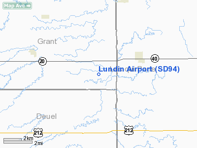
Location & QuickFacts
| FAA Information Effective: | 2008-09-25 |
| Airport Identifier: | SD94 |
| Airport Status: | Operational |
| Longitude/Latitude: | 096-28-37.1920W/44-59-34.8710N
-96.476998/44.993020 (Estimated) |
| Elevation: | 1186 ft / 361.49 m (Estimated) |
| Land: | 3 acres |
| From nearest city: | 4 nautical miles E of Revillo, SD |
| Location: | Grant County, SD |
| Magnetic Variation: | 06E (1985) |
Owner & Manager
| Ownership: | Privately owned |
| Owner: | Earl A. Lundin |
| Address: | Rr 1, Box 73
Revillo, SD 57259 |
| Phone number: | 605-678-2694
605-880-0468 (CELL) |
| Manager: | Earl A. Lundin |
| Address: | Rr 1, Box 73
Revillo, SD 57259 |
| Phone number: | 605-678-2694
605-880-0468 (CELL) |
Airport Operations and Facilities
| Airport Use: | Private |
| Wind indicator: | Yes |
| Segmented Circle: | No |
| Control Tower: | No |
| Landing fee charge: | No |
| Sectional chart: | Twin Cities |
| Region: | AGL - Great Lakes |
| Boundary ARTCC: | ZMP - Minneapolis |
| Tie-in FSS: | HON - Huron |
| FSS on Airport: | No |
| FSS Toll Free: | 1-800-WX-BRIEF |
Runway Information
Runway 09/27
| Dimension: | 2600 x 50 ft / 792.5 x 15.2 m |
| Surface: | TURF, |
| |
Runway 09 |
Runway 27 |
| Traffic Pattern: | Left | Left |
| Obstruction: | | 75 ft pline, 2640.0 ft from runway |
|
Radio Navigation Aids
| ID |
Type |
Name |
Ch |
Freq |
Var |
Dist |
| DXX | NDB | Dawson/madison | | 341.00 | 06E | 12.7 nm |
| VVV | NDB | Ortonville | | 332.00 | 05E | 18.7 nm |
| AQP | NDB | Appleton | | 356.00 | 05E | 24.4 nm |
| BBB | NDB | Benson | | 239.00 | 05E | 40.4 nm |
| ETH | NDB | Wheaton | | 326.00 | 05E | 47.6 nm |
| MVE | VOR/DME | Montevideo | 053X | 111.60 | 05E | 32.5 nm |
| MOX | VOR/DME | Morris | 033X | 109.60 | 05E | 40.6 nm |
| MML | VOR/DME | Marshall | 047X | 111.00 | 05E | 43.0 nm |
| BKX | VOR/DME | Brookings | 025X | 108.80 | 06E | 43.9 nm |
| ATY | VORTAC | Watertown | 113X | 116.60 | 09E | 28.3 nm |
Remarks
Images and information placed above are from
http://www.airport-data.com/airport/SD94/
We thank them for the data!
| General Info
|
| Country |
United States
|
| State |
SOUTH DAKOTA
|
| FAA ID |
SD94
|
| Latitude |
44-59-34.871N
|
| Longitude |
096-28-37.192W
|
| Elevation |
1186 feet
|
| Near City |
REVILLO
|
We don't guarantee the information is fresh and accurate. The data may
be wrong or outdated.
For more up-to-date information please refer to other sources.
|
|


