 |
|
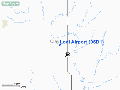
Location & QuickFacts
| FAA Information Effective: | 2008-09-25 |
| Airport Identifier: | 0SD1 |
| Airport Status: | Operational |
| Longitude/Latitude: | 096-58-48.6000W/42-58-20.0000N
-96.980167/42.972222 (Estimated) |
| Elevation: | 1200 ft / 365.76 m (Estimated) |
| Land: | 0 acres |
| From nearest city: | 8 nautical miles E of Wakonda, SD |
| Location: | Clay County, SD |
| Magnetic Variation: | 06E (1995) |
Owner & Manager
| Ownership: | Privately owned |
| Owner: | James V White |
| Address: | Rr1 Box 62a
Wakonda, SD 57073 |
| Phone number: | 605-267-2667 |
| Manager: | James V White |
| Address: | Rr1 Box 62a
Wakonda, SD 57073 |
| Phone number: | 605-267-2667 |
Airport Operations and Facilities
| Airport Use: | Private |
| Segmented Circle: | No |
| Control Tower: | No |
| Sectional chart: | Omaha |
| Region: | AGL - Great Lakes |
| Boundary ARTCC: | ZMP - Minneapolis |
| Tie-in FSS: | HON - Huron |
| FSS on Airport: | No |
| FSS Toll Free: | 1-800-WX-BRIEF |
Runway Information
Runway 08/26
| Dimension: | 1726 x 60 ft / 526.1 x 18.3 m |
| Surface: | TURF, |
| |
Runway 08 |
Runway 26 |
| Traffic Pattern: | Left | Left |
| Obstruction: | 20 ft pline, 920.0 ft from runway | 10 ft road, 20.0 ft from runway |
|
Radio Navigation Aids
| ID |
Type |
Name |
Ch |
Freq |
Var |
Dist |
| VMR | NDB | Vermillion | | 375.00 | 06E | 12.7 nm |
| FS | NDB | Rokky | | 245.00 | 06E | 32.1 nm |
| SOY | NDB | Sioux Center | | 368.00 | 06E | 36.0 nm |
| OI | NDB | Tommi | | 305.00 | 07E | 38.3 nm |
| ORC | NDB | Orange City | | 521.00 | 05E | 40.5 nm |
| GAK | NDB | Sioux Gateway | | 233.00 | 06E | 42.9 nm |
| LCG | NDB | Wayne | | 389.00 | 06E | 43.9 nm |
| SU | NDB | Salix | | 414.00 | 07E | 49.3 nm |
| YKN | VOR/DME | Yankton | 051X | 111.40 | 07E | 18.1 nm |
| FSD | VORTAC | Sioux Falls | 097X | 115.00 | 09E | 41.6 nm |
| SUX | VORTAC | Sioux City | 112X | 116.50 | 09E | 47.6 nm |
Remarks
- OBSTNS IN TY APCH SLOPE SFC BE LOWERED/REMOVED OR RY THLD DSPLCD; 125 FT EITHER SIDE OF RY CNTRLN & 200 FT EITHER END OF RY CLEAR OF OBSTNS.
Images and information placed above are from
http://www.airport-data.com/airport/0SD1/
We thank them for the data!
| General Info
|
| Country |
United States
|
| State |
SOUTH DAKOTA
|
| FAA ID |
0SD1
|
| Latitude |
42-58-20.000N
|
| Longitude |
096-58-48.600W
|
| Elevation |
1200 feet
|
| Near City |
WAKONDA
|
We don't guarantee the information is fresh and accurate. The data may
be wrong or outdated.
For more up-to-date information please refer to other sources.
|
|


