 |
|
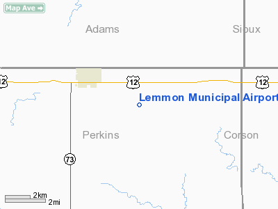
Location & QuickFacts
| FAA Information Effective: | 2008-09-25 |
| Airport Identifier: | LEM |
| Airport Status: | Operational |
| Longitude/Latitude: | 102-06-22.2400W/45-55-07.3100N
-102.106178/45.918697 (Estimated) |
| Elevation: | 2571 ft / 783.64 m (Surveyed) |
| Land: | 640 acres |
| From nearest city: | 3 nautical miles SE of Lemmon, SD |
| Location: | Perkins County, SD |
| Magnetic Variation: | 11E (1985) |
Owner & Manager
| Ownership: | Publicly owned |
| Owner: | City Of Lemmon |
| Address: | 303 1st Ave West
Lemmon, SD 57638 |
| Phone number: | 605-374-5681 |
| Manager: | Mike Ginther |
| Address: | 10216 Airport Rd
Lemmon, SD 57638 |
| Phone number: | 605-374-5281 |
Airport Operations and Facilities
| Airport Use: | Open to public |
| Wind indicator: | Yes |
| Segmented Circle: | No |
| Control Tower: | No |
| Lighting Schedule: | DUSK-DAWN
ACTVT MIRL RY 11/29, PAPI RYS 11 & 29 - CTAF. |
| Beacon Color: | Clear-Green (lighted land airport) |
| Landing fee charge: | No |
| Sectional chart: | Billings |
| Region: | AGL - Great Lakes |
| Boundary ARTCC: | ZMP - Minneapolis |
| Tie-in FSS: | HON - Huron |
| FSS on Airport: | No |
| FSS Toll Free: | 1-800-WX-BRIEF |
| NOTAMs Facility: | HON (NOTAM-d service avaliable) |
| Federal Agreements: | NGY |
Airport Communications
| CTAF: | 122.800 |
| Unicom: | 122.800 |
Airport Services
| Fuel available: | 100LLA
FOR FUEL CALL 605-374-5281. |
| Airframe Repair: | MAJOR |
| Power Plant Repair: | MAJOR |
| Bottled Oxygen: | NONE |
| Bulk Oxygen: | NONE |
Runway Information
Runway 11/29
| Dimension: | 4501 x 75 ft / 1371.9 x 22.9 m |
| Surface: | ASPH, Good Condition |
| Weight Limit: | Single wheel: 12500 lbs. |
| Edge Lights: | Medium |
| |
Runway 11 |
Runway 29 |
| Longitude: | 102-06-43.9640W | 102-05-52.3960W |
| Latitude: | 45-55-21.8740N | 45-54-55.8220N |
| Elevation: | 2566.00 ft | 2568.00 ft |
| Alignment: | 126 | 127 |
| Traffic Pattern: | Left | Left |
| Markings: | Non-precision instrument, Fair Condition | Non-precision instrument, Fair Condition |
| Crossing Height: | 25.00 ft | 25.00 ft |
| VASI: | 2-light PAPI on left side | 2-light PAPI on left side |
| Visual Glide Angle: | 3.00° | 3.00° |
| Runway End Identifier: | No | No |
| Centerline Lights: | No | No |
| Touchdown Lights: | No | No |
| Obstruction: | 13 ft road, 600.0 ft from runway, 30:1 slope to clear | , 50:1 slope to clear |
|
Runway 17/35
| Dimension: | 1900 x 60 ft / 579.1 x 18.3 m |
| Surface: | TURF, |
| |
Runway 17 |
Runway 35 |
| Longitude: | 102-06-32.5000W | 102-06-33.5000W |
| Latitude: | 45-55-11.5000N | 45-54-55.0000N |
| Traffic Pattern: | Left | Left |
| Runway End Identifier: | No | No |
| Centerline Lights: | No | No |
| Touchdown Lights: | No | No |
|
Radio Navigation Aids
| ID |
Type |
Name |
Ch |
Freq |
Var |
Dist |
| HEI | NDB | Hettinger | | 392.00 | 12E | 23.4 nm |
| LEM | VOR | Lemmon | | 111.40 | 13E | 0.1 nm |
Images and information placed above are from
http://www.airport-data.com/airport/LEM/
We thank them for the data!
| General Info
|
| Country |
United States
|
| State |
SOUTH DAKOTA
|
| FAA ID |
LEM
|
| Latitude |
45-55-07.310N
|
| Longitude |
102-06-22.240W
|
| Elevation |
2571 feet
|
| Near City |
LEMMON
|
We don't guarantee the information is fresh and accurate. The data may
be wrong or outdated.
For more up-to-date information please refer to other sources.
|
|


