 |
|
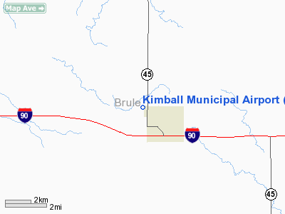
Location & QuickFacts
| FAA Information Effective: | 2008-09-25 |
| Airport Identifier: | 6A6 |
| Airport Status: | Operational |
| Longitude/Latitude: | 098-58-41.3340W/43-45-29.9940N
-98.978148/43.758332 (Estimated) |
| Elevation: | 1755 ft / 534.92 m (Surveyed) |
| Land: | 160 acres |
| From nearest city: | 2 nautical miles NW of Kimball, SD |
| Location: | Brule County, SD |
| Magnetic Variation: | 08E (1985) |
Owner & Manager
| Ownership: | Publicly owned |
| Owner: | City Of Kimball |
| Address: | Po Box 16
Kimball, SD 57355-0016 |
| Phone number: | 605-778-6277 |
| Manager: | Harold Bickner |
| Address: | C/o City Of Kimball, Po Box 16
Kimball, SD 57355-0016 |
| Phone number: | 605-778-6277 |
Airport Operations and Facilities
| Airport Use: | Open to public |
| Wind indicator: | Yes |
| Segmented Circle: | No |
| Control Tower: | No |
| Landing fee charge: | No |
| Sectional chart: | Omaha |
| Region: | AGL - Great Lakes |
| Boundary ARTCC: | ZMP - Minneapolis |
| Tie-in FSS: | HON - Huron |
| FSS on Airport: | No |
| FSS Toll Free: | 1-800-WX-BRIEF |
| NOTAMs Facility: | HON (NOTAM-d service avaliable) |
| Federal Agreements: | 1 |
Airport Communications
Airport Services
| Airframe Repair: | NONE |
| Power Plant Repair: | NONE |
| Bottled Oxygen: | NONE |
| Bulk Oxygen: | NONE |
Runway Information
Runway 13/31
| Dimension: | 2600 x 250 ft / 792.5 x 76.2 m |
| Surface: | TURF, Good Condition |
| |
Runway 13 |
Runway 31 |
| Longitude: | 098-58-59.0500W | 098-58-33.3300W |
| Latitude: | 43-45-32.5200N | 43-45-09.4900N |
| Elevation: | 1731.00 ft | 1755.00 ft |
| Traffic Pattern: | Left | Left |
| Runway End Identifier: | No | No |
| Centerline Lights: | No | No |
| Touchdown Lights: | No | No |
| Obstruction: | 16 ft road, 320.0 ft from runway, 20:1 slope to clear | 25 ft road, 500.0 ft from runway, 20:1 slope to clear |
|
Radio Navigation Aids
| ID |
Type |
Name |
Ch |
Freq |
Var |
Dist |
| ISD | VOR | Winner | | 112.80 | 08E | 37.8 nm |
| MHE | VOR/DME | Mitchell | 029X | 109.20 | 07E | 40.8 nm |
Remarks
Images and information placed above are from
http://www.airport-data.com/airport/6A6/
We thank them for the data!
| General Info
|
| Country |
United States
|
| State |
SOUTH DAKOTA
|
| FAA ID |
6A6
|
| Latitude |
43-45-29.994N
|
| Longitude |
098-58-41.334W
|
| Elevation |
1755 feet
|
| Near City |
KIMBALL
|
We don't guarantee the information is fresh and accurate. The data may
be wrong or outdated.
For more up-to-date information please refer to other sources.
|
|


