 |
|
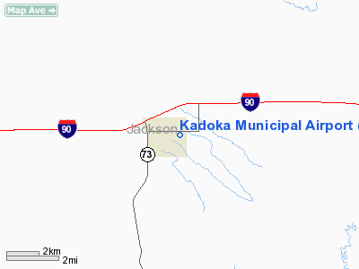
Location & QuickFacts
| FAA Information Effective: | 2008-09-25 |
| Airport Identifier: | 5V8 |
| Airport Status: | Operational |
| Longitude/Latitude: | 101-29-49.5170W/43-49-59.9740N
-101.497088/43.833326 (Estimated) |
| Elevation: | 2460 ft / 749.81 m (Estimated) |
| Land: | 77 acres |
| From nearest city: | 1 nautical miles E of Kadoka, SD |
| Location: | Jackson County, SD |
| Magnetic Variation: | 10E (1985) |
Owner & Manager
| Ownership: | Publicly owned |
| Owner: | City Of Kadoka |
| Address: | P O Box 58
Kadoka, SD 57543 |
| Phone number: | 605-837-2229 |
| Manager: | Patrick Solon
AN ADDL CTC BETTY LOU STRATTON 605-837-2229. |
| Address: | P O Box 58
Kadoka, SD 57543 |
| Phone number: | 605-837-2140 |
Airport Operations and Facilities
| Airport Use: | Open to public |
| Wind indicator: | Yes |
| Segmented Circle: | No |
| Control Tower: | No |
| Lighting Schedule: | DUSK-DAWN
ACTVT LIRL RY 12/30 - 122.8. |
| Beacon Color: | Clear-Green (lighted land airport) |
| Landing fee charge: | No |
| Sectional chart: | Cheyenne |
| Region: | AGL - Great Lakes |
| Boundary ARTCC: | ZDV - Denver |
| Tie-in FSS: | HON - Huron |
| FSS on Airport: | No |
| FSS Toll Free: | 1-800-WX-BRIEF |
| NOTAMs Facility: | HON (NOTAM-d service avaliable) |
| Federal Agreements: | N1 |
Airport Communications
Airport Services
| Airframe Repair: | NONE |
| Power Plant Repair: | NONE |
| Bottled Oxygen: | NONE |
| Bulk Oxygen: | NONE |
Runway Information
Runway 04/22
| Dimension: | 1600 x 100 ft / 487.7 x 30.5 m
CENTER PORTION OF RY 12/30 IS TURF/AGGREGATE 2400 FT BY 50 FT. |
| Surface: | TURF, Good Condition
FEW BUMPS ON RUNWAY DUE TO LOCAL RODENTS.. |
| |
Runway 04 |
Runway 22 |
| Longitude: | 101-29-56.4900W | 101-29-39.3404W |
| Latitude: | 43-49-56.4900N | 43-50-06.2655N |
| Elevation: | 2462.00 ft | 0.00 ft |
| Alignment: | 52 | 127 |
| Traffic Pattern: | Left | Left |
| Runway End Identifier: | No | No |
| Centerline Lights: | No | No |
| Touchdown Lights: | No | No |
|
Runway 12/30
| Dimension: | 2600 x 150 ft / 792.5 x 45.7 m
CENTER PORTION OF RY 12/30 IS TURF/AGGREGATE 2400 FT BY 50 FT. |
| Surface: | TURF-GRVL, Fair Condition
FEW BUMPS ON RUNWAY DUE TO LOCAL RODENTS.. |
| Edge Lights: | Low |
| |
Runway 12 |
Runway 30 |
| Longitude: | 101-30-01.5200W | 101-29-36.3900W |
| Latitude: | 43-50-08.9700N | 43-49-50.8500N |
| Elevation: | 2449.00 ft | 2466.00 ft |
| Traffic Pattern: | Left | Left |
| Runway End Identifier: | No | No |
| Centerline Lights: | No | No |
| Touchdown Lights: | No | No |
| Obstruction: | 73 ft ant, 1557.0 ft from runway, 212 ft right of centerline, 21:1 slope to clear | , 50:1 slope to clear |
|
Radio Navigation Aids
| ID |
Type |
Name |
Ch |
Freq |
Var |
Dist |
| PHP | VOR/DME | Philip | 021X | 108.40 | 12E | 15.3 nm |
Images and information placed above are from
http://www.airport-data.com/airport/5V8/
We thank them for the data!
| General Info
|
| Country |
United States
|
| State |
SOUTH DAKOTA
|
| FAA ID |
5V8
|
| Latitude |
43-49-59.974N
|
| Longitude |
101-29-49.517W
|
| Elevation |
2460 feet
|
| Near City |
KADOKA
|
We don't guarantee the information is fresh and accurate. The data may
be wrong or outdated.
For more up-to-date information please refer to other sources.
|
|


